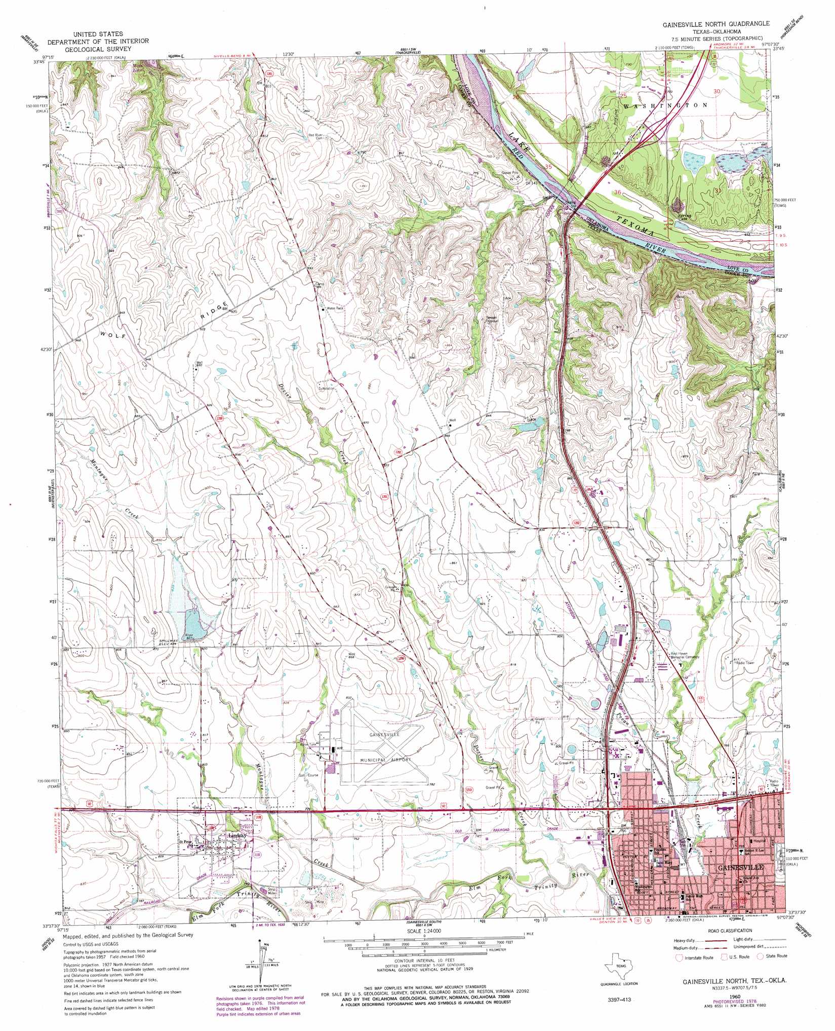
Gainesville North Topo Map Texas
To zoom in, hover over the map of Gainesville North
USGS Topo Quad 33097f2 - 1:24,000 scale
| Topo Map Name: | Gainesville North |
| USGS Topo Quad ID: | 33097f2 |
| Print Size: | ca. 21 1/4" wide x 27" high |
| Southeast Coordinates: | 33.625° N latitude / 97.125° W longitude |
| Map Center Coordinates: | 33.6875° N latitude / 97.1875° W longitude |
| U.S. States: | TX, OK |
| Filename: | o33097f2.jpg |
| Download Map JPG Image: | Gainesville North topo map 1:24,000 scale |
| Map Type: | Topographic |
| Topo Series: | 7.5´ |
| Map Scale: | 1:24,000 |
| Source of Map Images: | United States Geological Survey (USGS) |
| Alternate Map Versions: |
Gainesville North TX 1960, updated 1964 Download PDF Buy paper map Gainesville North TX 1960, updated 1978 Download PDF Buy paper map Gainesville North TX 2010 Download PDF Buy paper map Gainesville North TX 2013 Download PDF Buy paper map Gainesville North TX 2016 Download PDF Buy paper map |
1:24,000 Topo Quads surrounding Gainesville North
Leon North |
Burneyville |
Marietta West |
Marietta East |
Lebanon |
Leon South |
Marysville |
Thackerville |
Horseshoe Bend |
Dexter |
Muenster West |
Muenster East |
Gainesville North |
Callisburg |
Whitesboro |
Freemound |
Hood |
Gainesville South |
Woodbine |
Collinsville |
Greenwood |
Era |
Valley View |
Mountain Springs |
Pilot Point |
> Back to 33097e1 at 1:100,000 scale
> Back to 33096a1 at 1:250,000 scale
> Back to U.S. Topo Maps home
Gainesville North topo map: Gazetteer
Gainesville North: Airports
Gainesville Municipal Airport elevation 245m 803′Gainesville North: Dams
North Club Lake Dam elevation 236m 774′Oknoname 085003 Dam elevation 209m 685′
Soil Conservation Service Site 9 Dam elevation 252m 826′
Gainesville North: Parks
Edison Park elevation 228m 748′Lindsey Park elevation 244m 800′
Moffitt Park elevation 221m 725′
Gainesville North: Populated Places
Gainesville elevation 229m 751′Lindsay elevation 242m 793′
Gainesville North: Reservoirs
North Club Lake elevation 236m 774′Oknoname 085003 Reservoir elevation 209m 685′
Soil Conservation Service Site 9 Reservoir elevation 252m 826′
Gainesville North: Streams
Dozier Creek elevation 217m 711′Montague Creek elevation 223m 731′
Gainesville North digital topo map on disk
Buy this Gainesville North topo map showing relief, roads, GPS coordinates and other geographical features, as a high-resolution digital map file on DVD: