Bonita Topo Map Texas
To zoom in, hover over the map of Bonita
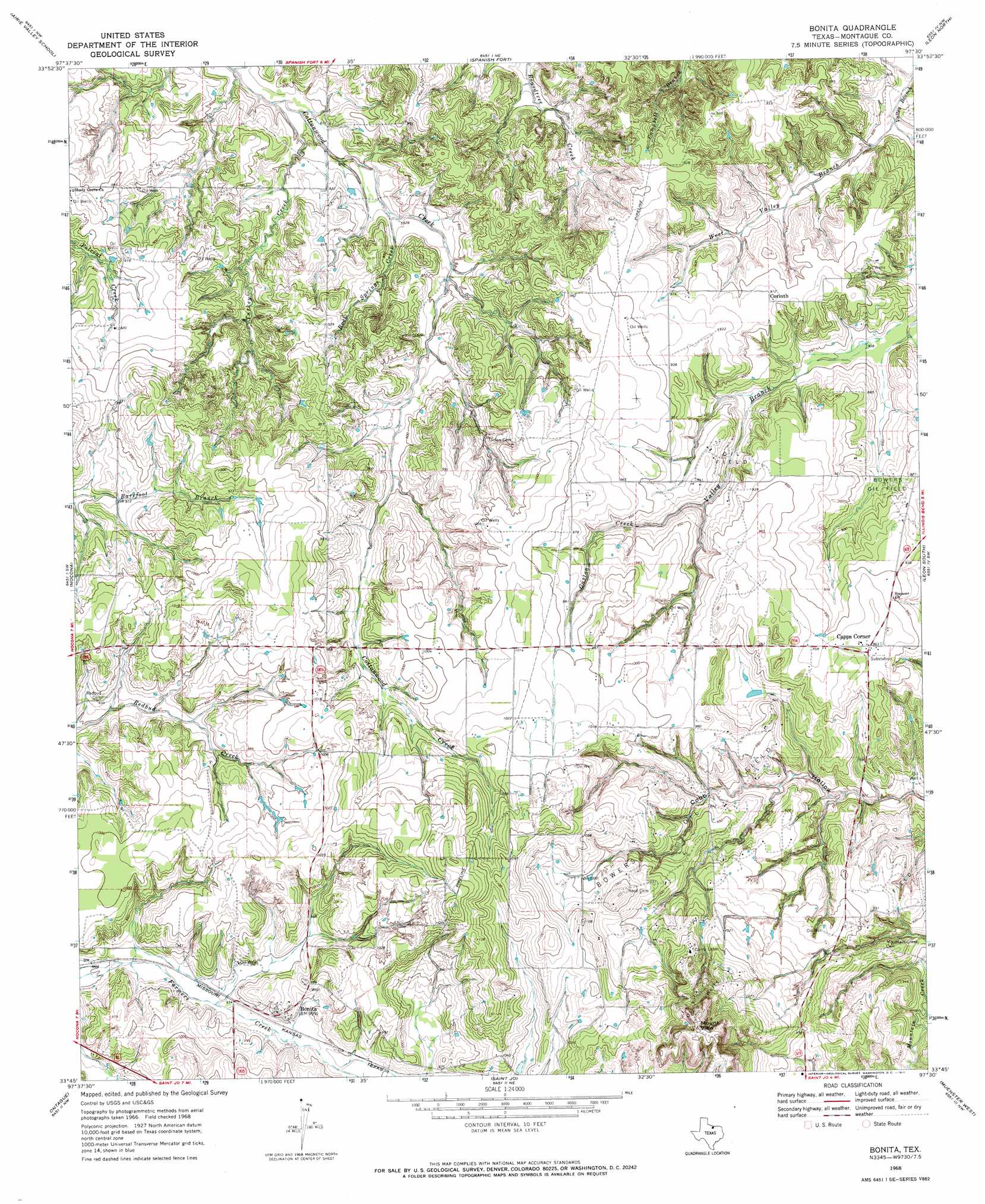
USGS Topo Quad 33097g5 - 1:24,000 scale
| Topo Map Name: | Bonita |
| USGS Topo Quad ID: | 33097g5 |
| Print Size: | ca. 21 1/4" wide x 27" high |
| Southeast Coordinates: | 33.75° N latitude / 97.5° W longitude |
| Map Center Coordinates: | 33.8125° N latitude / 97.5625° W longitude |
| U.S. State: | TX |
| Filename: | o33097g5.jpg |
| Download Map JPG Image: | Bonita topo map 1:24,000 scale |
| Map Type: | Topographic |
| Topo Series: | 7.5´ |
| Map Scale: | 1:24,000 |
| Source of Map Images: | United States Geological Survey (USGS) |
| Alternate Map Versions: |
Bonita TX 1968, updated 1971 Download PDF Buy paper map Bonita TX 2010 Download PDF Buy paper map Bonita TX 2013 Download PDF Buy paper map Bonita TX 2016 Download PDF Buy paper map |
1:24,000 Topo Quads surrounding Bonita
Ryan Se |
Grady |
Orr |
Healdton Sw |
Healdton Se |
Fleetwood |
Prairie Valley School |
Spanish Fort |
Leon North |
Burneyville |
Belcherville |
Nocona |
Bonita |
Leon South |
Marysville |
Buzzard Roost Knob |
Montague |
Saint Jo |
Muenster West |
Muenster East |
Bowie |
Salona |
Forestburg |
Freemound |
Hood |
> Back to 33097e1 at 1:100,000 scale
> Back to 33096a1 at 1:250,000 scale
> Back to U.S. Topo Maps home
Bonita topo map: Gazetteer
Bonita: Airports
Wilderness Point Airport elevation 290m 951′Bonita: Dams
Soil Conservation Service Debris Basin 102 Dam elevation 298m 977′Soil Conservation Service Debris Basin 104 Dam elevation 294m 964′
Soil Conservation Service Debris Basin 105 Dam elevation 289m 948′
Bonita: Oilfields
Bowers Oil Field elevation 266m 872′Bonita: Populated Places
Bonita elevation 303m 994′Capps Corner elevation 295m 967′
Corinth elevation 278m 912′
Bonita: Reservoirs
Soil Conservation Service Debris Basin 102 elevation 298m 977′Soil Conservation Service Debris Basin 104 elevation 294m 964′
Soil Conservation Service Debris Basin 105 elevation 289m 948′
Bonita: Streams
Gaston Creek elevation 269m 882′Rock Springs Creek elevation 248m 813′
Turkey Creek elevation 238m 780′
West Valley Branch elevation 238m 780′
Bonita: Summits
Mount View elevation 393m 1289′Bonita digital topo map on disk
Buy this Bonita topo map showing relief, roads, GPS coordinates and other geographical features, as a high-resolution digital map file on DVD: