Nocona Topo Map Texas
To zoom in, hover over the map of Nocona
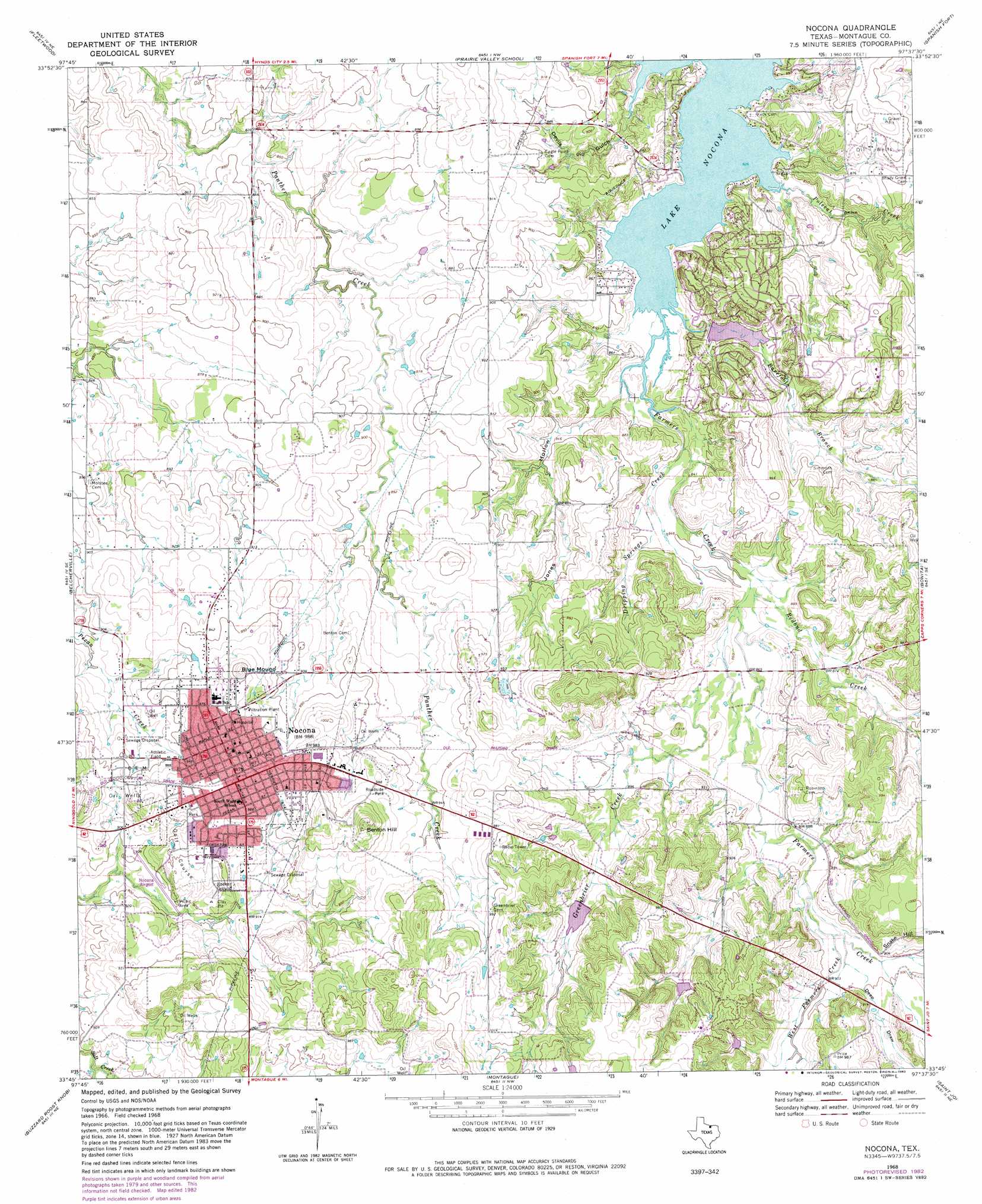
USGS Topo Quad 33097g6 - 1:24,000 scale
| Topo Map Name: | Nocona |
| USGS Topo Quad ID: | 33097g6 |
| Print Size: | ca. 21 1/4" wide x 27" high |
| Southeast Coordinates: | 33.75° N latitude / 97.625° W longitude |
| Map Center Coordinates: | 33.8125° N latitude / 97.6875° W longitude |
| U.S. State: | TX |
| Filename: | o33097g6.jpg |
| Download Map JPG Image: | Nocona topo map 1:24,000 scale |
| Map Type: | Topographic |
| Topo Series: | 7.5´ |
| Map Scale: | 1:24,000 |
| Source of Map Images: | United States Geological Survey (USGS) |
| Alternate Map Versions: |
Nocona TX 1968, updated 1971 Download PDF Buy paper map Nocona TX 1968, updated 1982 Download PDF Buy paper map Nocona TX 2010 Download PDF Buy paper map Nocona TX 2013 Download PDF Buy paper map Nocona TX 2016 Download PDF Buy paper map |
1:24,000 Topo Quads surrounding Nocona
Ryan |
Ryan Se |
Grady |
Orr |
Healdton Sw |
Terral |
Fleetwood |
Prairie Valley School |
Spanish Fort |
Leon North |
Ringgold |
Belcherville |
Nocona |
Bonita |
Leon South |
Stoneburg |
Buzzard Roost Knob |
Montague |
Saint Jo |
Muenster West |
Brushy Mound |
Bowie |
Salona |
Forestburg |
Freemound |
> Back to 33097e1 at 1:100,000 scale
> Back to 33096a1 at 1:250,000 scale
> Back to U.S. Topo Maps home
Nocona topo map: Gazetteer
Nocona: Airports
Nocona Airport elevation 273m 895′Nocona: Dams
Leisure Lake Dam elevation 257m 843′Soil Conservation Service Debris Basin 122 Dam elevation 309m 1013′
Soil Conservation Service Site 9 Dam elevation 280m 918′
Nocona: Parks
American Legion Park elevation 286m 938′Nocona: Populated Places
Nocona elevation 299m 980′Nocona: Reservoirs
Leisure Lake elevation 257m 843′Soil Conservation Service Debris Basin 122 elevation 309m 1013′
Soil Conservation Service Site 9 Reservoir elevation 280m 918′
Nocona: Streams
Barefoot Branch elevation 252m 826′Dripping Springs Creek elevation 254m 833′
Greenbrier Creek elevation 262m 859′
Polecat Creek elevation 252m 826′
Redbud Creek elevation 261m 856′
West Farmers Creek elevation 271m 889′
Nocona: Summits
Benton Hill elevation 324m 1062′Blue Mound elevation 312m 1023′
Snake Hill elevation 299m 980′
Nocona: Valleys
Deep Draw elevation 271m 889′Devils Gulch elevation 252m 826′
Jones Hollow elevation 252m 826′
Nocona digital topo map on disk
Buy this Nocona topo map showing relief, roads, GPS coordinates and other geographical features, as a high-resolution digital map file on DVD: