Marietta West Topo Map Oklahoma
To zoom in, hover over the map of Marietta West
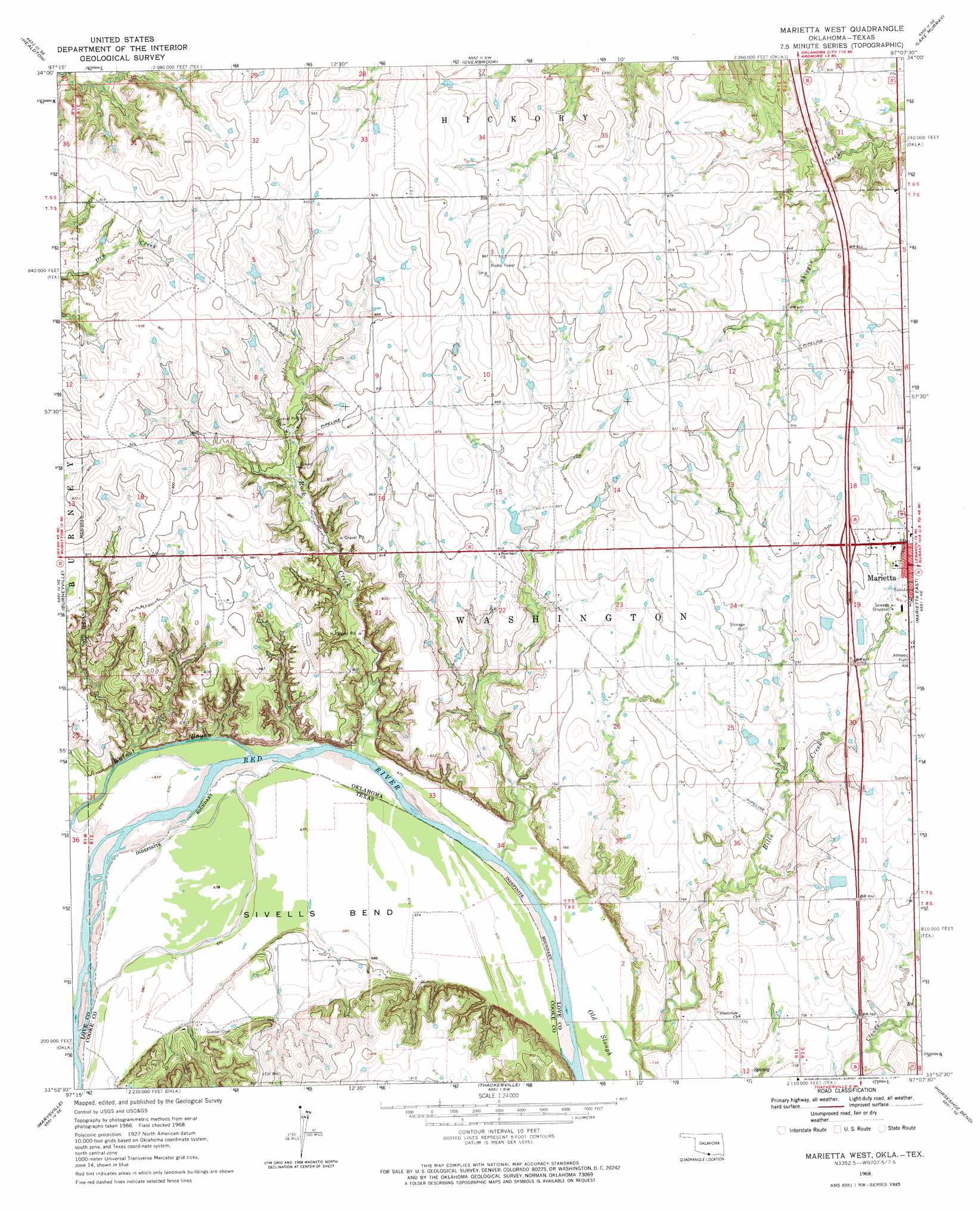
USGS Topo Quad 33097h2 - 1:24,000 scale
| Topo Map Name: | Marietta West |
| USGS Topo Quad ID: | 33097h2 |
| Print Size: | ca. 21 1/4" wide x 27" high |
| Southeast Coordinates: | 33.875° N latitude / 97.125° W longitude |
| Map Center Coordinates: | 33.9375° N latitude / 97.1875° W longitude |
| U.S. States: | OK, TX |
| Filename: | o33097h2.jpg |
| Download Map JPG Image: | Marietta West topo map 1:24,000 scale |
| Map Type: | Topographic |
| Topo Series: | 7.5´ |
| Map Scale: | 1:24,000 |
| Source of Map Images: | United States Geological Survey (USGS) |
| Alternate Map Versions: |
Marietta West OK 1968, updated 1971 Download PDF Buy paper map Marietta West OK 2010 Download PDF Buy paper map Marietta West OK 2013 Download PDF Buy paper map Marietta West OK 2016 Download PDF Buy paper map |
1:24,000 Topo Quads surrounding Marietta West
Healdton |
Lone Grove |
Ardmore West |
Ardmore East |
Mannsville |
Healdton Sw |
Healdton Se |
Overbrook |
Lake Murray |
Mcmillan |
Leon North |
Burneyville |
Marietta West |
Marietta East |
Lebanon |
Leon South |
Marysville |
Thackerville |
Horseshoe Bend |
Dexter |
Muenster West |
Muenster East |
Gainesville North |
Callisburg |
Whitesboro |
> Back to 33097e1 at 1:100,000 scale
> Back to 33096a1 at 1:250,000 scale
> Back to U.S. Topo Maps home
Marietta West topo map: Gazetteer
Marietta West: Airports
Love County Airport elevation 274m 898′McGehee Catfish Restaurant Airport elevation 229m 751′
W G Anderson Memorial Airport elevation 272m 892′
Marietta West: Bends
Sivells Bend elevation 207m 679′Marietta West: Streams
Rock Creek elevation 204m 669′Walnut Bayou elevation 204m 669′
Marietta West digital topo map on disk
Buy this Marietta West topo map showing relief, roads, GPS coordinates and other geographical features, as a high-resolution digital map file on DVD: