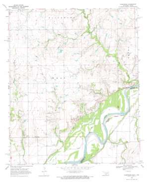
Fleetwood Topo Map Oklahoma
To zoom in, hover over the map of Fleetwood
USGS Topo Quad 33097h7 - 1:24,000 scale
| Topo Map Name: | Fleetwood |
| USGS Topo Quad ID: | 33097h7 |
| Print Size: | ca. 21 1/4" wide x 27" high |
| Southeast Coordinates: | 33.875° N latitude / 97.75° W longitude |
| Map Center Coordinates: | 33.9375° N latitude / 97.8125° W longitude |
| U.S. States: | OK, TX |
| Filename: | o33097h7.jpg |
| Download Map JPG Image: | Fleetwood topo map 1:24,000 scale |
| Map Type: | Topographic |
| Topo Series: | 7.5´ |
| Map Scale: | 1:24,000 |
| Source of Map Images: | United States Geological Survey (USGS) |
| Alternate Map Versions: |
Fleetwood OK 1968, updated 1971 Download PDF Buy paper map Fleetwood OK 2010 Download PDF Buy paper map Fleetwood OK 2012 Download PDF Buy paper map Fleetwood OK 2016 Download PDF Buy paper map |
1:24,000 Topo Quads surrounding Fleetwood
> Back to 33097e1 at 1:100,000 scale
> Back to 33096a1 at 1:250,000 scale
> Back to U.S. Topo Maps home
Fleetwood topo map: Gazetteer
Fleetwood: Dams
Oknoname 067013 Dam elevation 268m 879′Oknoname 067014 Dam elevation 263m 862′
Reagan Lake Dam elevation 257m 843′
Fleetwood: Populated Places
Fleetwood elevation 258m 846′Oscar elevation 270m 885′
Fleetwood: Reservoirs
Oknoname 067013 Reservoir elevation 268m 879′Oknoname 067014 Reservoir elevation 263m 862′
Reagan Lake elevation 257m 843′
Fleetwood: Streams
Cat Creek elevation 235m 770′Pecan Creek elevation 232m 761′
Pecan Creek elevation 231m 757′
Red Creek elevation 232m 761′
Salt Creek elevation 243m 797′
Fleetwood: Valleys
Sam Suell Hollow elevation 242m 793′Fleetwood digital topo map on disk
Buy this Fleetwood topo map showing relief, roads, GPS coordinates and other geographical features, as a high-resolution digital map file on DVD:


