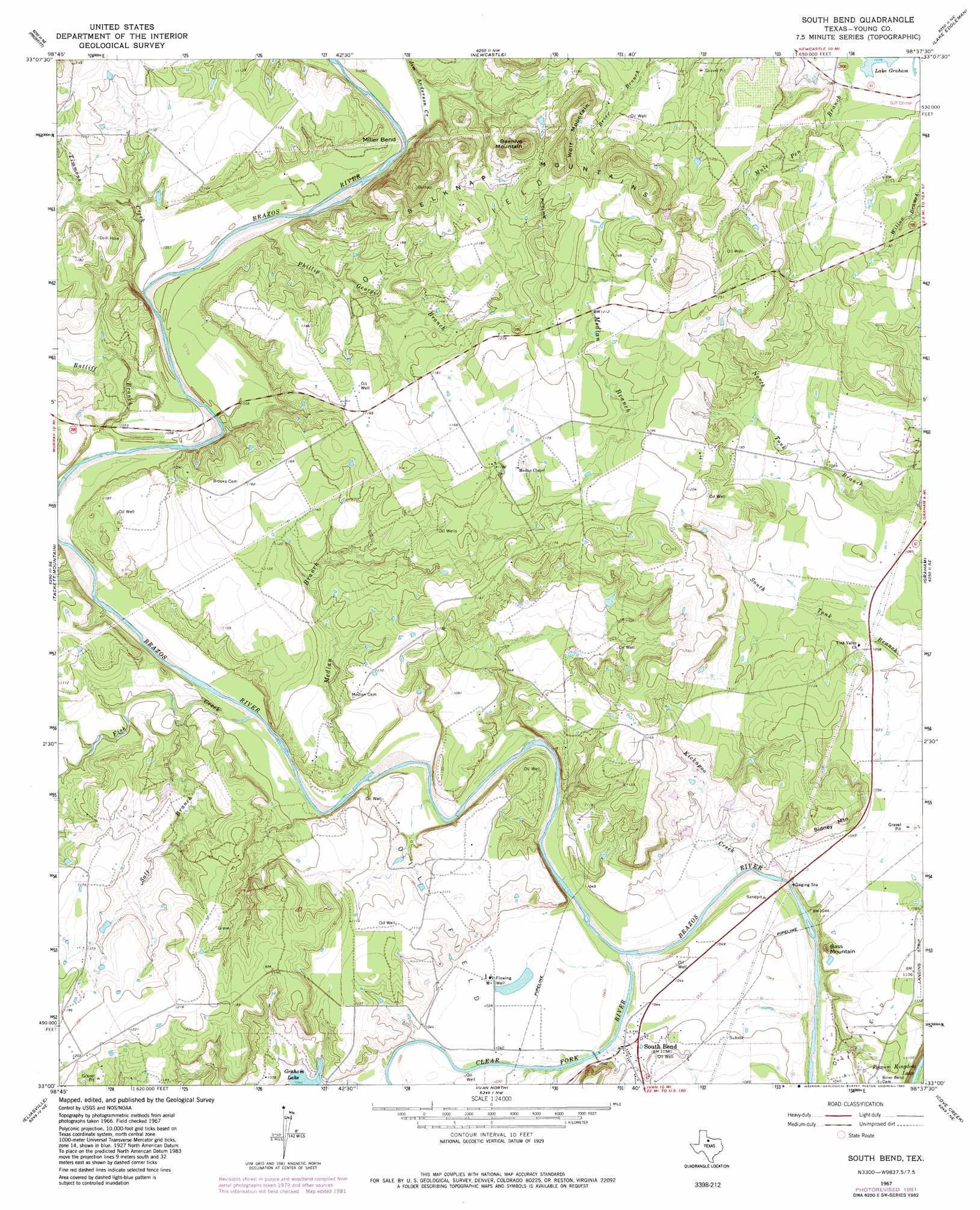
South Bend Topo Map Texas
To zoom in, hover over the map of South Bend
USGS Topo Quad 33098a6 - 1:24,000 scale
| Topo Map Name: | South Bend |
| USGS Topo Quad ID: | 33098a6 |
| Print Size: | ca. 21 1/4" wide x 27" high |
| Southeast Coordinates: | 33° N latitude / 98.625° W longitude |
| Map Center Coordinates: | 33.0625° N latitude / 98.6875° W longitude |
| U.S. State: | TX |
| Filename: | o33098a6.jpg |
| Download Map JPG Image: | South Bend topo map 1:24,000 scale |
| Map Type: | Topographic |
| Topo Series: | 7.5´ |
| Map Scale: | 1:24,000 |
| Source of Map Images: | United States Geological Survey (USGS) |
| Alternate Map Versions: |
South Bend TX 1967, updated 1970 Download PDF Buy paper map South Bend TX 1967, updated 1982 Download PDF Buy paper map South Bend TX 2010 Download PDF Buy paper map South Bend TX 2013 Download PDF Buy paper map South Bend TX 2016 Download PDF Buy paper map |
1:24,000 Topo Quads surrounding South Bend
Padgett |
Olney |
True |
Loving |
Markley |
Proffitt Crossing |
Proffitt |
Newcastle |
Lake Eddleman |
Bryson |
Murray |
Tackett Mountain |
South Bend |
Graham |
Ross Mountain |
Crystal Falls |
Eliasville |
Ivan North |
Cove Creek |
Costello Island |
Breckenridge |
Grand Lake |
Ivan South |
Brad |
Fortune Bend |
> Back to 33098a1 at 1:100,000 scale
> Back to 33098a1 at 1:250,000 scale
> Back to U.S. Topo Maps home
South Bend topo map: Gazetteer
South Bend: Airports
Rosser Ranch Airport elevation 337m 1105′South Bend: Bends
Miller Bend elevation 325m 1066′South Bend: Dams
Graham Lake Dam elevation 317m 1040′South Bend: Populated Places
South Bend elevation 318m 1043′South Bend: Ranges
Belknap Mountains elevation 374m 1227′South Bend: Reservoirs
Graham Lake elevation 318m 1043′South Bend: Streams
Clear Fork elevation 310m 1017′Fish Creek elevation 314m 1030′
Jim Anderson Creek elevation 322m 1056′
Kickapoo Creek elevation 308m 1010′
Medlan Branch elevation 313m 1026′
Phillip George Branch elevation 319m 1046′
Ratliff Branch elevation 316m 1036′
Salt Branch elevation 316m 1036′
Timmons Creek elevation 317m 1040′
South Bend: Summits
Bass Mountain elevation 346m 1135′Beehive Mountain elevation 419m 1374′
Sidney Mountain elevation 353m 1158′
Wolf Mountain elevation 420m 1377′
South Bend digital topo map on disk
Buy this South Bend topo map showing relief, roads, GPS coordinates and other geographical features, as a high-resolution digital map file on DVD: