Lake Eddleman Topo Map Texas
To zoom in, hover over the map of Lake Eddleman
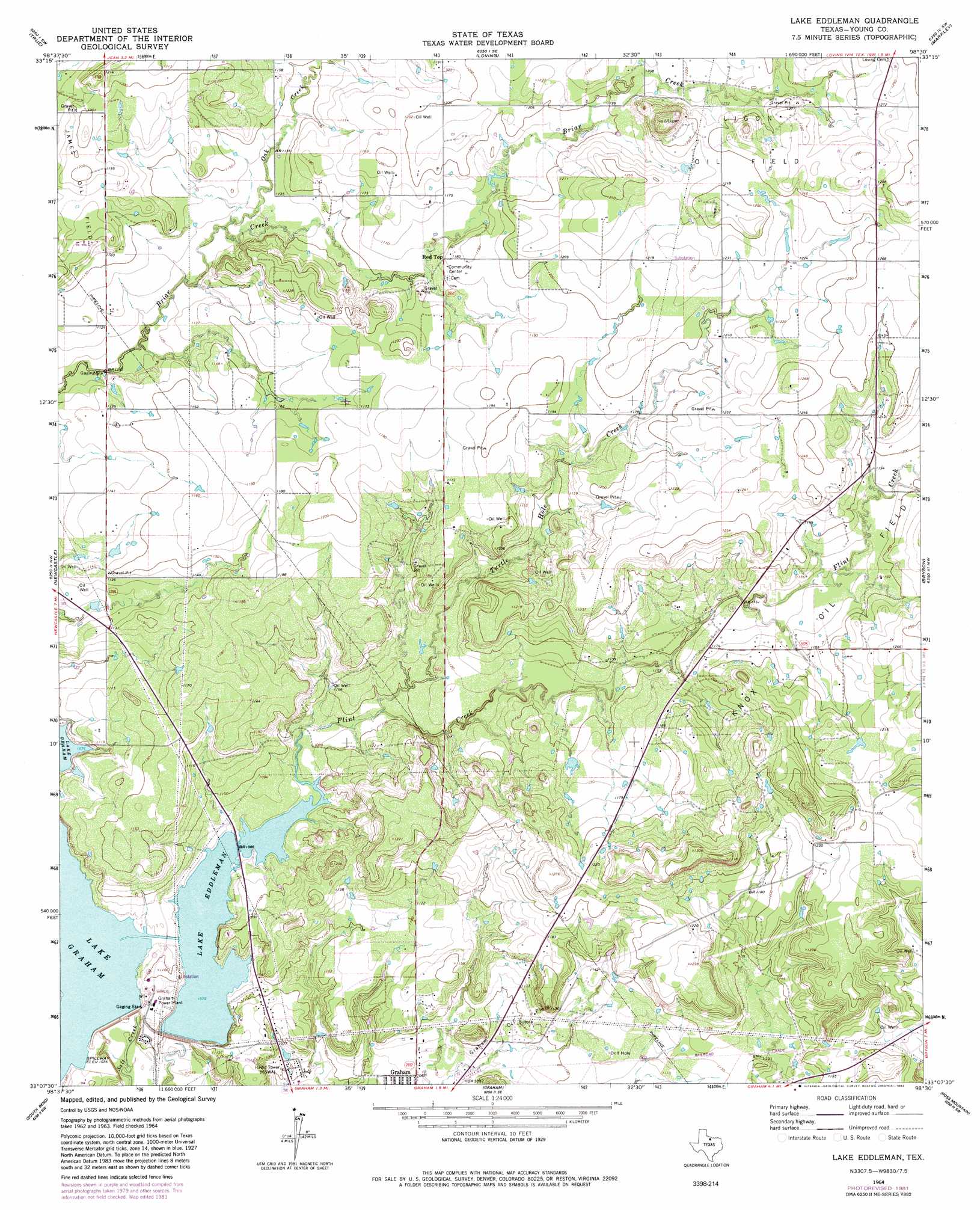
USGS Topo Quad 33098b5 - 1:24,000 scale
| Topo Map Name: | Lake Eddleman |
| USGS Topo Quad ID: | 33098b5 |
| Print Size: | ca. 21 1/4" wide x 27" high |
| Southeast Coordinates: | 33.125° N latitude / 98.5° W longitude |
| Map Center Coordinates: | 33.1875° N latitude / 98.5625° W longitude |
| U.S. State: | TX |
| Filename: | o33098b5.jpg |
| Download Map JPG Image: | Lake Eddleman topo map 1:24,000 scale |
| Map Type: | Topographic |
| Topo Series: | 7.5´ |
| Map Scale: | 1:24,000 |
| Source of Map Images: | United States Geological Survey (USGS) |
| Alternate Map Versions: |
Lake Eddleman TX 1964, updated 1967 Download PDF Buy paper map Lake Eddleman TX 1964, updated 1982 Download PDF Buy paper map Lake Eddleman TX 2010 Download PDF Buy paper map Lake Eddleman TX 2012 Download PDF Buy paper map Lake Eddleman TX 2016 Download PDF Buy paper map |
1:24,000 Topo Quads surrounding Lake Eddleman
Lake Olney |
Bobcat Bluff |
Prickly Pear Branch |
Darnell Branch |
Antelope |
Olney |
True |
Loving |
Markley |
Lynn Creek |
Proffitt |
Newcastle |
Lake Eddleman |
Bryson |
Senate |
Tackett Mountain |
South Bend |
Graham |
Ross Mountain |
Long Hollow |
Eliasville |
Ivan North |
Cove Creek |
Costello Island |
Graford West |
> Back to 33098a1 at 1:100,000 scale
> Back to 33098a1 at 1:250,000 scale
> Back to U.S. Topo Maps home
Lake Eddleman topo map: Gazetteer
Lake Eddleman: Dams
Lake Eddleman Dam elevation 315m 1033′Lake Graham Dam elevation 320m 1049′
Lake Eddleman: Oilfields
Graham Oil Field elevation 333m 1092′James Oil Field elevation 360m 1181′
Ligon Oil Field elevation 392m 1286′
Lake Eddleman: Populated Places
Red Top elevation 360m 1181′Lake Eddleman: Reservoirs
Lake Eddleman elevation 328m 1076′Lake Graham elevation 329m 1079′
Lake Eddleman: Streams
Flint Creek elevation 328m 1076′Oak Creek elevation 342m 1122′
Turtle Hole Creek elevation 331m 1085′
Lake Eddleman digital topo map on disk
Buy this Lake Eddleman topo map showing relief, roads, GPS coordinates and other geographical features, as a high-resolution digital map file on DVD: