Proffitt Crossing Topo Map Texas
To zoom in, hover over the map of Proffitt Crossing
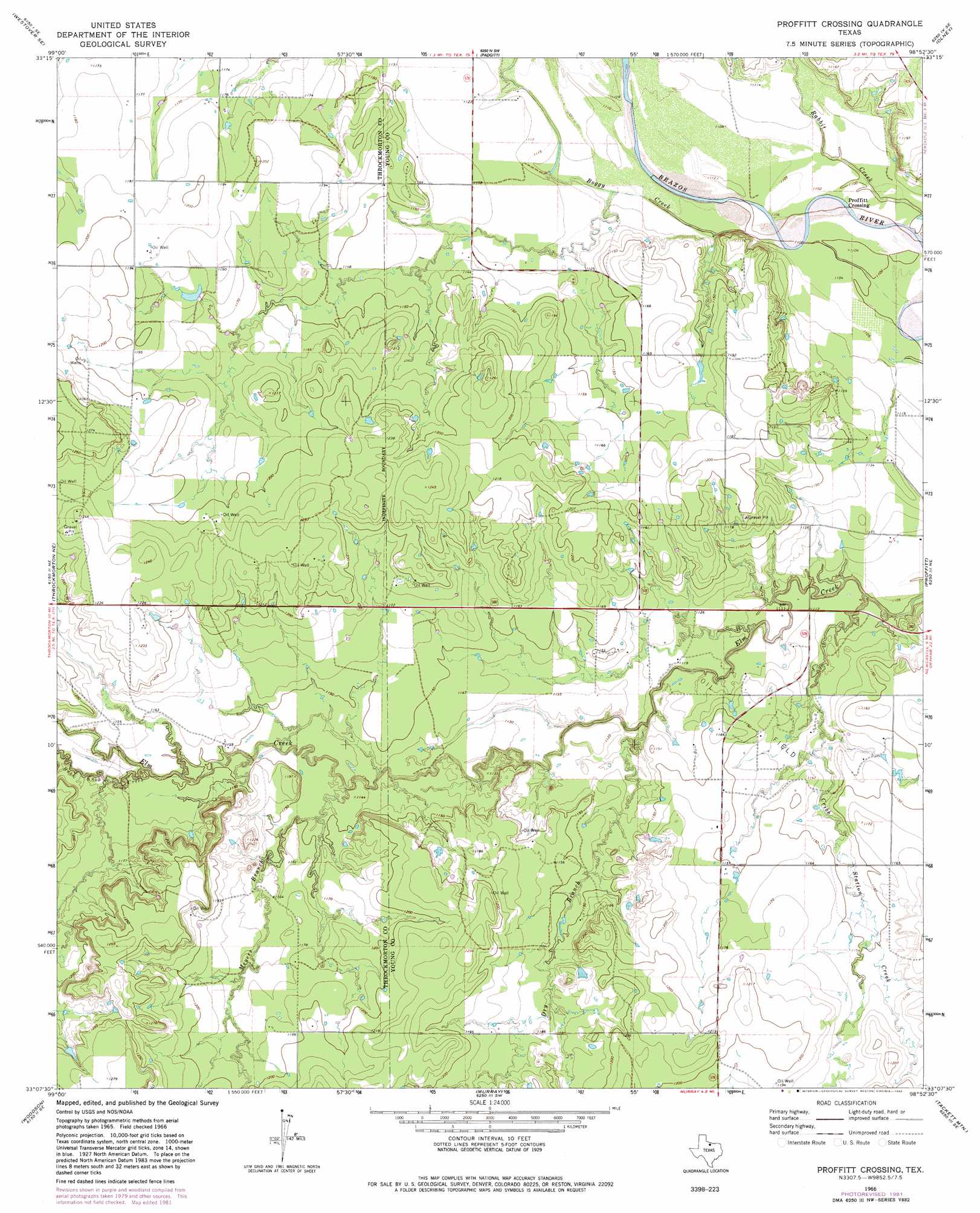
USGS Topo Quad 33098b8 - 1:24,000 scale
| Topo Map Name: | Proffitt Crossing |
| USGS Topo Quad ID: | 33098b8 |
| Print Size: | ca. 21 1/4" wide x 27" high |
| Southeast Coordinates: | 33.125° N latitude / 98.875° W longitude |
| Map Center Coordinates: | 33.1875° N latitude / 98.9375° W longitude |
| U.S. State: | TX |
| Filename: | o33098b8.jpg |
| Download Map JPG Image: | Proffitt Crossing topo map 1:24,000 scale |
| Map Type: | Topographic |
| Topo Series: | 7.5´ |
| Map Scale: | 1:24,000 |
| Source of Map Images: | United States Geological Survey (USGS) |
| Alternate Map Versions: |
Proffitt Crossing TX 1966, updated 1969 Download PDF Buy paper map Proffitt Crossing TX 1966, updated 1982 Download PDF Buy paper map Proffitt Crossing TX 2010 Download PDF Buy paper map Proffitt Crossing TX 2012 Download PDF Buy paper map Proffitt Crossing TX 2016 Download PDF Buy paper map |
1:24,000 Topo Quads surrounding Proffitt Crossing
Rock Canyon |
Westover |
Megargel |
Lake Olney |
Bobcat Bluff |
Westover Sw |
Westover Se |
Padgett |
Olney |
True |
Throckmorton |
Throckmorton Ne |
Proffitt Crossing |
Proffitt |
Newcastle |
Sibley Creek |
Woodson |
Murray |
Tackett Mountain |
South Bend |
Fort Griffin |
Lusk |
Crystal Falls |
Eliasville |
Ivan North |
> Back to 33098a1 at 1:100,000 scale
> Back to 33098a1 at 1:250,000 scale
> Back to U.S. Topo Maps home
Proffitt Crossing topo map: Gazetteer
Proffitt Crossing: Populated Places
Proffitt Crossing elevation 337m 1105′Proffitt Crossing: Streams
Boggy Creek elevation 335m 1099′Bush Knob Creek elevation 346m 1135′
Cribb Station Creek elevation 333m 1092′
Dry Branch elevation 338m 1108′
Meyers Branch elevation 345m 1131′
Proffitt Crossing digital topo map on disk
Buy this Proffitt Crossing topo map showing relief, roads, GPS coordinates and other geographical features, as a high-resolution digital map file on DVD: