Scotland Topo Map Texas
To zoom in, hover over the map of Scotland
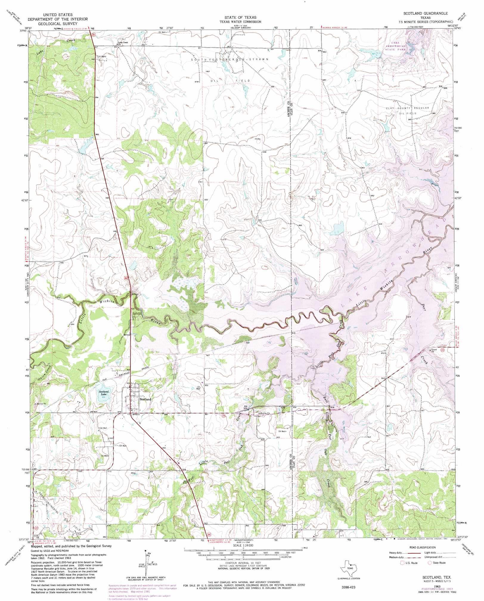
USGS Topo Quad 33098f4 - 1:24,000 scale
| Topo Map Name: | Scotland |
| USGS Topo Quad ID: | 33098f4 |
| Print Size: | ca. 21 1/4" wide x 27" high |
| Southeast Coordinates: | 33.625° N latitude / 98.375° W longitude |
| Map Center Coordinates: | 33.6875° N latitude / 98.4375° W longitude |
| U.S. State: | TX |
| Filename: | o33098f4.jpg |
| Download Map JPG Image: | Scotland topo map 1:24,000 scale |
| Map Type: | Topographic |
| Topo Series: | 7.5´ |
| Map Scale: | 1:24,000 |
| Source of Map Images: | United States Geological Survey (USGS) |
| Alternate Map Versions: |
Scotland TX 1963, updated 1964 Download PDF Buy paper map Scotland TX 1963, updated 1982 Download PDF Buy paper map Scotland TX 2010 Download PDF Buy paper map Scotland TX 2012 Download PDF Buy paper map Scotland TX 2016 Download PDF Buy paper map |
1:24,000 Topo Quads surrounding Scotland
Iowa Park |
Wichita Falls West |
Wichita Falls East |
Dean |
Hurnville |
Holliday |
Lake Wichita |
Sloop Creek |
Jolly |
Henrietta |
Dads Corner |
Archer City Ne |
Scotland |
Deer Creek |
Bluegrove |
Archer City West |
Archer City East |
Windthorst |
Scotland Se |
Joy |
Bobcat Bluff |
Prickly Pear Branch |
Darnell Branch |
Antelope |
Postoak |
> Back to 33098e1 at 1:100,000 scale
> Back to 33098a1 at 1:250,000 scale
> Back to U.S. Topo Maps home
Scotland topo map: Gazetteer
Scotland: Bends
Horseshoe Bend elevation 279m 915′Scotland: Dams
Medders Lake Dam elevation 296m 971′Scotland Lake Dam elevation 284m 931′
Three Island Lake Dam elevation 283m 928′
Scotland: Lakes
Scotland Lake elevation 285m 935′Scotland: Oilfields
BRR Oil Field elevation 279m 915′Clay County Regular Oil Field elevation 300m 984′
Southvogtsberger-Strawn Oil Field elevation 293m 961′
Scotland: Parks
Big Tree Park elevation 288m 944′Deer Creek Park elevation 287m 941′
Little Post Oak Creek Park elevation 291m 954′
Marsh Park elevation 284m 931′
Scotland: Populated Places
Scotland elevation 293m 961′Scotland: Reservoirs
Medders Lake elevation 296m 971′Scotland Lake elevation 284m 931′
Three Island Lake elevation 283m 928′
Scotland: Streams
Deer Creek elevation 279m 915′East Little Post Oak Creek elevation 279m 915′
Little Post Oak Creek elevation 279m 915′
West Little Post Oak Creek elevation 279m 915′
Scotland digital topo map on disk
Buy this Scotland topo map showing relief, roads, GPS coordinates and other geographical features, as a high-resolution digital map file on DVD: