Jolly Topo Map Texas
To zoom in, hover over the map of Jolly
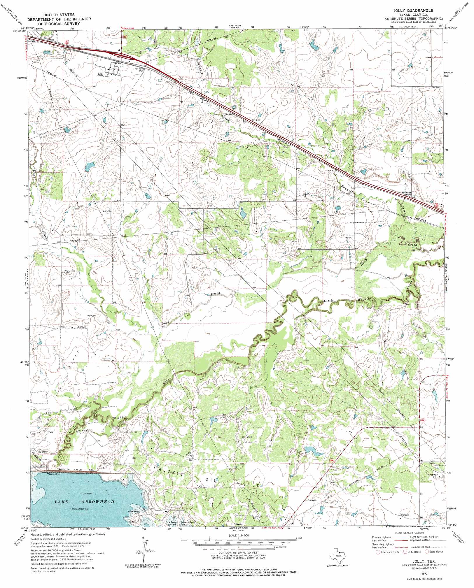
USGS Topo Quad 33098g3 - 1:24,000 scale
| Topo Map Name: | Jolly |
| USGS Topo Quad ID: | 33098g3 |
| Print Size: | ca. 21 1/4" wide x 27" high |
| Southeast Coordinates: | 33.75° N latitude / 98.25° W longitude |
| Map Center Coordinates: | 33.8125° N latitude / 98.3125° W longitude |
| U.S. State: | TX |
| Filename: | o33098g3.jpg |
| Download Map JPG Image: | Jolly topo map 1:24,000 scale |
| Map Type: | Topographic |
| Topo Series: | 7.5´ |
| Map Scale: | 1:24,000 |
| Source of Map Images: | United States Geological Survey (USGS) |
| Alternate Map Versions: |
Jolly TX 1972, updated 1975 Download PDF Buy paper map Jolly TX 2010 Download PDF Buy paper map Jolly TX 2012 Download PDF Buy paper map Jolly TX 2016 Download PDF Buy paper map |
1:24,000 Topo Quads surrounding Jolly
Burkburnett |
Thornberry |
Charlie |
Byers |
Irving |
Wichita Falls West |
Wichita Falls East |
Dean |
Hurnville |
Riverland Cemetery |
Lake Wichita |
Sloop Creek |
Jolly |
Henrietta |
Dickworsham |
Archer City Ne |
Scotland |
Deer Creek |
Bluegrove |
Bellevue |
Archer City East |
Windthorst |
Scotland Se |
Joy |
Vashti |
> Back to 33098e1 at 1:100,000 scale
> Back to 33098a1 at 1:250,000 scale
> Back to U.S. Topo Maps home
Jolly topo map: Gazetteer
Jolly: Dams
Halsell Lake Dam elevation 274m 898′Lake Arrowhead Dam elevation 272m 892′
School Land Lake Dam elevation 287m 941′
Triangle T Cattle Company Lake Dam elevation 283m 928′
Triangle T Lake Number 1 Dam elevation 289m 948′
Triangle T Lake Number 2 Dam elevation 282m 925′
Whitley Lake Dam elevation 277m 908′
Wichita Falls Dam elevation 274m 898′
Jolly: Parks
Crow Trace Park elevation 284m 931′Crow Trace Point Park elevation 279m 915′
Delaware Trail Park elevation 284m 931′
North Park elevation 269m 882′
Jolly: Populated Places
Jolly elevation 300m 984′Jolly: Reservoirs
Halsell Lake elevation 274m 898′Lake Arrowhead elevation 279m 915′
School Land Lake elevation 287m 941′
Triangle T Cattle Company Lake elevation 283m 928′
Triangle T Lake Number 1 elevation 289m 948′
Triangle T Lake Number 2 elevation 282m 925′
Whitley Lake elevation 277m 908′
Jolly: Streams
Bennett Creek elevation 259m 849′Duck Creek elevation 260m 853′
Lake Creek elevation 265m 869′
Jolly digital topo map on disk
Buy this Jolly topo map showing relief, roads, GPS coordinates and other geographical features, as a high-resolution digital map file on DVD: