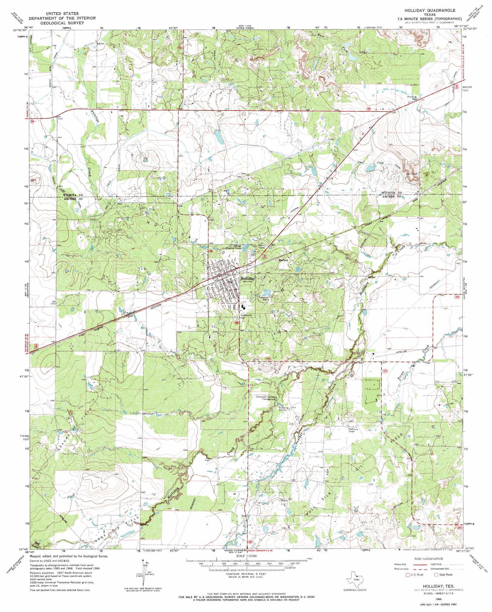
Holliday Topo Map Texas
To zoom in, hover over the map of Holliday
USGS Topo Quad 33098g6 - 1:24,000 scale
| Topo Map Name: | Holliday |
| USGS Topo Quad ID: | 33098g6 |
| Print Size: | ca. 21 1/4" wide x 27" high |
| Southeast Coordinates: | 33.75° N latitude / 98.625° W longitude |
| Map Center Coordinates: | 33.8125° N latitude / 98.6875° W longitude |
| U.S. State: | TX |
| Filename: | o33098g6.jpg |
| Download Map JPG Image: | Holliday topo map 1:24,000 scale |
| Map Type: | Topographic |
| Topo Series: | 7.5´ |
| Map Scale: | 1:24,000 |
| Source of Map Images: | United States Geological Survey (USGS) |
| Alternate Map Versions: |
Holliday TX 1966, updated 1968 Download PDF Buy paper map Holliday TX 2010 Download PDF Buy paper map Holliday TX 2012 Download PDF Buy paper map Holliday TX 2016 Download PDF Buy paper map |
1:24,000 Topo Quads surrounding Holliday
Electra |
Sunshine Hill |
Clara |
Burkburnett |
Thornberry |
Beaver Creek |
Fowlkes |
Iowa Park |
Wichita Falls West |
Wichita Falls East |
Lake Diversion |
Mankins |
Holliday |
Lake Wichita |
Sloop Creek |
Dundee |
Lake Kickapoo |
Dads Corner |
Archer City Ne |
Scotland |
Dundee Sw |
Dundee Se |
Archer City West |
Archer City East |
Windthorst |
> Back to 33098e1 at 1:100,000 scale
> Back to 33098a1 at 1:250,000 scale
> Back to U.S. Topo Maps home
Holliday topo map: Gazetteer
Holliday: Airports
Lucky G Airport elevation 325m 1066′Holliday: Canals
CA Lateral elevation 315m 1033′SZ Lateral elevation 310m 1017′
Holliday: Dams
Netherly Lake Dam elevation 313m 1026′Holliday: Oilfields
Daume Oil Field elevation 320m 1049′Gose Oil Field elevation 317m 1040′
Holliday Oil Field elevation 317m 1040′
Hull-Silk Oil Field elevation 312m 1023′
Holliday: Populated Places
Hartex elevation 314m 1030′Holliday elevation 321m 1053′
Holliday: Reservoirs
Netherly Lake elevation 313m 1026′Holliday: Streams
Bull Creek elevation 317m 1040′Panther Creek elevation 304m 997′
Holliday digital topo map on disk
Buy this Holliday topo map showing relief, roads, GPS coordinates and other geographical features, as a high-resolution digital map file on DVD: