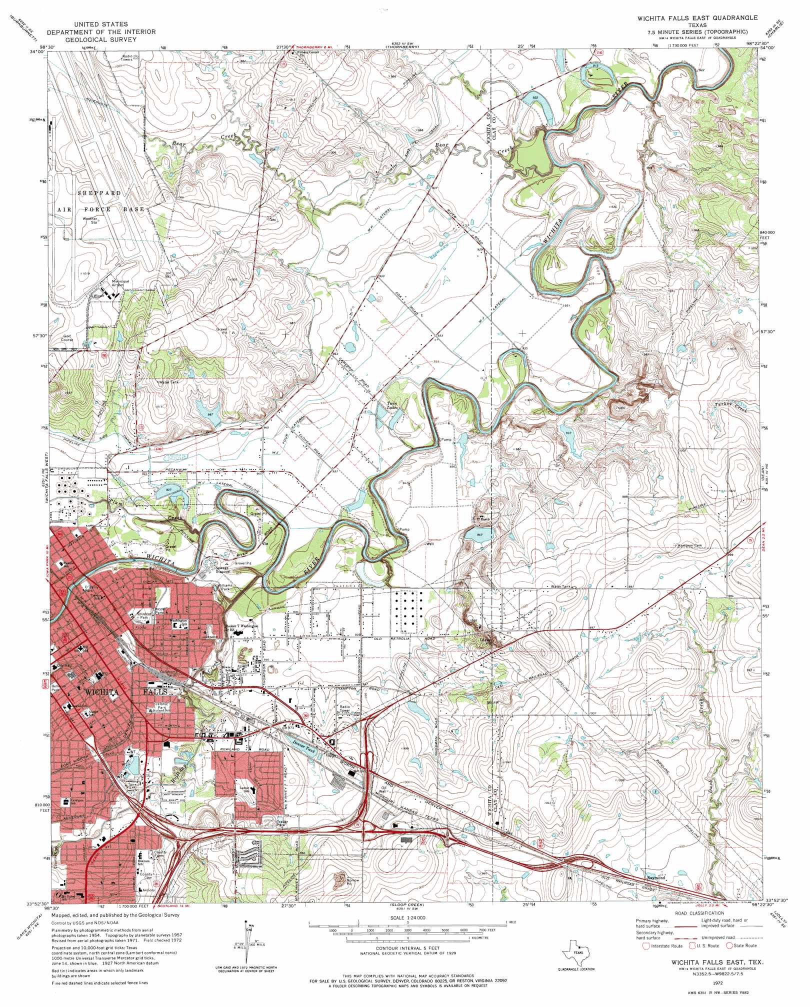
Wichita Falls East Topo Map Texas
To zoom in, hover over the map of Wichita Falls East
USGS Topo Quad 33098h4 - 1:24,000 scale
| Topo Map Name: | Wichita Falls East |
| USGS Topo Quad ID: | 33098h4 |
| Print Size: | ca. 21 1/4" wide x 27" high |
| Southeast Coordinates: | 33.875° N latitude / 98.375° W longitude |
| Map Center Coordinates: | 33.9375° N latitude / 98.4375° W longitude |
| U.S. State: | TX |
| Filename: | o33098h4.jpg |
| Download Map JPG Image: | Wichita Falls East topo map 1:24,000 scale |
| Map Type: | Topographic |
| Topo Series: | 7.5´ |
| Map Scale: | 1:24,000 |
| Source of Map Images: | United States Geological Survey (USGS) |
| Alternate Map Versions: |
Wichita Falls East TX 1957, updated 1958 Download PDF Buy paper map Wichita Falls East TX 1972, updated 1976 Download PDF Buy paper map Wichita Falls East TX 1972, updated 1986 Download PDF Buy paper map Wichita Falls East TX 2010 Download PDF Buy paper map Wichita Falls East TX 2013 Download PDF Buy paper map Wichita Falls East TX 2016 Download PDF Buy paper map |
1:24,000 Topo Quads surrounding Wichita Falls East
Grandfield |
Devol |
Randlett |
Taylor |
Hooper |
Clara |
Burkburnett |
Thornberry |
Charlie |
Byers |
Iowa Park |
Wichita Falls West |
Wichita Falls East |
Dean |
Hurnville |
Holliday |
Lake Wichita |
Sloop Creek |
Jolly |
Henrietta |
Dads Corner |
Archer City Ne |
Scotland |
Deer Creek |
Bluegrove |
> Back to 33098e1 at 1:100,000 scale
> Back to 33098a1 at 1:250,000 scale
> Back to U.S. Topo Maps home
Wichita Falls East topo map: Gazetteer
Wichita Falls East: Airports
Sheppard Air Force Base/Wichita Falls Municipal Airport elevation 301m 987′Wichita Falls East: Canals
W J Four Lateral elevation 286m 938′W J Lateral elevation 287m 941′
W P Lateral elevation 289m 948′
Wichita Falls East: Dams
Denver Tank Dam elevation 294m 964′Henry Lake Dam elevation 287m 941′
Parker Estate Lake Dam elevation 283m 928′
Seventy-Seven Ranch Lake Dam elevation 286m 938′
Wichita Falls East: Parks
Bellevue Park elevation 303m 994′Donnell Park elevation 287m 941′
Jalonic Park elevation 288m 944′
Lamar Park elevation 291m 954′
Lincoln Park elevation 286m 938′
O'Reilly Park elevation 287m 941′
Spudder Park elevation 288m 944′
Williams Park elevation 285m 935′
Wichita Falls East: Populated Places
Raymond elevation 290m 951′Wichita Falls elevation 289m 948′
Wichita Falls East: Reservoirs
Denver Tank elevation 295m 967′Henry Lake elevation 287m 941′
Parker Estate Lake elevation 283m 928′
Seventy-Seven Ranch Lake elevation 286m 938′
Twin Lakes elevation 284m 931′
Wichita Falls East: Streams
Bear Creek elevation 278m 912′Holliday Creek elevation 278m 912′
Plum Creek elevation 279m 915′
Wichita Falls East digital topo map on disk
Buy this Wichita Falls East topo map showing relief, roads, GPS coordinates and other geographical features, as a high-resolution digital map file on DVD: