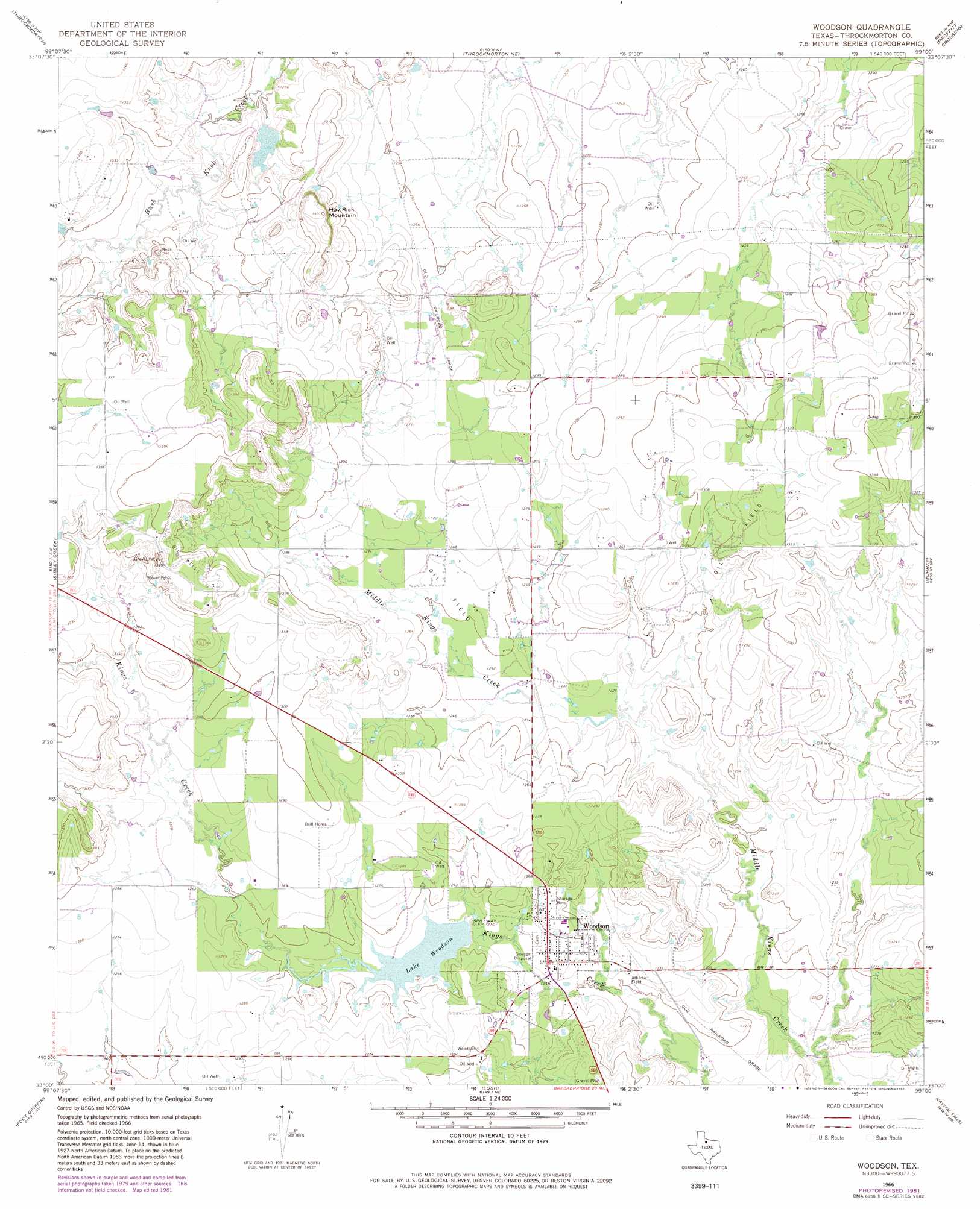
Woodson Topo Map Texas
To zoom in, hover over the map of Woodson
USGS Topo Quad 33099a1 - 1:24,000 scale
| Topo Map Name: | Woodson |
| USGS Topo Quad ID: | 33099a1 |
| Print Size: | ca. 21 1/4" wide x 27" high |
| Southeast Coordinates: | 33° N latitude / 99° W longitude |
| Map Center Coordinates: | 33.0625° N latitude / 99.0625° W longitude |
| U.S. State: | TX |
| Filename: | o33099a1.jpg |
| Download Map JPG Image: | Woodson topo map 1:24,000 scale |
| Map Type: | Topographic |
| Topo Series: | 7.5´ |
| Map Scale: | 1:24,000 |
| Source of Map Images: | United States Geological Survey (USGS) |
| Alternate Map Versions: |
Woodson TX 1966, updated 1968 Download PDF Buy paper map Woodson TX 1966, updated 1982 Download PDF Buy paper map Woodson TX 2010 Download PDF Buy paper map Woodson TX 2012 Download PDF Buy paper map Woodson TX 2016 Download PDF Buy paper map |
1:24,000 Topo Quads surrounding Woodson
Antelope Creek Se |
Westover Sw |
Westover Se |
Padgett |
Olney |
Tonk Creek |
Throckmorton |
Throckmorton Ne |
Proffitt Crossing |
Proffitt |
Reynolds Bend |
Sibley Creek |
Woodson |
Murray |
Tackett Mountain |
Collins Creek |
Fort Griffin |
Lusk |
Crystal Falls |
Eliasville |
Round Hill |
Murphy Creek |
Edwards Branch |
Breckenridge |
Grand Lake |
> Back to 33099a1 at 1:100,000 scale
> Back to 33098a1 at 1:250,000 scale
> Back to U.S. Topo Maps home
Woodson topo map: Gazetteer
Woodson: Dams
Hugh Dickie Lake Dam elevation 370m 1213′Lake Woodson Dam elevation 375m 1230′
McKnight Lake Dam elevation 386m 1266′
Woodson: Populated Places
Woodson elevation 374m 1227′Woodson: Reservoirs
Hugh Dickie Lake elevation 370m 1213′Lake Woodson elevation 375m 1230′
McKnight Lake elevation 386m 1266′
Woodson: Summits
Hay Rick Mountain elevation 413m 1354′Woodson digital topo map on disk
Buy this Woodson topo map showing relief, roads, GPS coordinates and other geographical features, as a high-resolution digital map file on DVD: