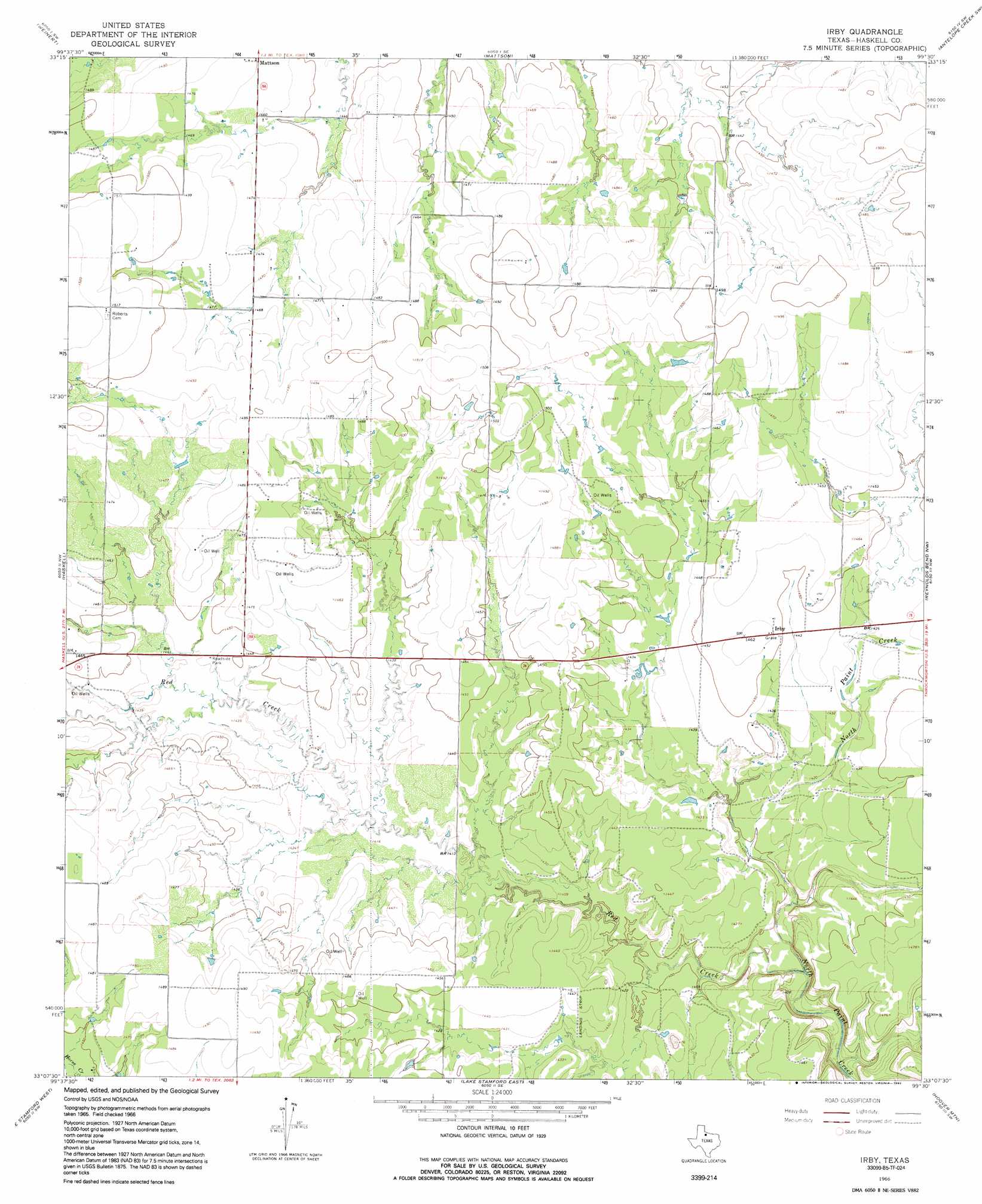
Irby Topo Map Texas
To zoom in, hover over the map of Irby
USGS Topo Quad 33099b5 - 1:24,000 scale
| Topo Map Name: | Irby |
| USGS Topo Quad ID: | 33099b5 |
| Print Size: | ca. 21 1/4" wide x 27" high |
| Southeast Coordinates: | 33.125° N latitude / 99.5° W longitude |
| Map Center Coordinates: | 33.1875° N latitude / 99.5625° W longitude |
| U.S. State: | TX |
| Filename: | o33099b5.jpg |
| Download Map JPG Image: | Irby topo map 1:24,000 scale |
| Map Type: | Topographic |
| Topo Series: | 7.5´ |
| Map Scale: | 1:24,000 |
| Source of Map Images: | United States Geological Survey (USGS) |
| Alternate Map Versions: |
Irby TX 1966, updated 1970 Download PDF Buy paper map Irby TX 1966, updated 1992 Download PDF Buy paper map Irby TX 2010 Download PDF Buy paper map Irby TX 2013 Download PDF Buy paper map Irby TX 2016 Download PDF Buy paper map |
1:24,000 Topo Quads surrounding Irby
Knox City |
Munday West |
Munday East |
Antelope Creek Nw |
Antelope Creek Ne |
Rochester |
Weinert |
Mattson |
Antelope Creek Sw |
Antelope Creek Se |
Pinkerton |
Haskell |
Irby |
Reynolds Bend Nw |
Tonk Creek |
Dudleys Creek |
Lake Stamford West |
Lake Stamford East |
Hoover Mountain |
Reynolds Bend |
Stamford |
Lueders Nw |
Lueders Ne |
Antelope Hills |
Collins Creek |
> Back to 33099a1 at 1:100,000 scale
> Back to 33098a1 at 1:250,000 scale
> Back to U.S. Topo Maps home
Irby digital topo map on disk
Buy this Irby topo map showing relief, roads, GPS coordinates and other geographical features, as a high-resolution digital map file on DVD: