Antelope Creek Nw Topo Map Texas
To zoom in, hover over the map of Antelope Creek Nw
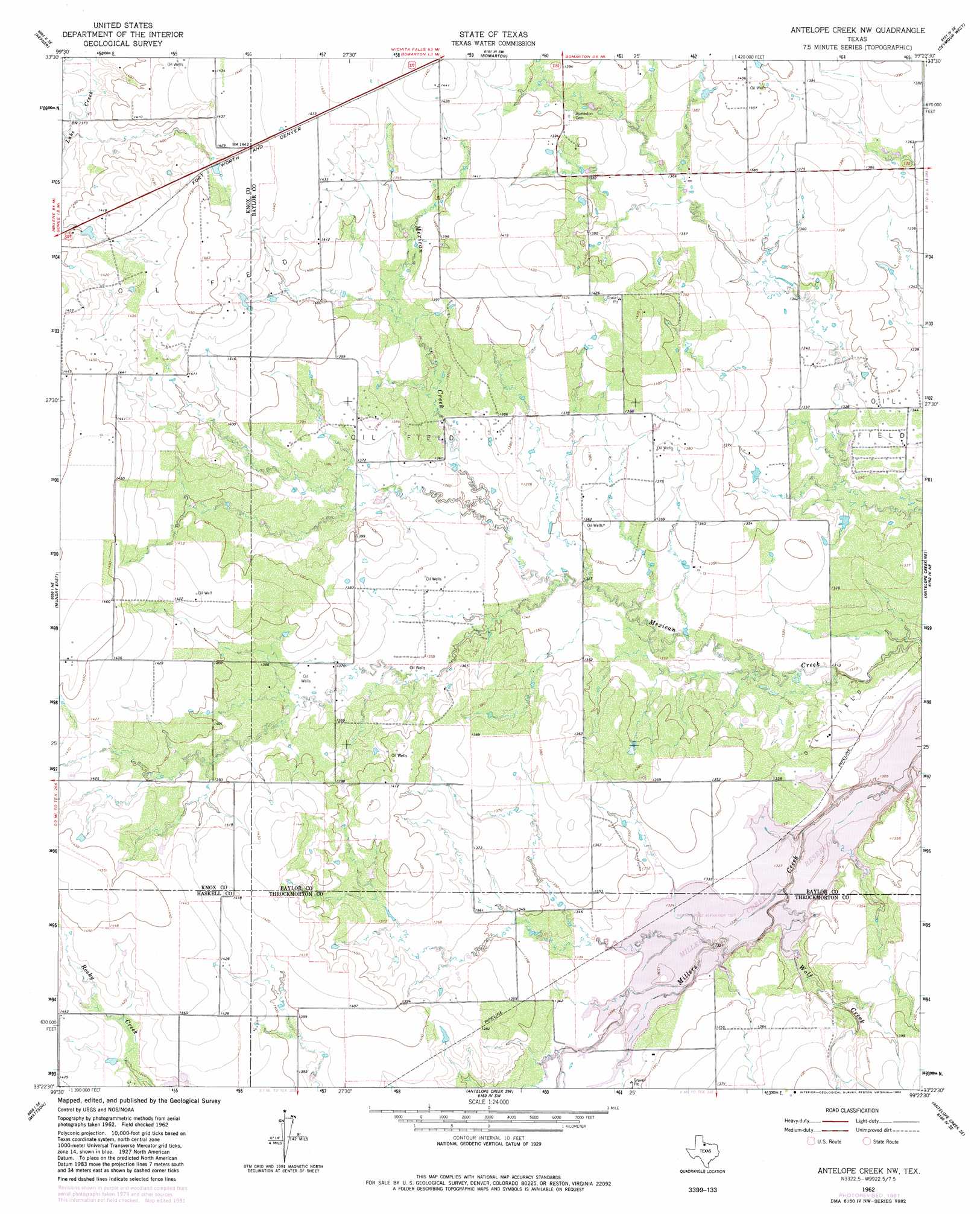
USGS Topo Quad 33099d4 - 1:24,000 scale
| Topo Map Name: | Antelope Creek Nw |
| USGS Topo Quad ID: | 33099d4 |
| Print Size: | ca. 21 1/4" wide x 27" high |
| Southeast Coordinates: | 33.375° N latitude / 99.375° W longitude |
| Map Center Coordinates: | 33.4375° N latitude / 99.4375° W longitude |
| U.S. State: | TX |
| Filename: | o33099d4.jpg |
| Download Map JPG Image: | Antelope Creek Nw topo map 1:24,000 scale |
| Map Type: | Topographic |
| Topo Series: | 7.5´ |
| Map Scale: | 1:24,000 |
| Source of Map Images: | United States Geological Survey (USGS) |
| Alternate Map Versions: |
Antelope Creek NW TX 1962, updated 1965 Download PDF Buy paper map Antelope Creek NW TX 1962, updated 1982 Download PDF Buy paper map Antelope Creek NW TX 2010 Download PDF Buy paper map Antelope Creek NW TX 2012 Download PDF Buy paper map Antelope Creek NW TX 2016 Download PDF Buy paper map |
1:24,000 Topo Quads surrounding Antelope Creek Nw
Gilliland |
Vera |
Soap Creek |
Southwest Lake Kemp |
Southeast Lake Kemp |
Rhineland |
Hefner |
Bomarton |
Seymour West |
Seymour East |
Munday West |
Munday East |
Antelope Creek Nw |
Antelope Creek Ne |
Rock Canyon |
Weinert |
Mattson |
Antelope Creek Sw |
Antelope Creek Se |
Westover Sw |
Haskell |
Irby |
Reynolds Bend Nw |
Tonk Creek |
Throckmorton |
> Back to 33099a1 at 1:100,000 scale
> Back to 33098a1 at 1:250,000 scale
> Back to U.S. Topo Maps home
Antelope Creek Nw digital topo map on disk
Buy this Antelope Creek Nw topo map showing relief, roads, GPS coordinates and other geographical features, as a high-resolution digital map file on DVD: