Cope Branch Topo Map Texas
To zoom in, hover over the map of Cope Branch
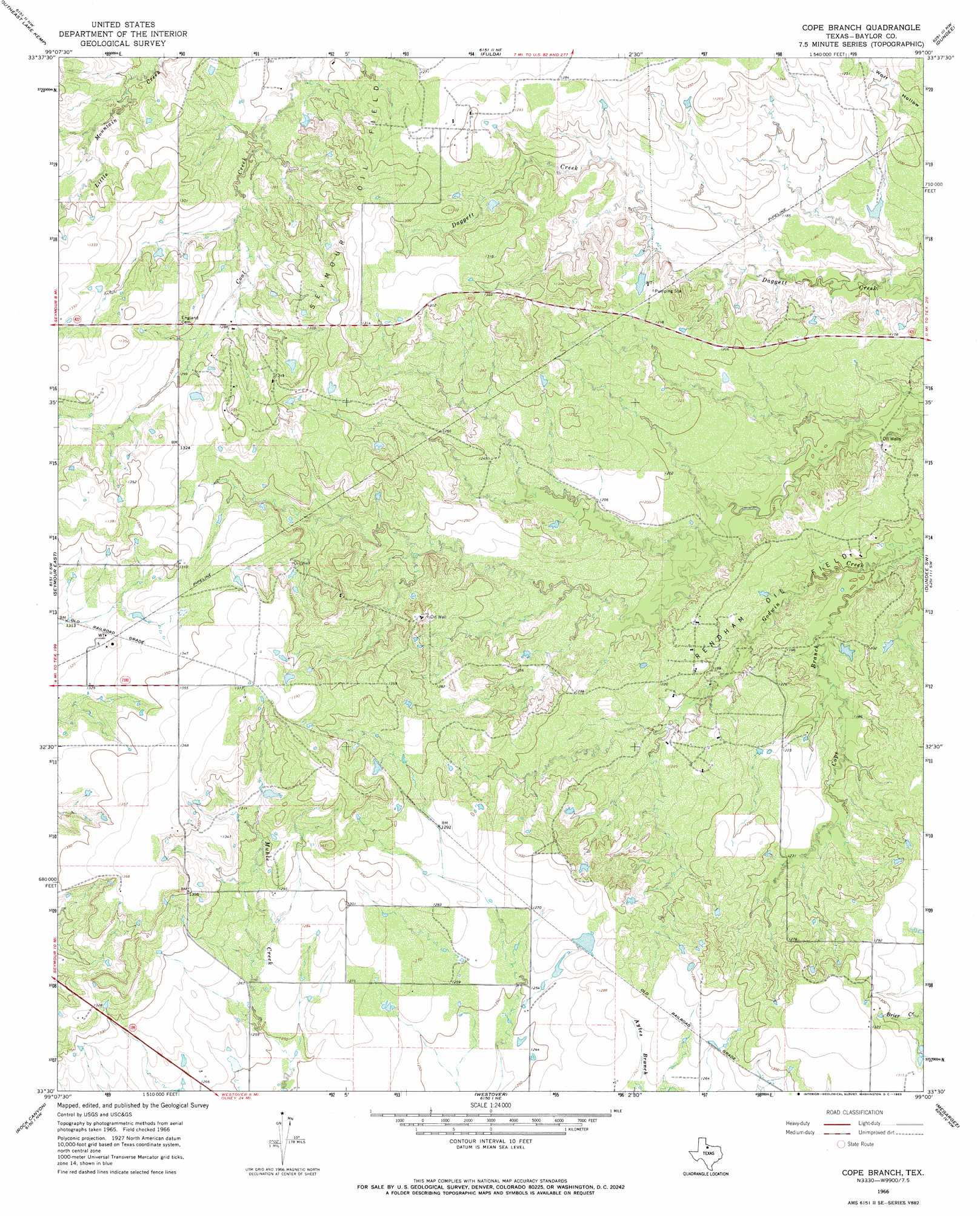
USGS Topo Quad 33099e1 - 1:24,000 scale
| Topo Map Name: | Cope Branch |
| USGS Topo Quad ID: | 33099e1 |
| Print Size: | ca. 21 1/4" wide x 27" high |
| Southeast Coordinates: | 33.5° N latitude / 99° W longitude |
| Map Center Coordinates: | 33.5625° N latitude / 99.0625° W longitude |
| U.S. State: | TX |
| Filename: | o33099e1.jpg |
| Download Map JPG Image: | Cope Branch topo map 1:24,000 scale |
| Map Type: | Topographic |
| Topo Series: | 7.5´ |
| Map Scale: | 1:24,000 |
| Source of Map Images: | United States Geological Survey (USGS) |
| Alternate Map Versions: |
Cope Branch TX 1966, updated 1969 Download PDF Buy paper map Cope Branch TX 2010 Download PDF Buy paper map Cope Branch TX 2013 Download PDF Buy paper map Cope Branch TX 2016 Download PDF Buy paper map |
1:24,000 Topo Quads surrounding Cope Branch
Northwest Lake Kemp |
Northeast Lake Kemp |
Franklin Bend |
Lake Diversion |
Mankins |
Southwest Lake Kemp |
Southeast Lake Kemp |
Fulda |
Dundee |
Lake Kickapoo |
Seymour West |
Seymour East |
Cope Branch |
Dundee Sw |
Dundee Se |
Antelope Creek Ne |
Rock Canyon |
Westover |
Megargel |
Lake Olney |
Antelope Creek Se |
Westover Sw |
Westover Se |
Padgett |
Olney |
> Back to 33099e1 at 1:100,000 scale
> Back to 33098a1 at 1:250,000 scale
> Back to U.S. Topo Maps home
Cope Branch topo map: Gazetteer
Cope Branch: Oilfields
Rendham Oil Field elevation 363m 1190′Seymour Oil Field elevation 398m 1305′
Cope Branch: Streams
Cope Branch elevation 345m 1131′Cope Branch digital topo map on disk
Buy this Cope Branch topo map showing relief, roads, GPS coordinates and other geographical features, as a high-resolution digital map file on DVD: