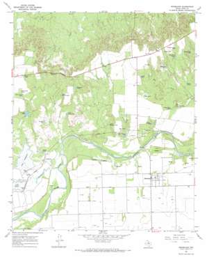
Rhineland Topo Map Texas
To zoom in, hover over the map of Rhineland
USGS Topo Quad 33099e6 - 1:24,000 scale
| Topo Map Name: | Rhineland |
| USGS Topo Quad ID: | 33099e6 |
| Print Size: | ca. 21 1/4" wide x 27" high |
| Southeast Coordinates: | 33.5° N latitude / 99.625° W longitude |
| Map Center Coordinates: | 33.5625° N latitude / 99.6875° W longitude |
| U.S. State: | TX |
| Filename: | o33099e6.jpg |
| Download Map JPG Image: | Rhineland topo map 1:24,000 scale |
| Map Type: | Topographic |
| Topo Series: | 7.5´ |
| Map Scale: | 1:24,000 |
| Source of Map Images: | United States Geological Survey (USGS) |
| Alternate Map Versions: |
Rhineland TX 1967, updated 1970 Download PDF Buy paper map Rhineland TX 2010 Download PDF Buy paper map Rhineland TX 2013 Download PDF Buy paper map Rhineland TX 2016 Download PDF Buy paper map |
1:24,000 Topo Quads surrounding Rhineland
> Back to 33099e1 at 1:100,000 scale
> Back to 33098a1 at 1:250,000 scale
> Back to U.S. Topo Maps home
Rhineland topo map: Gazetteer
Rhineland: Dams
Crappie Tank Dam elevation 440m 1443′Lake Catharine Dam elevation 423m 1387′
Lake Davis Dam elevation 423m 1387′
Rhineland: Gaps
The Narrows elevation 456m 1496′Rhineland: Populated Places
Rhineland elevation 428m 1404′Rhineland: Reservoirs
Atkinson Tank elevation 425m 1394′Cox Tank elevation 452m 1482′
Crappie Tank elevation 440m 1443′
Deep Tank elevation 424m 1391′
Double Tanks elevation 424m 1391′
Dragline Tank elevation 425m 1394′
East Breaks Tank elevation 436m 1430′
Glover Trap Tank elevation 448m 1469′
Grass Field Tank elevation 424m 1391′
Gravel Tank elevation 421m 1381′
Highline Tank elevation 436m 1430′
Horse Pasture Tank elevation 419m 1374′
Lake Catharine elevation 428m 1404′
Lake Davis elevation 429m 1407′
Little Grass Field Tank elevation 428m 1404′
Long Trap Tanks elevation 440m 1443′
Moss Tank elevation 434m 1423′
North Double Tanks elevation 440m 1443′
North Patton Tank elevation 433m 1420′
Parker Tank elevation 446m 1463′
Shipman Trap Tank elevation 448m 1469′
Waggoner Tank elevation 446m 1463′
Ward Field Tank elevation 449m 1473′
Ward Tank elevation 456m 1496′
West McClain Tank elevation 422m 1384′
White Tank elevation 452m 1482′
Rhineland: Streams
Dutchman Creek elevation 415m 1361′Rhineland digital topo map on disk
Buy this Rhineland topo map showing relief, roads, GPS coordinates and other geographical features, as a high-resolution digital map file on DVD:


