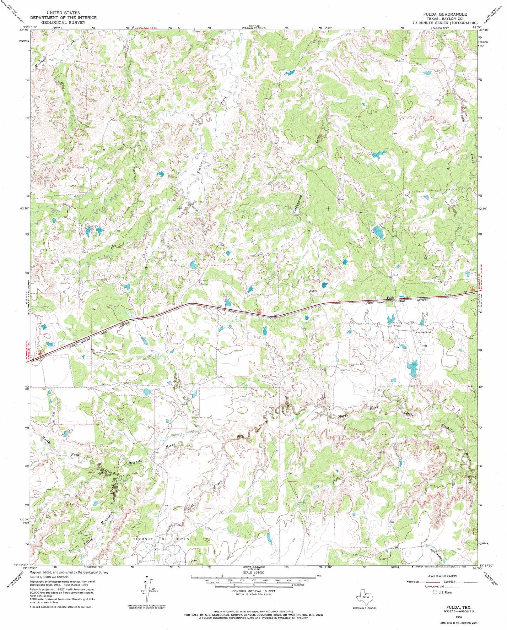
Fulda Topo Map Texas
To zoom in, hover over the map of Fulda
USGS Topo Quad 33099f1 - 1:24,000 scale
| Topo Map Name: | Fulda |
| USGS Topo Quad ID: | 33099f1 |
| Print Size: | ca. 21 1/4" wide x 27" high |
| Southeast Coordinates: | 33.625° N latitude / 99° W longitude |
| Map Center Coordinates: | 33.6875° N latitude / 99.0625° W longitude |
| U.S. State: | TX |
| Filename: | o33099f1.jpg |
| Download Map JPG Image: | Fulda topo map 1:24,000 scale |
| Map Type: | Topographic |
| Topo Series: | 7.5´ |
| Map Scale: | 1:24,000 |
| Source of Map Images: | United States Geological Survey (USGS) |
| Alternate Map Versions: |
Fulda TX 1966, updated 1968 Download PDF Buy paper map Fulda TX 2010 Download PDF Buy paper map Fulda TX 2012 Download PDF Buy paper map Fulda TX 2016 Download PDF Buy paper map |
1:24,000 Topo Quads surrounding Fulda
Santa Rosa Lake |
Grayback |
Lake Electra |
Beaver Creek |
Fowlkes |
Northwest Lake Kemp |
Northeast Lake Kemp |
Franklin Bend |
Lake Diversion |
Mankins |
Southwest Lake Kemp |
Southeast Lake Kemp |
Fulda |
Dundee |
Lake Kickapoo |
Seymour West |
Seymour East |
Cope Branch |
Dundee Sw |
Dundee Se |
Antelope Creek Ne |
Rock Canyon |
Westover |
Megargel |
Lake Olney |
> Back to 33099e1 at 1:100,000 scale
> Back to 33098a1 at 1:250,000 scale
> Back to U.S. Topo Maps home
Fulda topo map: Gazetteer
Fulda: Dams
Cowan Lake Dam elevation 350m 1148′Fulda: Populated Places
Fulda elevation 370m 1213′Fulda: Reservoirs
Cowan Lake elevation 350m 1148′Fulda: Streams
Coal Creek elevation 354m 1161′Little Mountain Creek elevation 366m 1200′
Fulda digital topo map on disk
Buy this Fulda topo map showing relief, roads, GPS coordinates and other geographical features, as a high-resolution digital map file on DVD: