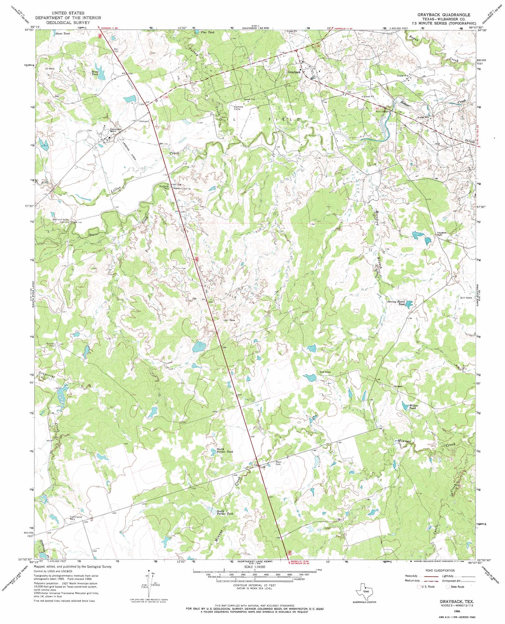
Grayback Topo Map Texas
To zoom in, hover over the map of Grayback
USGS Topo Quad 33099h2 - 1:24,000 scale
| Topo Map Name: | Grayback |
| USGS Topo Quad ID: | 33099h2 |
| Print Size: | ca. 21 1/4" wide x 27" high |
| Southeast Coordinates: | 33.875° N latitude / 99.125° W longitude |
| Map Center Coordinates: | 33.9375° N latitude / 99.1875° W longitude |
| U.S. State: | TX |
| Filename: | o33099h2.jpg |
| Download Map JPG Image: | Grayback topo map 1:24,000 scale |
| Map Type: | Topographic |
| Topo Series: | 7.5´ |
| Map Scale: | 1:24,000 |
| Source of Map Images: | United States Geological Survey (USGS) |
| Alternate Map Versions: |
Grayback TX 1966, updated 1968 Download PDF Buy paper map Grayback TX 2010 Download PDF Buy paper map Grayback TX 2012 Download PDF Buy paper map Grayback TX 2016 Download PDF Buy paper map |
1:24,000 Topo Quads surrounding Grayback
Tolbert |
Vernon |
Oklaunion |
Davidson |
Cowboy Springs |
Rayland |
Lockett |
Boggy Creek |
Harrold |
Electra |
Santa Rosa Lake Nw |
Santa Rosa Lake |
Grayback |
Lake Electra |
Beaver Creek |
Santa Rosa Lake Sw |
Northwest Lake Kemp |
Northeast Lake Kemp |
Franklin Bend |
Lake Diversion |
Soap Creek |
Southwest Lake Kemp |
Southeast Lake Kemp |
Fulda |
Dundee |
> Back to 33099e1 at 1:100,000 scale
> Back to 33098a1 at 1:250,000 scale
> Back to U.S. Topo Maps home
Grayback topo map: Gazetteer
Grayback: Populated Places
Grayback elevation 361m 1184′Hoot and Holler Crossing elevation 347m 1138′
Midway Crossing elevation 344m 1128′
Rock Crossing elevation 335m 1099′
Grayback: Reservoirs
Bronc Tank elevation 361m 1184′Diving Board Tank elevation 360m 1181′
Flax Tank elevation 351m 1151′
North Parker Tank elevation 375m 1230′
South Parker Tank elevation 372m 1220′
Willow Tank elevation 360m 1181′
Grayback: Streams
Cattle Creek elevation 346m 1135′Hereford Branch elevation 337m 1105′
Lillus Creek elevation 342m 1122′
Turkey Creek elevation 337m 1105′
Grayback digital topo map on disk
Buy this Grayback topo map showing relief, roads, GPS coordinates and other geographical features, as a high-resolution digital map file on DVD: