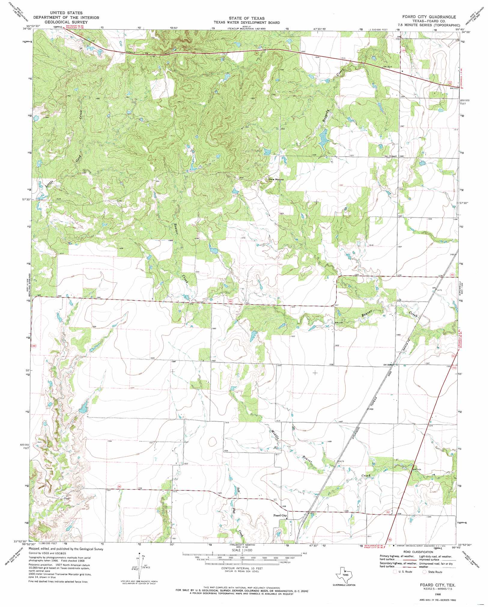
Foard City Topo Map Texas
To zoom in, hover over the map of Foard City
USGS Topo Quad 33099h7 - 1:24,000 scale
| Topo Map Name: | Foard City |
| USGS Topo Quad ID: | 33099h7 |
| Print Size: | ca. 21 1/4" wide x 27" high |
| Southeast Coordinates: | 33.875° N latitude / 99.75° W longitude |
| Map Center Coordinates: | 33.9375° N latitude / 99.8125° W longitude |
| U.S. State: | TX |
| Filename: | o33099h7.jpg |
| Download Map JPG Image: | Foard City topo map 1:24,000 scale |
| Map Type: | Topographic |
| Topo Series: | 7.5´ |
| Map Scale: | 1:24,000 |
| Source of Map Images: | United States Geological Survey (USGS) |
| Alternate Map Versions: |
Foard City TX 1968, updated 1970 Download PDF Buy paper map Foard City TX 2010 Download PDF Buy paper map Foard City TX 2012 Download PDF Buy paper map Foard City TX 2016 Download PDF Buy paper map |
1:24,000 Topo Quads surrounding Foard City
Baker |
Cactus Creek |
Maybell Canyon |
Big Mound |
Medicine Mound |
Triangle Ranch |
Vivian |
Teacup Mountain |
Margaret |
Warrior Hollow |
Y Ranch |
Boiling Spring |
Foard City |
Crowell |
Thalia |
Lowrance Mountain |
Big Four Ranch |
Truscott North |
Halsell Ranch |
Colwell Creek |
Ox Yoke Creek |
Maverick Flat |
Truscott South |
Gilliland |
Vera |
> Back to 33099e1 at 1:100,000 scale
> Back to 33098a1 at 1:250,000 scale
> Back to U.S. Topo Maps home
Foard City topo map: Gazetteer
Foard City: Populated Places
Foard City elevation 460m 1509′Foard City: Summits
Dixie Mound elevation 500m 1640′Foard City digital topo map on disk
Buy this Foard City topo map showing relief, roads, GPS coordinates and other geographical features, as a high-resolution digital map file on DVD: