Boiling Spring Topo Map Texas
To zoom in, hover over the map of Boiling Spring
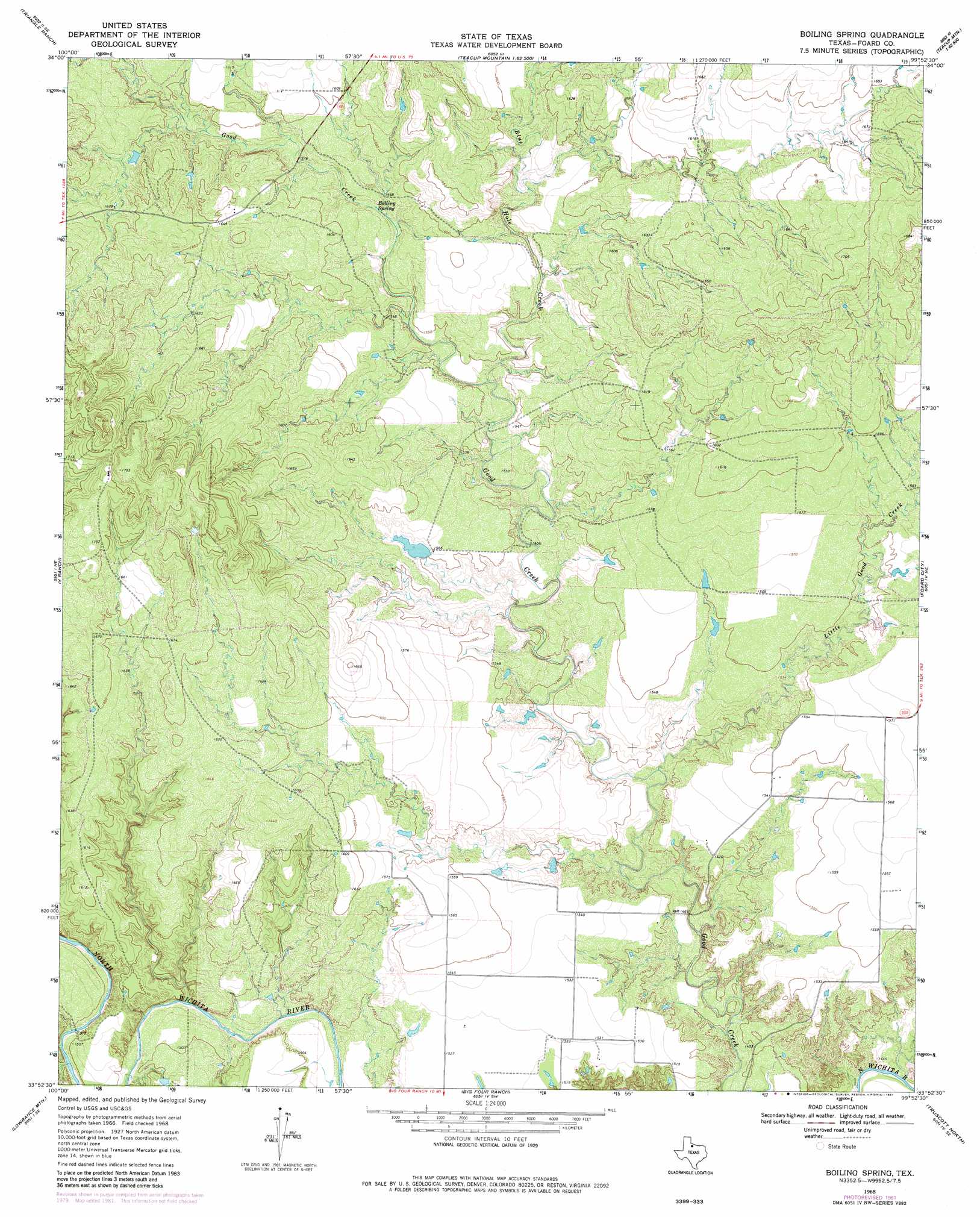
USGS Topo Quad 33099h8 - 1:24,000 scale
| Topo Map Name: | Boiling Spring |
| USGS Topo Quad ID: | 33099h8 |
| Print Size: | ca. 21 1/4" wide x 27" high |
| Southeast Coordinates: | 33.875° N latitude / 99.875° W longitude |
| Map Center Coordinates: | 33.9375° N latitude / 99.9375° W longitude |
| U.S. State: | TX |
| Filename: | o33099h8.jpg |
| Download Map JPG Image: | Boiling Spring topo map 1:24,000 scale |
| Map Type: | Topographic |
| Topo Series: | 7.5´ |
| Map Scale: | 1:24,000 |
| Source of Map Images: | United States Geological Survey (USGS) |
| Alternate Map Versions: |
Boiling Spring TX 1968, updated 1970 Download PDF Buy paper map Boiling Spring TX 1968, updated 1981 Download PDF Buy paper map Boiling Spring TX 2010 Download PDF Buy paper map Boiling Spring TX 2013 Download PDF Buy paper map Boiling Spring TX 2016 Download PDF Buy paper map |
1:24,000 Topo Quads surrounding Boiling Spring
Swearingen |
Baker |
Cactus Creek |
Maybell Canyon |
Big Mound |
Moons Camp |
Triangle Ranch |
Vivian |
Teacup Mountain |
Margaret |
Chalk |
Y Ranch |
Boiling Spring |
Foard City |
Crowell |
Chalk Sw |
Lowrance Mountain |
Big Four Ranch |
Truscott North |
Halsell Ranch |
J Y Ranch |
Ox Yoke Creek |
Maverick Flat |
Truscott South |
Gilliland |
> Back to 33099e1 at 1:100,000 scale
> Back to 33098a1 at 1:250,000 scale
> Back to U.S. Topo Maps home
Boiling Spring topo map: Gazetteer
Boiling Spring: Dams
Geneva Potts Lake Dam elevation 474m 1555′Boiling Spring: Reservoirs
Geneva Potts Lake elevation 474m 1555′Boiling Spring: Springs
Boiling Spring elevation 477m 1564′Boiling Springs elevation 486m 1594′
Boiling Spring: Streams
Blue Hole Creek elevation 466m 1528′Little Good Creek elevation 449m 1473′
Boiling Spring digital topo map on disk
Buy this Boiling Spring topo map showing relief, roads, GPS coordinates and other geographical features, as a high-resolution digital map file on DVD: