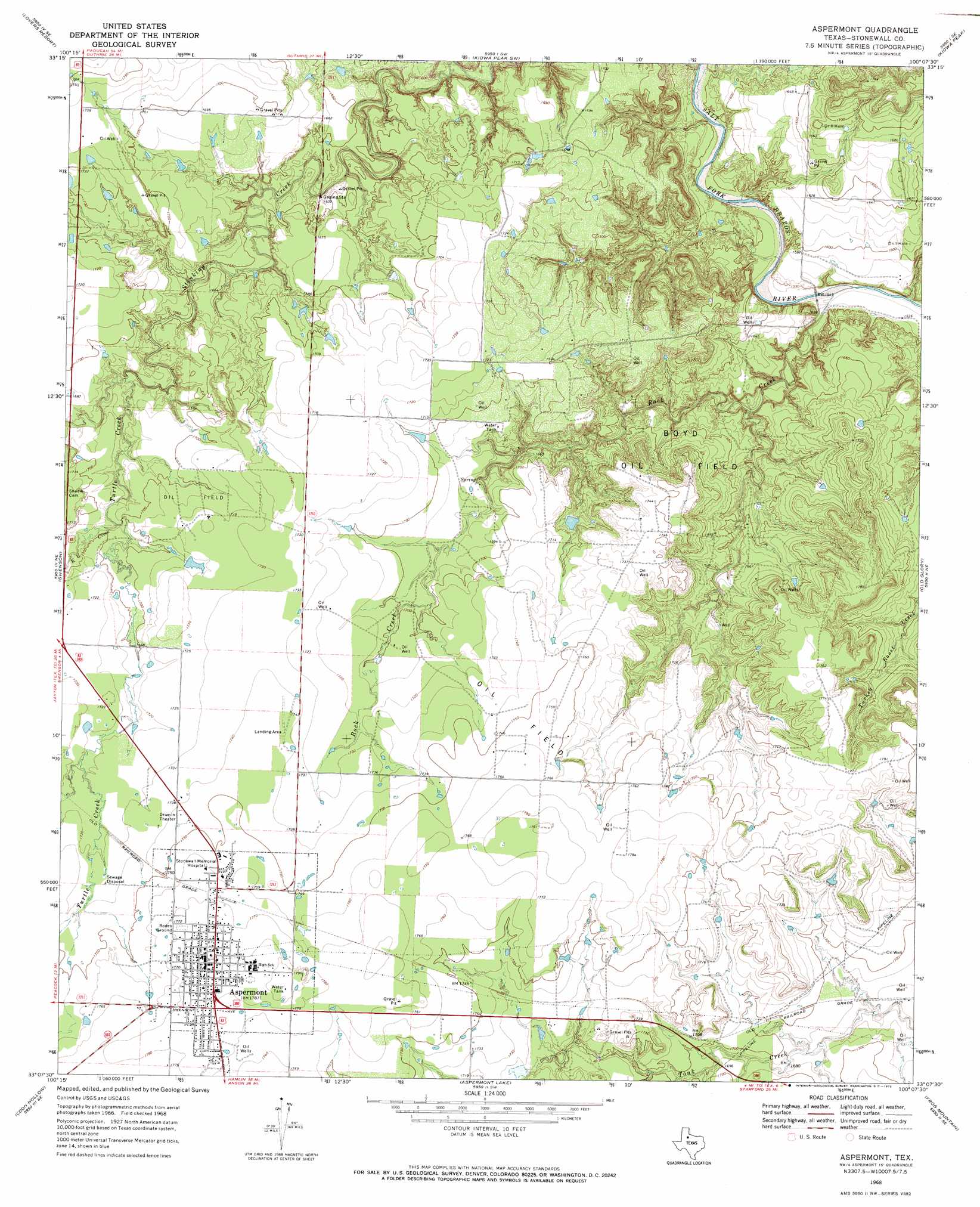
Aspermont Topo Map Texas
To zoom in, hover over the map of Aspermont
USGS Topo Quad 33100b2 - 1:24,000 scale
| Topo Map Name: | Aspermont |
| USGS Topo Quad ID: | 33100b2 |
| Print Size: | ca. 21 1/4" wide x 27" high |
| Southeast Coordinates: | 33.125° N latitude / 100.125° W longitude |
| Map Center Coordinates: | 33.1875° N latitude / 100.1875° W longitude |
| U.S. State: | TX |
| Filename: | o33100b2.jpg |
| Download Map JPG Image: | Aspermont topo map 1:24,000 scale |
| Map Type: | Topographic |
| Topo Series: | 7.5´ |
| Map Scale: | 1:24,000 |
| Source of Map Images: | United States Geological Survey (USGS) |
| Alternate Map Versions: |
Aspermont TX 1968, updated 1972 Download PDF Buy paper map Aspermont TX 2010 Download PDF Buy paper map Aspermont TX 2012 Download PDF Buy paper map Aspermont TX 2016 Download PDF Buy paper map |
1:24,000 Topo Quads surrounding Aspermont
Southerland Canyon |
Bob Creek |
Kiowa Peak Nw |
Kiowa Peak Ne |
Knox City Nw |
Seven Diamond L Canyon |
Lovers Resort |
Kiowa Peak Sw |
Kiowa Peak |
Jud |
Peacock |
Swenson |
Aspermont |
Old Glory |
Rule |
Double Mountains |
Coon Hollow |
Aspermont Lake |
Frog Mountain |
Sagerton |
White Canyon |
Poke Mountain |
Hamlin Nw |
Hamlin Ne |
Tuxedo |
> Back to 33100a1 at 1:100,000 scale
> Back to 33100a1 at 1:250,000 scale
> Back to U.S. Topo Maps home
Aspermont topo map: Gazetteer
Aspermont: Airports
Douglas Flying Service Airport elevation 531m 1742′Stonewall County Airport elevation 525m 1722′
Aspermont: Oilfields
Boyd Oil Field elevation 519m 1702′Aspermont: Populated Places
Aspermont elevation 543m 1781′Aspermont: Streams
K U Creek elevation 512m 1679′Rock Creek elevation 466m 1528′
Turtle Creek elevation 506m 1660′
Aspermont digital topo map on disk
Buy this Aspermont topo map showing relief, roads, GPS coordinates and other geographical features, as a high-resolution digital map file on DVD: