Swenson Topo Map Texas
To zoom in, hover over the map of Swenson
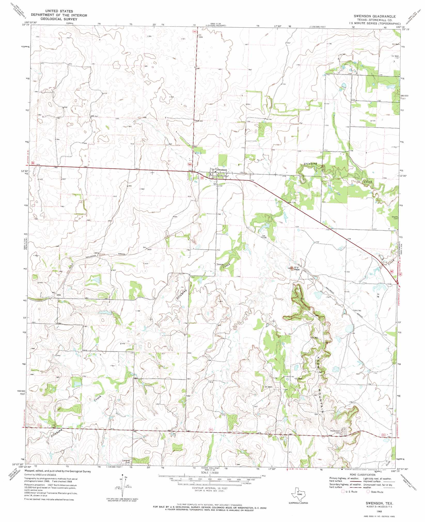
USGS Topo Quad 33100b3 - 1:24,000 scale
| Topo Map Name: | Swenson |
| USGS Topo Quad ID: | 33100b3 |
| Print Size: | ca. 21 1/4" wide x 27" high |
| Southeast Coordinates: | 33.125° N latitude / 100.25° W longitude |
| Map Center Coordinates: | 33.1875° N latitude / 100.3125° W longitude |
| U.S. State: | TX |
| Filename: | o33100b3.jpg |
| Download Map JPG Image: | Swenson topo map 1:24,000 scale |
| Map Type: | Topographic |
| Topo Series: | 7.5´ |
| Map Scale: | 1:24,000 |
| Source of Map Images: | United States Geological Survey (USGS) |
| Alternate Map Versions: |
Swenson TX 1968, updated 1972 Download PDF Buy paper map Swenson TX 2010 Download PDF Buy paper map Swenson TX 2012 Download PDF Buy paper map Swenson TX 2016 Download PDF Buy paper map |
1:24,000 Topo Quads surrounding Swenson
Pursley House |
Southerland Canyon |
Bob Creek |
Kiowa Peak Nw |
Kiowa Peak Ne |
Jayton North |
Seven Diamond L Canyon |
Lovers Resort |
Kiowa Peak Sw |
Kiowa Peak |
Jayton South |
Peacock |
Swenson |
Aspermont |
Old Glory |
A B C Creek |
Double Mountains |
Coon Hollow |
Aspermont Lake |
Frog Mountain |
Tige Canyon |
White Canyon |
Poke Mountain |
Hamlin Nw |
Hamlin Ne |
> Back to 33100a1 at 1:100,000 scale
> Back to 33100a1 at 1:250,000 scale
> Back to U.S. Topo Maps home
Swenson topo map: Gazetteer
Swenson: Dams
Parker Lake Dam elevation 551m 1807′Swenson: Populated Places
Swenson elevation 542m 1778′Swenson: Reservoirs
Parker Lake elevation 551m 1807′Swenson: Summits
K U Peak elevation 548m 1797′Keen Mountain elevation 571m 1873′
Swenson digital topo map on disk
Buy this Swenson topo map showing relief, roads, GPS coordinates and other geographical features, as a high-resolution digital map file on DVD: