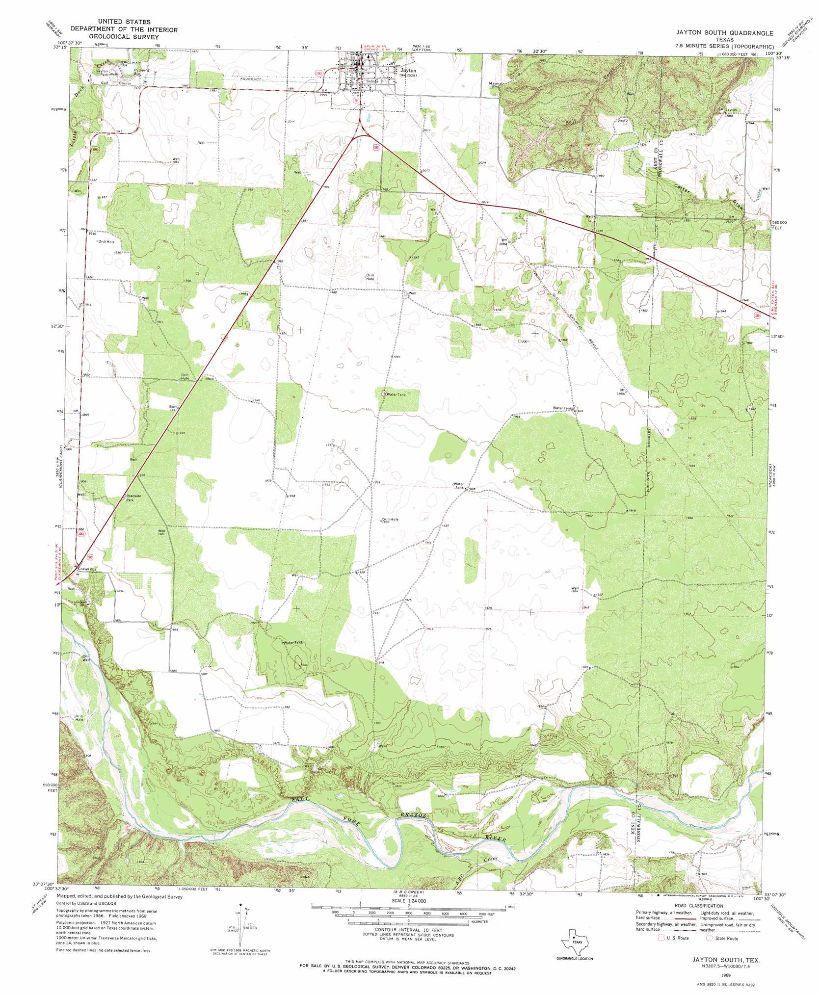
Jayton South Topo Map Texas
To zoom in, hover over the map of Jayton South
USGS Topo Quad 33100b5 - 1:24,000 scale
| Topo Map Name: | Jayton South |
| USGS Topo Quad ID: | 33100b5 |
| Print Size: | ca. 21 1/4" wide x 27" high |
| Southeast Coordinates: | 33.125° N latitude / 100.5° W longitude |
| Map Center Coordinates: | 33.1875° N latitude / 100.5625° W longitude |
| U.S. State: | TX |
| Filename: | o33100b5.jpg |
| Download Map JPG Image: | Jayton South topo map 1:24,000 scale |
| Map Type: | Topographic |
| Topo Series: | 7.5´ |
| Map Scale: | 1:24,000 |
| Source of Map Images: | United States Geological Survey (USGS) |
| Alternate Map Versions: |
Jayton South TX 1969, updated 1972 Download PDF Buy paper map Jayton South TX 2010 Download PDF Buy paper map Jayton South TX 2012 Download PDF Buy paper map Jayton South TX 2016 Download PDF Buy paper map |
1:24,000 Topo Quads surrounding Jayton South
Spur |
Gilpin |
Pursley House |
Southerland Canyon |
Bob Creek |
White Camp |
Girard |
Jayton North |
Seven Diamond L Canyon |
Lovers Resort |
Clairemont West |
Clairemont East |
Jayton South |
Peacock |
Swenson |
Cooper Mountain |
Gant Hills |
A B C Creek |
Double Mountains |
Coon Hollow |
Maverick Creek |
Hudd |
Tige Canyon |
White Canyon |
Poke Mountain |
> Back to 33100a1 at 1:100,000 scale
> Back to 33100a1 at 1:250,000 scale
> Back to U.S. Topo Maps home
Jayton South topo map: Gazetteer
Jayton South: Airports
Kent County Airport elevation 610m 2001′Norris Field elevation 594m 1948′
Jayton South: Dams
City Jayton Lake Dam elevation 596m 1955′Jayton South: Parks
Jayton Park elevation 588m 1929′Jayton South: Populated Places
Jayton elevation 611m 2004′Jayton South: Reservoirs
Jayton City Lake elevation 596m 1955′Jayton South: Streams
A B C Creek elevation 546m 1791′Butte Creek elevation 558m 1830′
Jayton South digital topo map on disk
Buy this Jayton South topo map showing relief, roads, GPS coordinates and other geographical features, as a high-resolution digital map file on DVD: