Lovers Resort Topo Map Texas
To zoom in, hover over the map of Lovers Resort
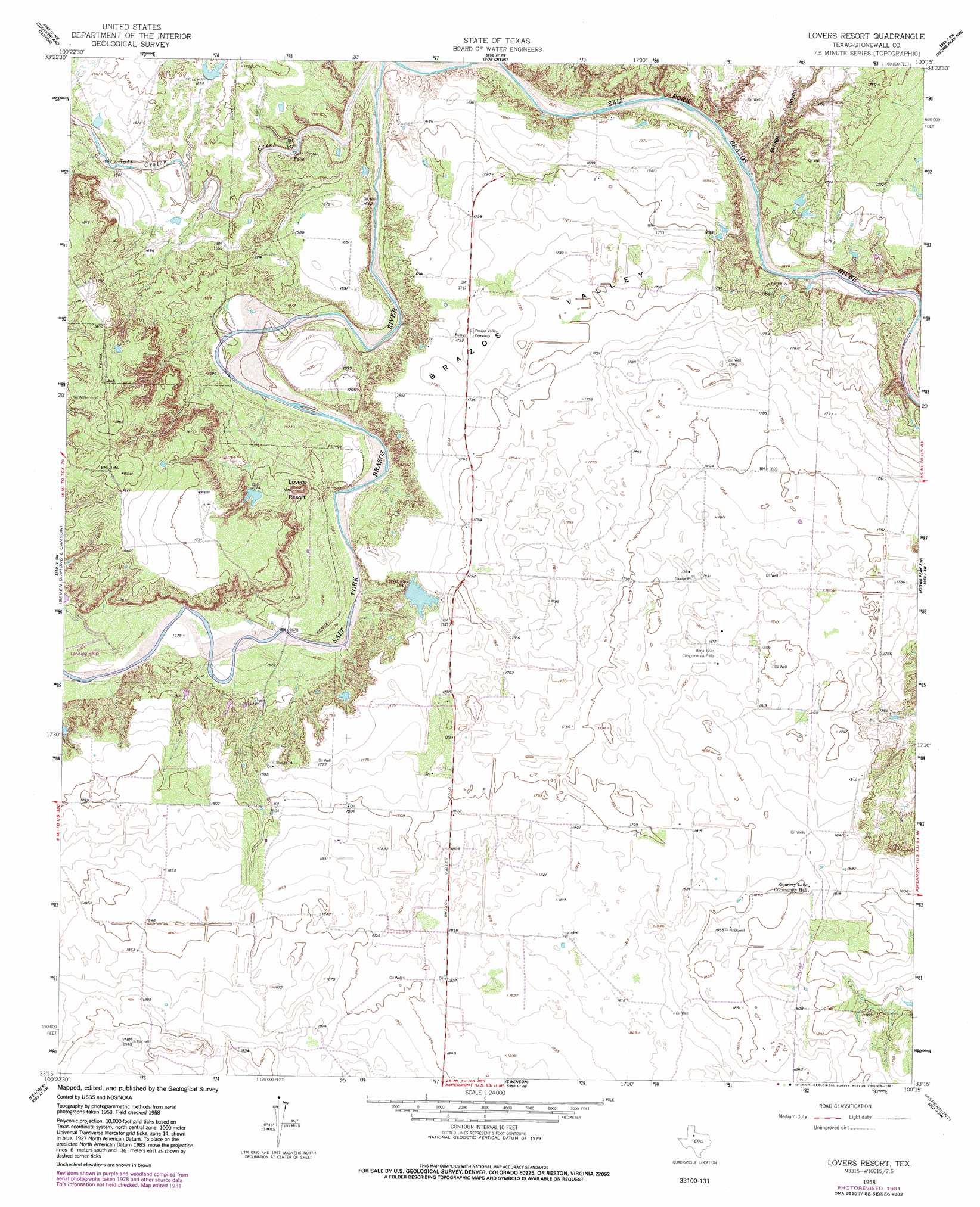
USGS Topo Quad 33100c3 - 1:24,000 scale
| Topo Map Name: | Lovers Resort |
| USGS Topo Quad ID: | 33100c3 |
| Print Size: | ca. 21 1/4" wide x 27" high |
| Southeast Coordinates: | 33.25° N latitude / 100.25° W longitude |
| Map Center Coordinates: | 33.3125° N latitude / 100.3125° W longitude |
| U.S. State: | TX |
| Filename: | o33100c3.jpg |
| Download Map JPG Image: | Lovers Resort topo map 1:24,000 scale |
| Map Type: | Topographic |
| Topo Series: | 7.5´ |
| Map Scale: | 1:24,000 |
| Source of Map Images: | United States Geological Survey (USGS) |
| Alternate Map Versions: |
Lovers Resort TX 1958, updated 1959 Download PDF Buy paper map Lovers Resort TX 1958, updated 1981 Download PDF Buy paper map Lovers Resort TX 2010 Download PDF Buy paper map Lovers Resort TX 2012 Download PDF Buy paper map Lovers Resort TX 2016 Download PDF Buy paper map |
1:24,000 Topo Quads surrounding Lovers Resort
Pitchfork Ranch |
Pitchfork Flats |
Guthrie |
Dark Canyon |
Buzzard Peak |
Pursley House |
Southerland Canyon |
Bob Creek |
Kiowa Peak Nw |
Kiowa Peak Ne |
Jayton North |
Seven Diamond L Canyon |
Lovers Resort |
Kiowa Peak Sw |
Kiowa Peak |
Jayton South |
Peacock |
Swenson |
Aspermont |
Old Glory |
A B C Creek |
Double Mountains |
Coon Hollow |
Aspermont Lake |
Frog Mountain |
> Back to 33100a1 at 1:100,000 scale
> Back to 33100a1 at 1:250,000 scale
> Back to U.S. Topo Maps home
Lovers Resort topo map: Gazetteer
Lovers Resort: Basins
Brazos Valley elevation 530m 1738′Lovers Resort: Dams
Duda Lake Dam elevation 524m 1719′Lovers Resort: Falls
Salt Croton Falls elevation 498m 1633′Lovers Resort: Reservoirs
Duda Lake elevation 524m 1719′Lovers Resort: Summits
Lovers Resort elevation 550m 1804′Lovers Resort: Valleys
Bridge Canyon elevation 489m 1604′Lovers Resort digital topo map on disk
Buy this Lovers Resort topo map showing relief, roads, GPS coordinates and other geographical features, as a high-resolution digital map file on DVD: