Gilpin Topo Map Texas
To zoom in, hover over the map of Gilpin
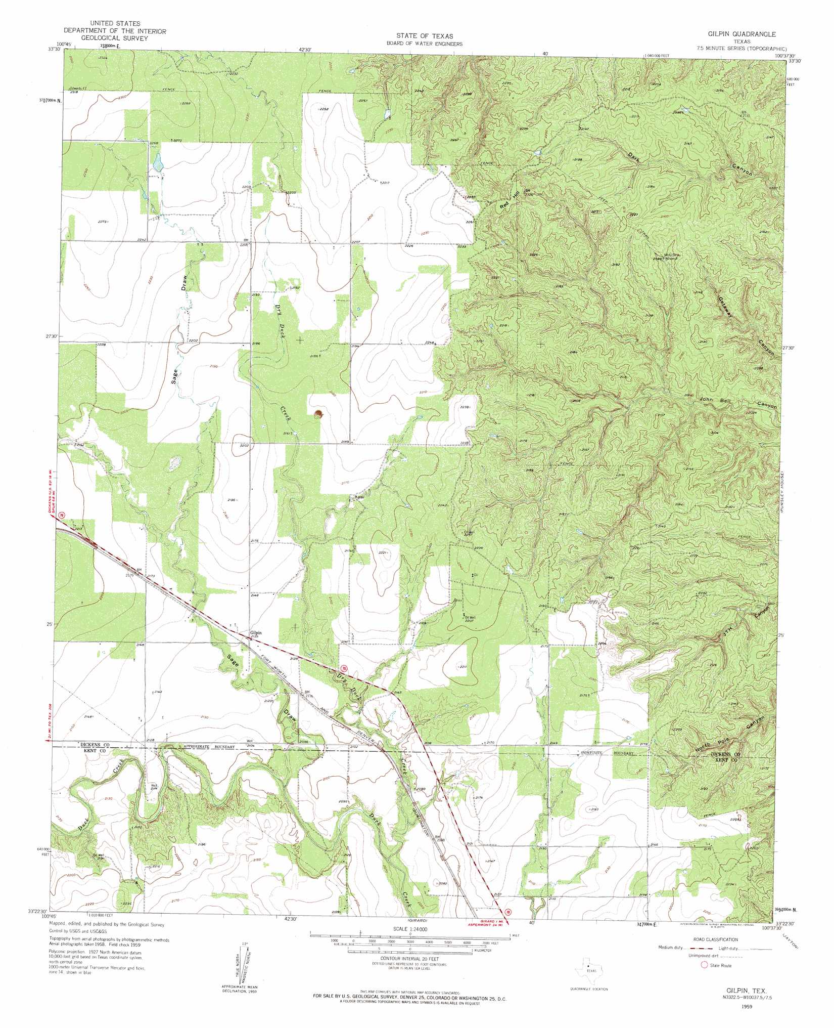
USGS Topo Quad 33100d6 - 1:24,000 scale
| Topo Map Name: | Gilpin |
| USGS Topo Quad ID: | 33100d6 |
| Print Size: | ca. 21 1/4" wide x 27" high |
| Southeast Coordinates: | 33.375° N latitude / 100.625° W longitude |
| Map Center Coordinates: | 33.4375° N latitude / 100.6875° W longitude |
| U.S. State: | TX |
| Filename: | o33100d6.jpg |
| Download Map JPG Image: | Gilpin topo map 1:24,000 scale |
| Map Type: | Topographic |
| Topo Series: | 7.5´ |
| Map Scale: | 1:24,000 |
| Source of Map Images: | United States Geological Survey (USGS) |
| Alternate Map Versions: |
Gilpin TX 1959, updated 1959 Download PDF Buy paper map Gilpin TX 2010 Download PDF Buy paper map Gilpin TX 2012 Download PDF Buy paper map Gilpin TX 2016 Download PDF Buy paper map |
1:24,000 Topo Quads surrounding Gilpin
Haystack Mountain |
Dickens North |
East Afton |
East Afton Ne |
Guthrie Nw |
Foreman Chapel |
Dickens South |
Croton Camp |
Pitchfork Ranch |
Pitchfork Flats |
Spur Nw |
Spur |
Gilpin |
Pursley House |
Southerland Canyon |
Spur Sw |
White Camp |
Girard |
Jayton North |
Seven Diamond L Canyon |
T-O Creek |
Clairemont West |
Clairemont East |
Jayton South |
Peacock |
> Back to 33100a1 at 1:100,000 scale
> Back to 33100a1 at 1:250,000 scale
> Back to U.S. Topo Maps home
Gilpin topo map: Gazetteer
Gilpin: Populated Places
Gilpin elevation 652m 2139′Gilpin: Streams
Dry Duck Creek elevation 621m 2037′Gilpin: Summits
Red Hill elevation 709m 2326′Gilpin: Valleys
Sage Draw elevation 634m 2080′Gilpin digital topo map on disk
Buy this Gilpin topo map showing relief, roads, GPS coordinates and other geographical features, as a high-resolution digital map file on DVD: