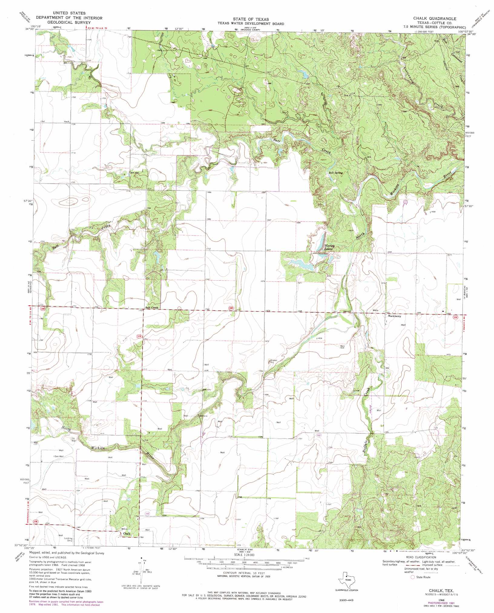
Chalk Topo Map Texas
To zoom in, hover over the map of Chalk
USGS Topo Quad 33100h2 - 1:24,000 scale
| Topo Map Name: | Chalk |
| USGS Topo Quad ID: | 33100h2 |
| Print Size: | ca. 21 1/4" wide x 27" high |
| Southeast Coordinates: | 33.875° N latitude / 100.125° W longitude |
| Map Center Coordinates: | 33.9375° N latitude / 100.1875° W longitude |
| U.S. State: | TX |
| Filename: | o33100h2.jpg |
| Download Map JPG Image: | Chalk topo map 1:24,000 scale |
| Map Type: | Topographic |
| Topo Series: | 7.5´ |
| Map Scale: | 1:24,000 |
| Source of Map Images: | United States Geological Survey (USGS) |
| Alternate Map Versions: |
Chalk TX 1968, updated 1970 Download PDF Buy paper map Chalk TX 1968, updated 1981 Download PDF Buy paper map Chalk TX 2010 Download PDF Buy paper map Chalk TX 2012 Download PDF Buy paper map Chalk TX 2016 Download PDF Buy paper map |
1:24,000 Topo Quads surrounding Chalk
Cee Vee |
Dunlap |
Swearingen |
Baker |
Cactus Creek |
Devils Canyon |
Paducah |
Moons Camp |
Triangle Ranch |
Vivian |
Grow Nw |
Ginsite |
Chalk |
Y Ranch |
Boiling Spring |
Buffalo Creek |
Grow |
Chalk Sw |
Lowrance Mountain |
Big Four Ranch |
Guthrie Nw |
Fourmile Hill |
J Y Ranch |
Ox Yoke Creek |
Maverick Flat |
> Back to 33100e1 at 1:100,000 scale
> Back to 33100a1 at 1:250,000 scale
> Back to U.S. Topo Maps home
Chalk topo map: Gazetteer
Chalk: Dams
L V Worley Lake Dam elevation 506m 1660′Chalk: Populated Places
Chalk elevation 542m 1778′Hackberry elevation 516m 1692′
Chalk: Reservoirs
L V Worley Lake elevation 506m 1660′Worley Lake elevation 500m 1640′
Chalk: Springs
Salt Spring elevation 491m 1610′Chalk: Streams
Buffalo Creek elevation 494m 1620′Salt Creek elevation 487m 1597′
Chalk digital topo map on disk
Buy this Chalk topo map showing relief, roads, GPS coordinates and other geographical features, as a high-resolution digital map file on DVD: