Justiceburg Topo Map Texas
To zoom in, hover over the map of Justiceburg
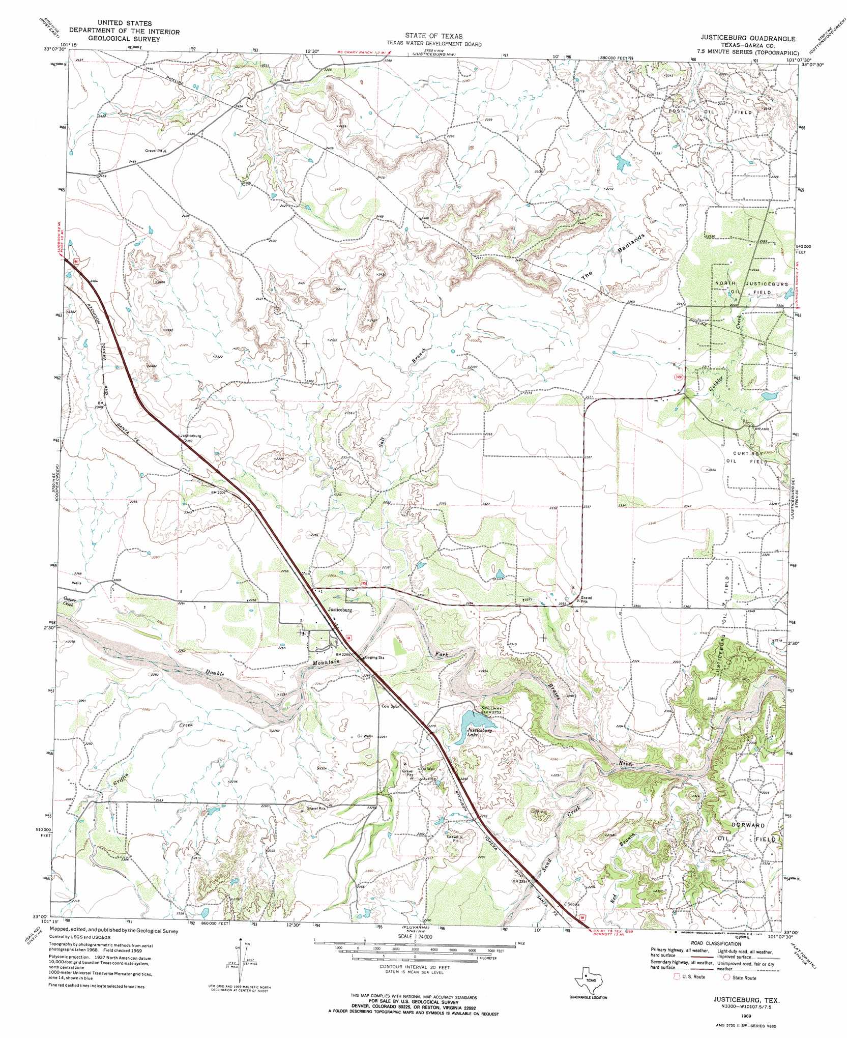
USGS Topo Quad 33101a2 - 1:24,000 scale
| Topo Map Name: | Justiceburg |
| USGS Topo Quad ID: | 33101a2 |
| Print Size: | ca. 21 1/4" wide x 27" high |
| Southeast Coordinates: | 33° N latitude / 101.125° W longitude |
| Map Center Coordinates: | 33.0625° N latitude / 101.1875° W longitude |
| U.S. State: | TX |
| Filename: | o33101a2.jpg |
| Download Map JPG Image: | Justiceburg topo map 1:24,000 scale |
| Map Type: | Topographic |
| Topo Series: | 7.5´ |
| Map Scale: | 1:24,000 |
| Source of Map Images: | United States Geological Survey (USGS) |
| Alternate Map Versions: |
Justiceburg TX 1969, updated 1972 Download PDF Buy paper map Justiceburg TX 2010 Download PDF Buy paper map Justiceburg TX 2012 Download PDF Buy paper map Justiceburg TX 2016 Download PDF Buy paper map |
1:24,000 Topo Quads surrounding Justiceburg
South Dokegood Creek |
Cap Rock Se |
Verbena |
Twomile Creek |
Spur Sw |
Post West |
Post East |
Justiceburg Nw |
Cottonwood Creek |
T-O Creek |
Middle Creek |
Cooper Creek |
Justiceburg |
Justiceburg Se |
Polar |
Beal Hollow |
Gail Ne |
Fluvanna |
Flat Top Mountain |
Mckenzie Mountains |
Gail |
Fivemile Creek |
Arah |
Dermott |
Brand |
> Back to 33101a1 at 1:100,000 scale
> Back to 33100a1 at 1:250,000 scale
> Back to U.S. Topo Maps home
Justiceburg topo map: Gazetteer
Justiceburg: Dams
Justiceburg Lake Dam elevation 687m 2253′Justiceburg: Flats
The Badlands elevation 696m 2283′Justiceburg: Oilfields
Curt- Roy Oil Field elevation 707m 2319′Justiceburg Oil Field elevation 715m 2345′
North Justiceburg Oil Field elevation 714m 2342′
Justiceburg: Populated Places
Justiceburg elevation 689m 2260′Justiceburg elevation 687m 2253′
Justiceburg: Reservoirs
Justiceburg Lake elevation 685m 2247′Justiceburg: Streams
Cooper Creek elevation 689m 2260′Gobbler Creek elevation 697m 2286′
Griffin Creek elevation 683m 2240′
Red Branch elevation 672m 2204′
Salt Branch elevation 683m 2240′
Sand Creek elevation 668m 2191′
Justiceburg digital topo map on disk
Buy this Justiceburg topo map showing relief, roads, GPS coordinates and other geographical features, as a high-resolution digital map file on DVD: