Cooper Creek Topo Map Texas
To zoom in, hover over the map of Cooper Creek
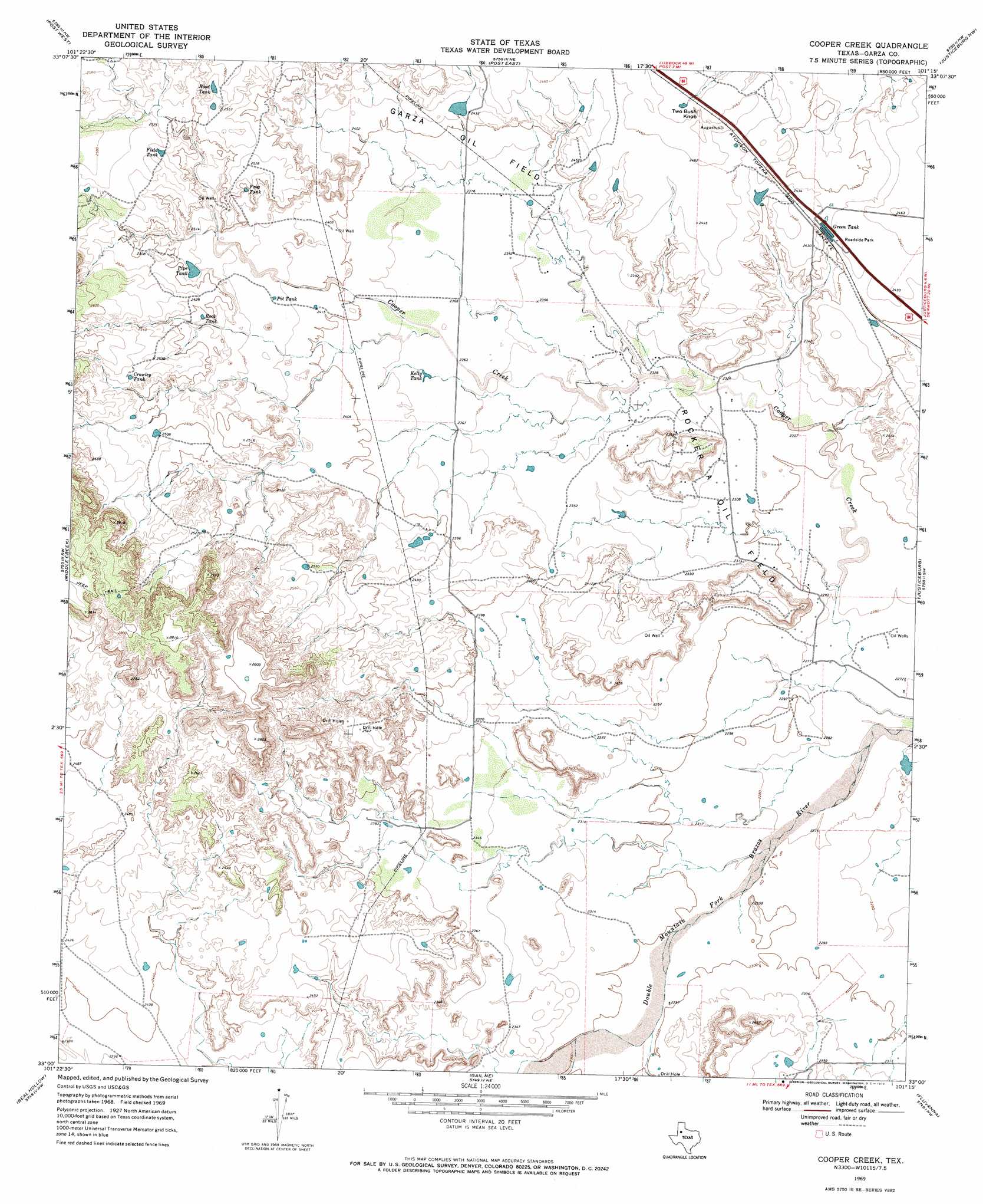
USGS Topo Quad 33101a3 - 1:24,000 scale
| Topo Map Name: | Cooper Creek |
| USGS Topo Quad ID: | 33101a3 |
| Print Size: | ca. 21 1/4" wide x 27" high |
| Southeast Coordinates: | 33° N latitude / 101.25° W longitude |
| Map Center Coordinates: | 33.0625° N latitude / 101.3125° W longitude |
| U.S. State: | TX |
| Filename: | o33101a3.jpg |
| Download Map JPG Image: | Cooper Creek topo map 1:24,000 scale |
| Map Type: | Topographic |
| Topo Series: | 7.5´ |
| Map Scale: | 1:24,000 |
| Source of Map Images: | United States Geological Survey (USGS) |
| Alternate Map Versions: |
Cooper Creek TX 1969, updated 1972 Download PDF Buy paper map Cooper Creek TX 2010 Download PDF Buy paper map Cooper Creek TX 2012 Download PDF Buy paper map Cooper Creek TX 2016 Download PDF Buy paper map |
1:24,000 Topo Quads surrounding Cooper Creek
Southland |
South Dokegood Creek |
Cap Rock Se |
Verbena |
Twomile Creek |
Grassland |
Post West |
Post East |
Justiceburg Nw |
Cottonwood Creek |
Grassland Se |
Middle Creek |
Cooper Creek |
Justiceburg |
Justiceburg Se |
Indian Canyon Ne |
Beal Hollow |
Gail Ne |
Fluvanna |
Flat Top Mountain |
Holloway Canyon |
Gail |
Fivemile Creek |
Arah |
Dermott |
> Back to 33101a1 at 1:100,000 scale
> Back to 33100a1 at 1:250,000 scale
> Back to U.S. Topo Maps home
Cooper Creek topo map: Gazetteer
Cooper Creek: Oilfields
Rocker A Oil Field elevation 705m 2312′Cooper Creek: Reservoirs
Crowley Tank elevation 774m 2539′Field Tank elevation 771m 2529′
Frog Tank elevation 755m 2477′
Green Tank elevation 735m 2411′
Kelly Tank elevation 723m 2372′
Pipe Tank elevation 751m 2463′
Pit Tank elevation 740m 2427′
Rock Tank elevation 757m 2483′
Rood Tank elevation 776m 2545′
Cooper Creek: Summits
Two Bush Knob elevation 752m 2467′Cooper Creek digital topo map on disk
Buy this Cooper Creek topo map showing relief, roads, GPS coordinates and other geographical features, as a high-resolution digital map file on DVD: