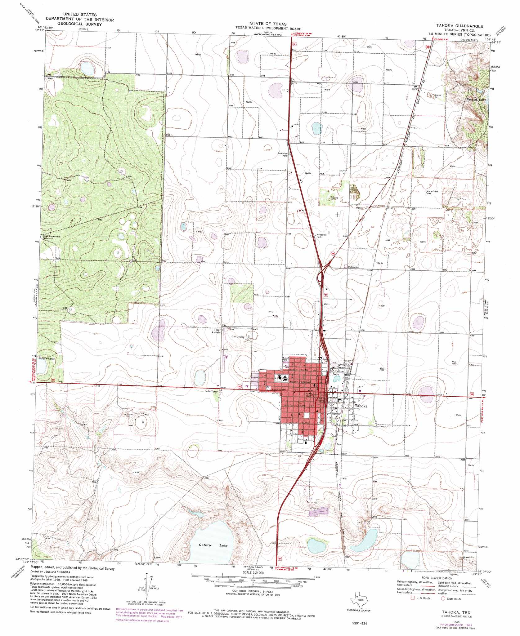
Tahoka Topo Map Texas
To zoom in, hover over the map of Tahoka
USGS Topo Quad 33101b7 - 1:24,000 scale
| Topo Map Name: | Tahoka |
| USGS Topo Quad ID: | 33101b7 |
| Print Size: | ca. 21 1/4" wide x 27" high |
| Southeast Coordinates: | 33.125° N latitude / 101.75° W longitude |
| Map Center Coordinates: | 33.1875° N latitude / 101.8125° W longitude |
| U.S. State: | TX |
| Filename: | o33101b7.jpg |
| Download Map JPG Image: | Tahoka topo map 1:24,000 scale |
| Map Type: | Topographic |
| Topo Series: | 7.5´ |
| Map Scale: | 1:24,000 |
| Source of Map Images: | United States Geological Survey (USGS) |
| Alternate Map Versions: |
Tahoka TX 1969, updated 1971 Download PDF Buy paper map Tahoka TX 1969, updated 1982 Download PDF Buy paper map Tahoka TX 2010 Download PDF Buy paper map Tahoka TX 2012 Download PDF Buy paper map Tahoka TX 2016 Download PDF Buy paper map |
1:24,000 Topo Quads surrounding Tahoka
Busterville |
Slide |
Woodrow |
Slaton |
Slaton Ne |
Meadow Se |
New Home |
New Home Se |
Wilson |
Southland |
Mound Lake |
Double Lakes |
Tahoka |
New Lynn |
Grassland |
New Moore |
Tahoka Sw |
Skeen Lake |
Draw |
Grassland Se |
Welch East |
Gooch Lake |
O'Donnell |
Indian Canyon Nw |
Indian Canyon Ne |
> Back to 33101a1 at 1:100,000 scale
> Back to 33100a1 at 1:250,000 scale
> Back to U.S. Topo Maps home
Tahoka topo map: Gazetteer
Tahoka: Airports
T-Bar Airport elevation 949m 3113′Tahoka: Populated Places
Tahoka elevation 939m 3080′Tahoka digital topo map on disk
Buy this Tahoka topo map showing relief, roads, GPS coordinates and other geographical features, as a high-resolution digital map file on DVD: