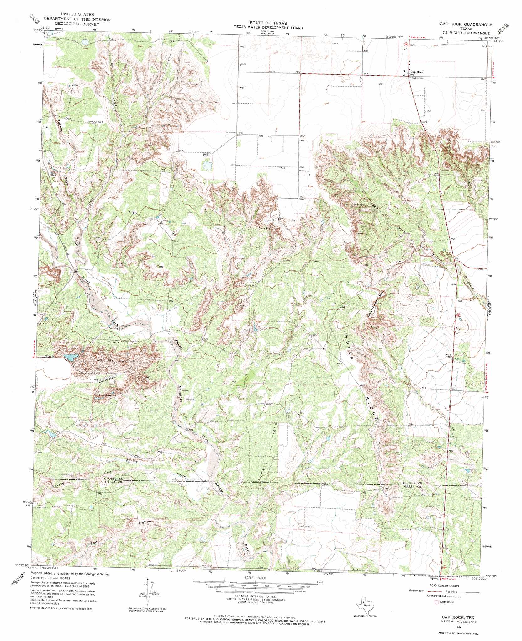
Cap Rock Topo Map Texas
To zoom in, hover over the map of Cap Rock
USGS Topo Quad 33101d4 - 1:24,000 scale
| Topo Map Name: | Cap Rock |
| USGS Topo Quad ID: | 33101d4 |
| Print Size: | ca. 21 1/4" wide x 27" high |
| Southeast Coordinates: | 33.375° N latitude / 101.375° W longitude |
| Map Center Coordinates: | 33.4375° N latitude / 101.4375° W longitude |
| U.S. State: | TX |
| Filename: | o33101d4.jpg |
| Download Map JPG Image: | Cap Rock topo map 1:24,000 scale |
| Map Type: | Topographic |
| Topo Series: | 7.5´ |
| Map Scale: | 1:24,000 |
| Source of Map Images: | United States Geological Survey (USGS) |
| Alternate Map Versions: |
Cap Rock TX 1966, updated 1968 Download PDF Buy paper map Cap Rock TX 2010 Download PDF Buy paper map Cap Rock TX 2012 Download PDF Buy paper map Cap Rock TX 2016 Download PDF Buy paper map |
1:24,000 Topo Quads surrounding Cap Rock
Idalou |
Lorenzo |
Ralls |
Ralls Ne |
Crosbyton |
Buffalo Springs Lake |
Acuff |
Savage |
Ralls Se |
Collett Springs |
Slaton |
Slaton Ne |
Cap Rock |
Canyon Valley |
Kalgary |
Wilson |
Southland |
South Dokegood Creek |
Cap Rock Se |
Verbena |
New Lynn |
Grassland |
Post West |
Post East |
Justiceburg Nw |
> Back to 33101a1 at 1:100,000 scale
> Back to 33100a1 at 1:250,000 scale
> Back to U.S. Topo Maps home
Cap Rock topo map: Gazetteer
Cap Rock: Dams
Caddell Dam elevation 865m 2837′Janes-Prentice Dam elevation 858m 2814′
Cap Rock: Oilfields
Forbes Oil Field elevation 830m 2723′Cap Rock: Populated Places
Cap Rock elevation 922m 3024′Cap Rock: Reservoirs
Caddell Lake elevation 865m 2837′Janes-Prentice Lake elevation 858m 2814′
Cap Rock: Ridges
Indian Ridge elevation 839m 2752′Cap Rock: Streams
Harvey Creek elevation 815m 2673′Plum Creek elevation 826m 2709′
Spring Creek elevation 803m 2634′
Cap Rock: Summits
Courthouse Mountain elevation 910m 2985′Cap Rock: Valleys
Red Hollow elevation 807m 2647′Turkey Draw elevation 834m 2736′
Cap Rock digital topo map on disk
Buy this Cap Rock topo map showing relief, roads, GPS coordinates and other geographical features, as a high-resolution digital map file on DVD: