New Deal Topo Map Texas
To zoom in, hover over the map of New Deal
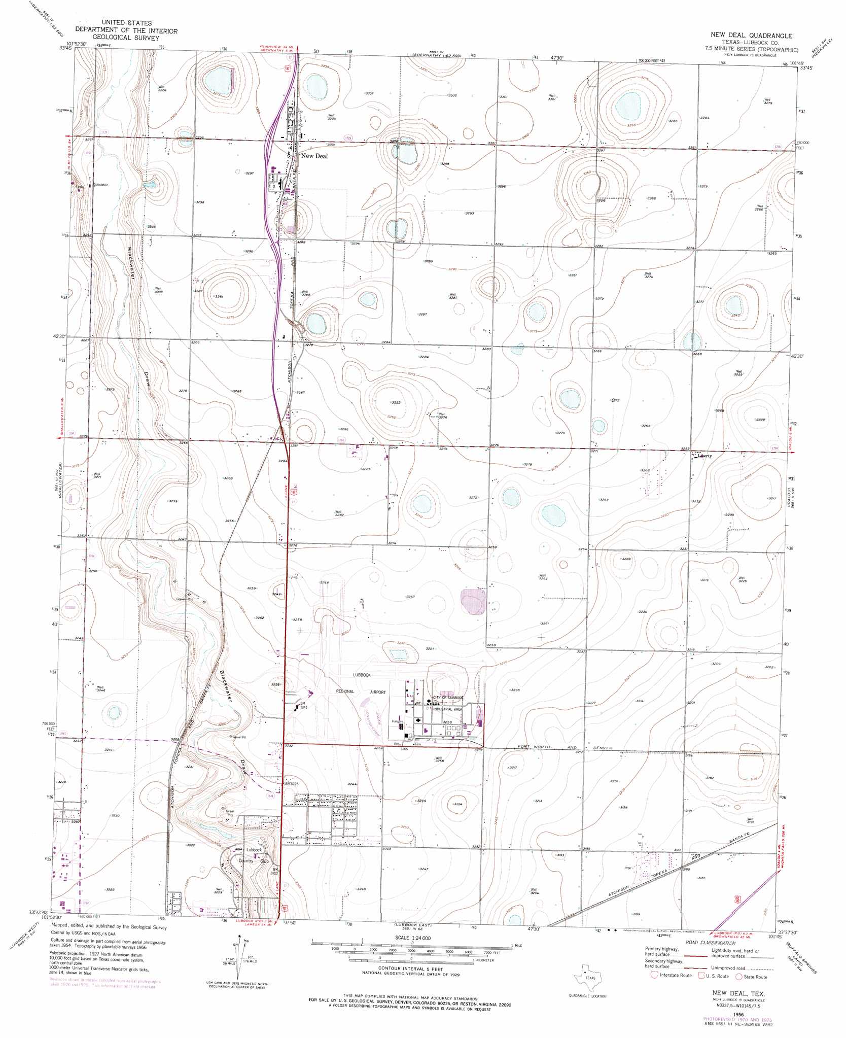
USGS Topo Quad 33101f7 - 1:24,000 scale
| Topo Map Name: | New Deal |
| USGS Topo Quad ID: | 33101f7 |
| Print Size: | ca. 21 1/4" wide x 27" high |
| Southeast Coordinates: | 33.625° N latitude / 101.75° W longitude |
| Map Center Coordinates: | 33.6875° N latitude / 101.8125° W longitude |
| U.S. State: | TX |
| Filename: | o33101f7.jpg |
| Download Map JPG Image: | New Deal topo map 1:24,000 scale |
| Map Type: | Topographic |
| Topo Series: | 7.5´ |
| Map Scale: | 1:24,000 |
| Source of Map Images: | United States Geological Survey (USGS) |
| Alternate Map Versions: |
New Deal TX 1956, updated 1957 Download PDF Buy paper map New Deal TX 1956, updated 1971 Download PDF Buy paper map New Deal TX 1956, updated 1977 Download PDF Buy paper map New Deal TX 2010 Download PDF Buy paper map New Deal TX 2012 Download PDF Buy paper map New Deal TX 2016 Download PDF Buy paper map |
1:24,000 Topo Quads surrounding New Deal
Anton Ne |
Cotton Center |
Underwood |
Julia Lake |
Barwise |
Roundup |
Abernathy Sw |
Abernathy |
Heckville |
Petersburg |
Wolfforth Ne |
Shallowater |
New Deal |
Idalou |
Lorenzo |
Wolfforth |
Lubbock West |
Lubbock East |
Buffalo Springs Lake |
Acuff |
Busterville |
Slide |
Woodrow |
Slaton |
Slaton Ne |
> Back to 33101e1 at 1:100,000 scale
> Back to 33100a1 at 1:250,000 scale
> Back to U.S. Topo Maps home
New Deal topo map: Gazetteer
New Deal: Airports
Lubbock International Airport elevation 992m 3254′New Deal: Dams
Lubbock Terminal Reservoir Levee elevation 996m 3267′New Deal: Parks
Davies Park elevation 984m 3228′New Deal: Populated Places
Liberty elevation 994m 3261′New Deal elevation 1006m 3300′
New Deal: Reservoirs
Lubbock Terminal Reservoir elevation 996m 3267′New Deal digital topo map on disk
Buy this New Deal topo map showing relief, roads, GPS coordinates and other geographical features, as a high-resolution digital map file on DVD: