Mound Lake Topo Map Texas
To zoom in, hover over the map of Mound Lake
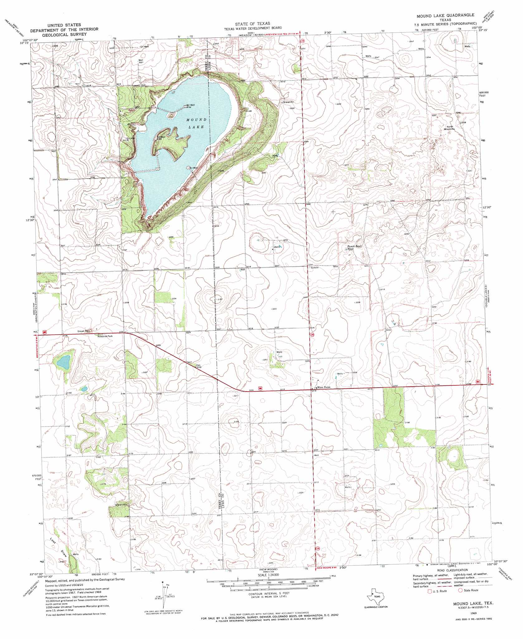
USGS Topo Quad 33102b1 - 1:24,000 scale
| Topo Map Name: | Mound Lake |
| USGS Topo Quad ID: | 33102b1 |
| Print Size: | ca. 21 1/4" wide x 27" high |
| Southeast Coordinates: | 33.125° N latitude / 102° W longitude |
| Map Center Coordinates: | 33.1875° N latitude / 102.0625° W longitude |
| U.S. State: | TX |
| Filename: | o33102b1.jpg |
| Download Map JPG Image: | Mound Lake topo map 1:24,000 scale |
| Map Type: | Topographic |
| Topo Series: | 7.5´ |
| Map Scale: | 1:24,000 |
| Source of Map Images: | United States Geological Survey (USGS) |
| Alternate Map Versions: |
Mound Lake TX 1969, updated 1971 Download PDF Buy paper map Mound Lake TX 2010 Download PDF Buy paper map Mound Lake TX 2012 Download PDF Buy paper map Mound Lake TX 2016 Download PDF Buy paper map |
1:24,000 Topo Quads surrounding Mound Lake
Lockettville |
Ropesville |
Busterville |
Slide |
Woodrow |
Sundown Se |
Meadow |
Meadow Se |
New Home |
New Home Se |
Brownfield West |
Brownfield East |
Mound Lake |
Double Lakes |
Tahoka |
Foster |
Union School |
New Moore |
Tahoka Sw |
Skeen Lake |
Ashmore |
Welch West |
Welch East |
Gooch Lake |
O'Donnell |
> Back to 33102a1 at 1:100,000 scale
> Back to 33102a1 at 1:250,000 scale
> Back to U.S. Topo Maps home
Mound Lake topo map: Gazetteer
Mound Lake: Lakes
Mound Lake elevation 959m 3146′Mound Lake: Populated Places
West Point elevation 980m 3215′Mound Lake: Reservoirs
Punch Bowl Tank elevation 988m 3241′Mound Lake digital topo map on disk
Buy this Mound Lake topo map showing relief, roads, GPS coordinates and other geographical features, as a high-resolution digital map file on DVD: