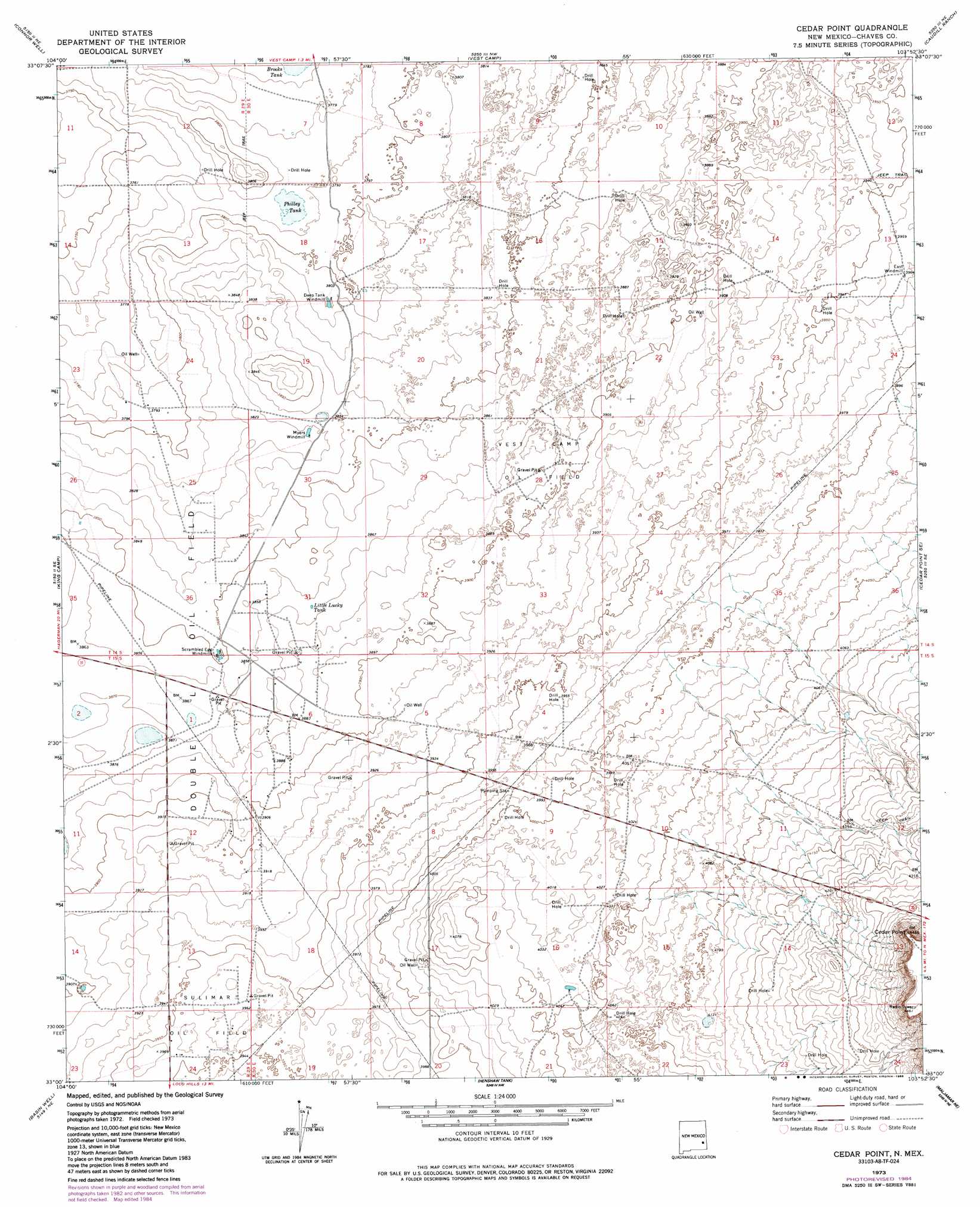
Cedar Point Topo Map New Mexico
To zoom in, hover over the map of Cedar Point
USGS Topo Quad 33103a8 - 1:24,000 scale
| Topo Map Name: | Cedar Point |
| USGS Topo Quad ID: | 33103a8 |
| Print Size: | ca. 21 1/4" wide x 27" high |
| Southeast Coordinates: | 33° N latitude / 103.875° W longitude |
| Map Center Coordinates: | 33.0625° N latitude / 103.9375° W longitude |
| U.S. State: | NM |
| Filename: | o33103a8.jpg |
| Download Map JPG Image: | Cedar Point topo map 1:24,000 scale |
| Map Type: | Topographic |
| Topo Series: | 7.5´ |
| Map Scale: | 1:24,000 |
| Source of Map Images: | United States Geological Survey (USGS) |
| Alternate Map Versions: |
Cedar Point NM 1973, updated 1976 Download PDF Buy paper map Cedar Point NM 1973, updated 1985 Download PDF Buy paper map Cedar Point NM 2010 Download PDF Buy paper map Cedar Point NM 2013 Download PDF Buy paper map Cedar Point NM 2017 Download PDF Buy paper map |
1:24,000 Topo Quads surrounding Cedar Point
Wade Ranch |
Malstrom Ranch |
Culp Ranch |
Mescalero Point |
Soldier Hill |
Bar C Bar Ranch |
Conner Well |
Vest Camp |
Caudill Ranch |
Cooper-Good Ranch |
Derrick Draw |
King Camp |
Cedar Point |
Cedar Point Se |
Dean Ranch |
Diamond Mound |
Basin Well |
Henshaw Tank |
Maljamar Ne |
Buckeye Nw |
Red Lake |
Red Lake Se |
Loco Hills |
Maljamar |
Dog Lake |
> Back to 33103a1 at 1:100,000 scale
> Back to 33102a1 at 1:250,000 scale
> Back to U.S. Topo Maps home
Cedar Point topo map: Gazetteer
Cedar Point: Capes
Cedar Point elevation 1362m 4468′Cedar Point: Oilfields
Double Oil Field elevation 1178m 3864′Sulimar Oil Field elevation 1207m 3959′
Vest Camp Oil Field elevation 1184m 3884′
Cedar Point: Reservoirs
Brooks Tank elevation 1149m 3769′Little Lucky Tank elevation 1179m 3868′
Philley Tank elevation 1155m 3789′
Cedar Point digital topo map on disk
Buy this Cedar Point topo map showing relief, roads, GPS coordinates and other geographical features, as a high-resolution digital map file on DVD: