Prairieview Ne Topo Map New Mexico
To zoom in, hover over the map of Prairieview Ne
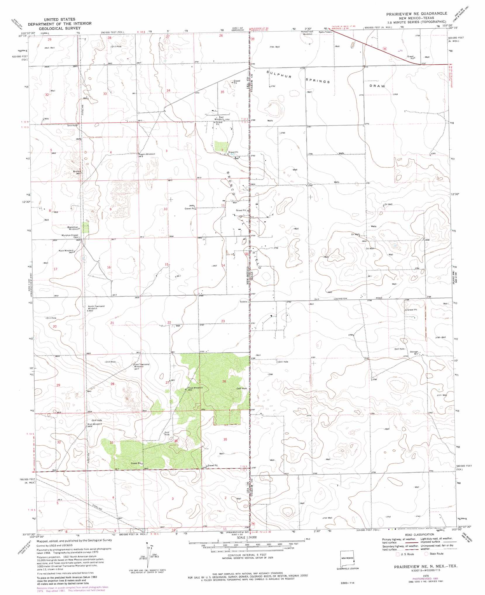
USGS Topo Quad 33103b1 - 1:24,000 scale
| Topo Map Name: | Prairieview Ne |
| USGS Topo Quad ID: | 33103b1 |
| Print Size: | ca. 21 1/4" wide x 27" high |
| Southeast Coordinates: | 33.125° N latitude / 103° W longitude |
| Map Center Coordinates: | 33.1875° N latitude / 103.0625° W longitude |
| U.S. States: | NM, TX |
| Filename: | o33103b1.jpg |
| Download Map JPG Image: | Prairieview Ne topo map 1:24,000 scale |
| Map Type: | Topographic |
| Topo Series: | 7.5´ |
| Map Scale: | 1:24,000 |
| Source of Map Images: | United States Geological Survey (USGS) |
| Alternate Map Versions: |
Prairieview NE NM 1970, updated 1972 Download PDF Buy paper map Prairieview NE NM 1970, updated 1981 Download PDF Buy paper map Prairieview NE NM 2010 Download PDF Buy paper map Prairieview NE NM 2013 Download PDF Buy paper map Prairieview NE NM 2017 Download PDF Buy paper map |
1:24,000 Topo Quads surrounding Prairieview Ne
Ranger Lake |
Walking Cane Ranch |
Bronco Ne |
Two B Ranch Nw |
Schooler Ranch |
Tatum North |
Gladiola |
Bronco |
Two B Ranch Sw |
Two B Ranch |
Tatum South |
Prairieview Nw |
Prairieview Ne |
Plains Nw |
Plains |
Hillburn City |
Prairieview |
Prairieview Se |
Ink Basin |
Plains Se |
Lovington |
Humble City Nw |
Humble City Ne |
Higginbotham |
Denver City |
> Back to 33103a1 at 1:100,000 scale
> Back to 33102a1 at 1:250,000 scale
> Back to U.S. Topo Maps home
Prairieview Ne topo map: Gazetteer
Prairieview Ne: Oilfields
Bronco Oil Field elevation 1158m 3799′Bronco Oil Field elevation 1158m 3799′
Prairieview Ne digital topo map on disk
Buy this Prairieview Ne topo map showing relief, roads, GPS coordinates and other geographical features, as a high-resolution digital map file on DVD: