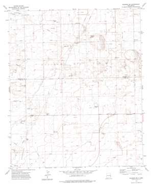
Bledsoe Sw Topo Map New Mexico
To zoom in, hover over the map of Bledsoe Sw
USGS Topo Quad 33103e2 - 1:24,000 scale
| Topo Map Name: | Bledsoe Sw |
| USGS Topo Quad ID: | 33103e2 |
| Print Size: | ca. 21 1/4" wide x 27" high |
| Southeast Coordinates: | 33.5° N latitude / 103.125° W longitude |
| Map Center Coordinates: | 33.5625° N latitude / 103.1875° W longitude |
| U.S. State: | NM |
| Filename: | o33103e2.jpg |
| Download Map JPG Image: | Bledsoe Sw topo map 1:24,000 scale |
| Map Type: | Topographic |
| Topo Series: | 7.5´ |
| Map Scale: | 1:24,000 |
| Source of Map Images: | United States Geological Survey (USGS) |
| Alternate Map Versions: |
Bledsoe SW NM 1972, updated 1975 Download PDF Buy paper map Bledsoe SW NM 1972, updated 1988 Download PDF Buy paper map Bledsoe SW NM 2010 Download PDF Buy paper map Bledsoe SW NM 2013 Download PDF Buy paper map Bledsoe SW NM 2017 Download PDF Buy paper map |
1:24,000 Topo Quads surrounding Bledsoe Sw
> Back to 33103e1 at 1:100,000 scale
> Back to 33102a1 at 1:250,000 scale
> Back to U.S. Topo Maps home
Bledsoe Sw topo map: Gazetteer
Bledsoe Sw: Oilfields
Allison Oil Field elevation 1232m 4041′Crossroads Oil Field elevation 1229m 4032′
Bledsoe Sw: Wells
05068 Water Well elevation 1222m 4009′12550 Water Well elevation 1237m 4058′
12551 Water Well elevation 1229m 4032′
12552 Water Well elevation 1235m 4051′
12557 Water Well elevation 1218m 3996′
12558 Water Well elevation 1227m 4025′
12559 Water Well elevation 1217m 3992′
12606 Water Well elevation 1249m 4097′
12609 Water Well elevation 1243m 4078′
12611 Water Well elevation 1236m 4055′
12612 Water Well elevation 1233m 4045′
12621 Water Well elevation 1222m 4009′
12624 Water Well elevation 1243m 4078′
12625 Water Well elevation 1230m 4035′
12626 Water Well elevation 1224m 4015′
12628 Water Well elevation 1224m 4015′
12629 Water Well elevation 1229m 4032′
12630 Water Well elevation 1232m 4041′
12631 Water Well elevation 1231m 4038′
12842 Water Well elevation 1233m 4045′
12843 Water Well elevation 1230m 4035′
13135 Water Well elevation 1208m 3963′
Bledsoe Sw digital topo map on disk
Buy this Bledsoe Sw topo map showing relief, roads, GPS coordinates and other geographical features, as a high-resolution digital map file on DVD:


