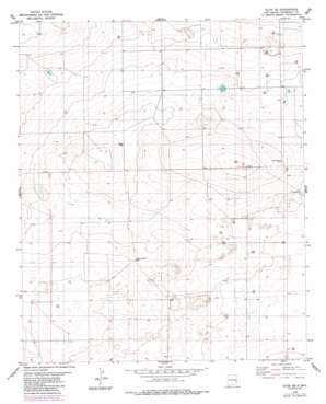
Elida Se Topo Map New Mexico
To zoom in, hover over the map of Elida Se
USGS Topo Quad 33103g5 - 1:24,000 scale
| Topo Map Name: | Elida Se |
| USGS Topo Quad ID: | 33103g5 |
| Print Size: | ca. 21 1/4" wide x 27" high |
| Southeast Coordinates: | 33.75° N latitude / 103.5° W longitude |
| Map Center Coordinates: | 33.8125° N latitude / 103.5625° W longitude |
| U.S. State: | NM |
| Filename: | o33103g5.jpg |
| Download Map JPG Image: | Elida Se topo map 1:24,000 scale |
| Map Type: | Topographic |
| Topo Series: | 7.5´ |
| Map Scale: | 1:24,000 |
| Source of Map Images: | United States Geological Survey (USGS) |
| Alternate Map Versions: |
Elida SE NM 1979, updated 1985 Download PDF Buy paper map Elida SE NM 2010 Download PDF Buy paper map Elida SE NM 2013 Download PDF Buy paper map Elida SE NM 2017 Download PDF Buy paper map |
1:24,000 Topo Quads surrounding Elida Se
> Back to 33103e1 at 1:100,000 scale
> Back to 33102a1 at 1:250,000 scale
> Back to U.S. Topo Maps home
Elida Se topo map: Gazetteer
Elida Se: Wells
06126 Water Well elevation 1349m 4425′06128 Water Well elevation 1360m 4461′
06129 Water Well elevation 1341m 4399′
06130 Water Well elevation 1347m 4419′
06131 Water Well elevation 1340m 4396′
06132 Water Well elevation 1339m 4393′
06133 Water Well elevation 1338m 4389′
06134 Water Well elevation 1336m 4383′
06135 Water Well elevation 1327m 4353′
06145 Water Well elevation 1352m 4435′
06146 Water Well elevation 1351m 4432′
06148 Water Well elevation 1341m 4399′
06170 Water Well elevation 1351m 4432′
06177 Water Well elevation 1340m 4396′
06178 Water Well elevation 1340m 4396′
06180 Water Well elevation 1335m 4379′
06184 Water Well elevation 1342m 4402′
Rector Well elevation 1333m 4373′
School Section Well elevation 1345m 4412′
Elida Se digital topo map on disk
Buy this Elida Se topo map showing relief, roads, GPS coordinates and other geographical features, as a high-resolution digital map file on DVD:


