Indian Bluff Topo Map New Mexico
To zoom in, hover over the map of Indian Bluff
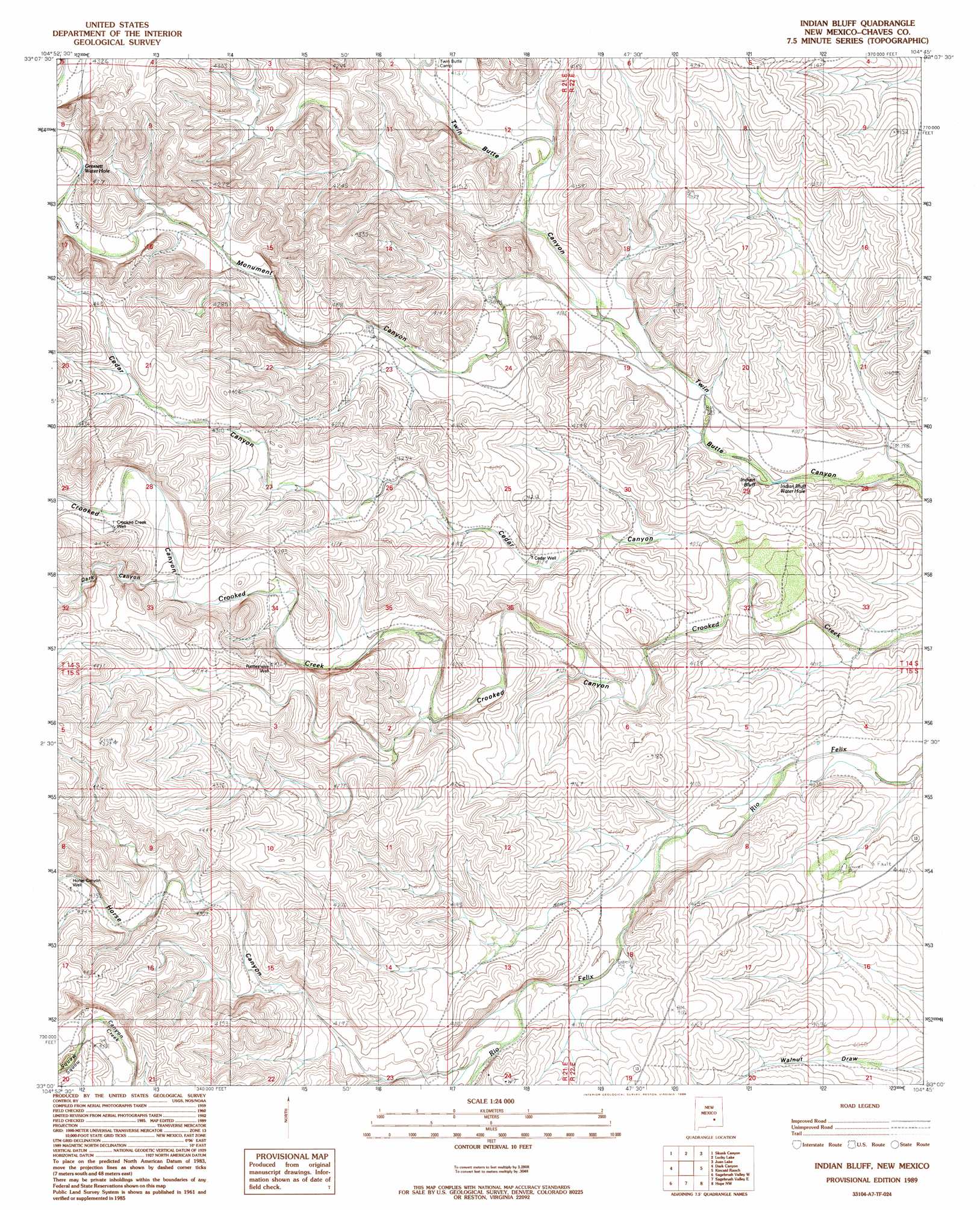
USGS Topo Quad 33104a7 - 1:24,000 scale
| Topo Map Name: | Indian Bluff |
| USGS Topo Quad ID: | 33104a7 |
| Print Size: | ca. 21 1/4" wide x 27" high |
| Southeast Coordinates: | 33° N latitude / 104.75° W longitude |
| Map Center Coordinates: | 33.0625° N latitude / 104.8125° W longitude |
| U.S. State: | NM |
| Filename: | o33104a7.jpg |
| Download Map JPG Image: | Indian Bluff topo map 1:24,000 scale |
| Map Type: | Topographic |
| Topo Series: | 7.5´ |
| Map Scale: | 1:24,000 |
| Source of Map Images: | United States Geological Survey (USGS) |
| Alternate Map Versions: |
Indian Bluff NM 1989, updated 1989 Download PDF Buy paper map Indian Bluff NM 2010 Download PDF Buy paper map Indian Bluff NM 2013 Download PDF Buy paper map Indian Bluff NM 2017 Download PDF Buy paper map |
1:24,000 Topo Quads surrounding Indian Bluff
Sunset |
Horseshoe Bend |
Diamond A Ranch |
Hondo Reservoir |
Roswell South |
Flying H Ne |
Skunk Canyon |
Lucky Lake |
Juan Lake |
Peters Lake |
Flying H |
Dark Canyon |
Indian Bluff |
Kincaid Ranch |
Hackberry Ranch |
Singer Lake |
Sagebrush Valley W. |
Sagebrush Valley E. |
Hope Nw |
Hope Ne |
Meadow Hill |
Sixteenmile Draw West |
Sixteenmile Draw East |
Hope |
Hope Se |
> Back to 33104a1 at 1:100,000 scale
> Back to 33104a1 at 1:250,000 scale
> Back to U.S. Topo Maps home
Indian Bluff topo map: Gazetteer
Indian Bluff: Bays
Gressett Water Hole elevation 1302m 4271′Indian Bluff Water Hole elevation 1218m 3996′
Indian Bluff: Cliffs
Indian Bluff elevation 1229m 4032′Indian Bluff: Valleys
Cedar Canyon elevation 1225m 4019′Dark Canyon elevation 1310m 4297′
Horse Canyon elevation 1275m 4183′
Monument Canyon elevation 1235m 4051′
Indian Bluff: Wells
10476 Water Well elevation 1224m 4015′Cedar Well elevation 1258m 4127′
Crooked Creek Well elevation 1327m 4353′
Horse Canyon Well elevation 1335m 4379′
Rattlesnake Well elevation 1325m 4347′
Indian Bluff digital topo map on disk
Buy this Indian Bluff topo map showing relief, roads, GPS coordinates and other geographical features, as a high-resolution digital map file on DVD: