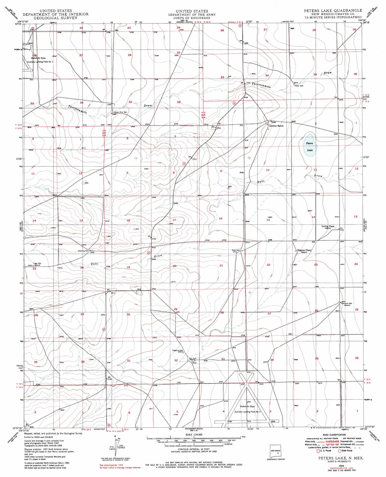
Peters Lake Topo Map New Mexico
To zoom in, hover over the map of Peters Lake
USGS Topo Quad 33104b5 - 1:24,000 scale
| Topo Map Name: | Peters Lake |
| USGS Topo Quad ID: | 33104b5 |
| Print Size: | ca. 21 1/4" wide x 27" high |
| Southeast Coordinates: | 33.125° N latitude / 104.5° W longitude |
| Map Center Coordinates: | 33.1875° N latitude / 104.5625° W longitude |
| U.S. State: | NM |
| Filename: | o33104b5.jpg |
| Download Map JPG Image: | Peters Lake topo map 1:24,000 scale |
| Map Type: | Topographic |
| Topo Series: | 7.5´ |
| Map Scale: | 1:24,000 |
| Source of Map Images: | United States Geological Survey (USGS) |
| Alternate Map Versions: |
Peters Lake NM 1949 Download PDF Buy paper map Peters Lake NM 1949, updated 1980 Download PDF Buy paper map Peters Lake NM 2010 Download PDF Buy paper map Peters Lake NM 2013 Download PDF Buy paper map Peters Lake NM 2017 Download PDF Buy paper map |
1:24,000 Topo Quads surrounding Peters Lake
Blackwater Hill |
Corn Ranch |
Roswell North |
Bitter Lake |
Comanche Spring |
Diamond A Ranch |
Hondo Reservoir |
Roswell South |
South Spring |
Bottomless Lakes |
Lucky Lake |
Juan Lake |
Peters Lake |
Dexter West |
Dexter East |
Indian Bluff |
Kincaid Ranch |
Hackberry Ranch |
Hagerman Sw |
Hagerman |
Sagebrush Valley E. |
Hope Nw |
Hope Ne |
Espuela |
Artesia Ne |
> Back to 33104a1 at 1:100,000 scale
> Back to 33104a1 at 1:250,000 scale
> Back to U.S. Topo Maps home
Peters Lake topo map: Gazetteer
Peters Lake: Dams
Zuber Draw Site Number One Dam elevation 1129m 3704′Zuber Draw Site Three Dam elevation 1120m 3674′
Zuber Draw Site Two Dam elevation 1112m 3648′
Peters Lake: Lakes
Peters Lake elevation 1112m 3648′Peters Lake: Populated Places
Blackdom (historical) elevation 1113m 3651′Higgins Place elevation 1117m 3664′
Loving Place elevation 1111m 3645′
Peters Lake: Post Offices
Blackdom Post Office (historical) elevation 1113m 3651′Peters Lake: Wells
Blackdom Well elevation 1113m 3651′Brown Brothers Well elevation 1145m 3756′
Greening Well elevation 1149m 3769′
Higgs Well elevation 1156m 3792′
Number Six Well elevation 1135m 3723′
Peters Well elevation 1120m 3674′
Pyatt Well elevation 1132m 3713′
Ragstone Well elevation 1135m 3723′
Peters Lake digital topo map on disk
Buy this Peters Lake topo map showing relief, roads, GPS coordinates and other geographical features, as a high-resolution digital map file on DVD: