Wade Ranch Topo Map New Mexico
To zoom in, hover over the map of Wade Ranch
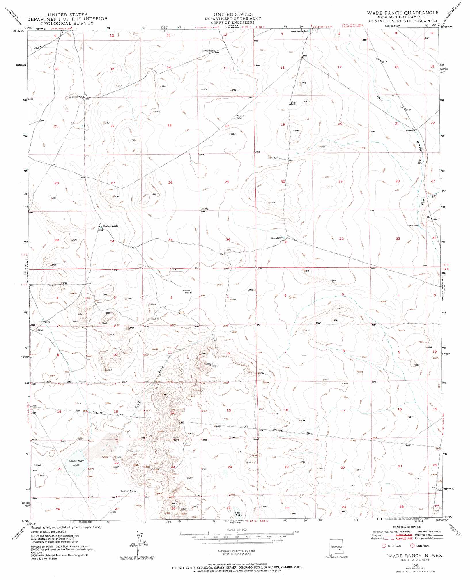
USGS Topo Quad 33104c2 - 1:24,000 scale
| Topo Map Name: | Wade Ranch |
| USGS Topo Quad ID: | 33104c2 |
| Print Size: | ca. 21 1/4" wide x 27" high |
| Southeast Coordinates: | 33.25° N latitude / 104.125° W longitude |
| Map Center Coordinates: | 33.3125° N latitude / 104.1875° W longitude |
| U.S. State: | NM |
| Filename: | o33104c2.jpg |
| Download Map JPG Image: | Wade Ranch topo map 1:24,000 scale |
| Map Type: | Topographic |
| Topo Series: | 7.5´ |
| Map Scale: | 1:24,000 |
| Source of Map Images: | United States Geological Survey (USGS) |
| Alternate Map Versions: |
Wade Ranch NM 1949 Download PDF Buy paper map Wade Ranch NM 1949, updated 1974 Download PDF Buy paper map Wade Ranch NM 2010 Download PDF Buy paper map Wade Ranch NM 2013 Download PDF Buy paper map Wade Ranch NM 2017 Download PDF Buy paper map |
1:24,000 Topo Quads surrounding Wade Ranch
Melena |
Acme |
Campbell |
Sardine Lake |
Presler Lake |
Bitter Lake |
Comanche Spring |
L E Ranch |
Sardine Mountain |
Oasis |
South Spring |
Bottomless Lakes |
Wade Ranch |
Malstrom Ranch |
Culp Ranch |
Dexter West |
Dexter East |
Bar C Bar Ranch |
Conner Well |
Vest Camp |
Hagerman Sw |
Hagerman |
Derrick Draw |
King Camp |
Cedar Point |
> Back to 33104a1 at 1:100,000 scale
> Back to 33104a1 at 1:250,000 scale
> Back to U.S. Topo Maps home
Wade Ranch topo map: Gazetteer
Wade Ranch: Lakes
Cockle Burr Lake elevation 1087m 3566′East Lake elevation 1124m 3687′
Wade Ranch: Reservoirs
Camps Tank elevation 1109m 3638′Mesquite Tank elevation 1133m 3717′
Wade Ranch: Streams
East Fork Long Arroyo elevation 1109m 3638′Wade Ranch: Valleys
Sand Draw elevation 1091m 3579′Wade Ranch: Wells
Annaya Well elevation 1145m 3756′Chuckbox Well elevation 1107m 3631′
Three Corner Well elevation 1128m 3700′
Wade Ranch digital topo map on disk
Buy this Wade Ranch topo map showing relief, roads, GPS coordinates and other geographical features, as a high-resolution digital map file on DVD: