Hondo Reservoir Topo Map New Mexico
To zoom in, hover over the map of Hondo Reservoir
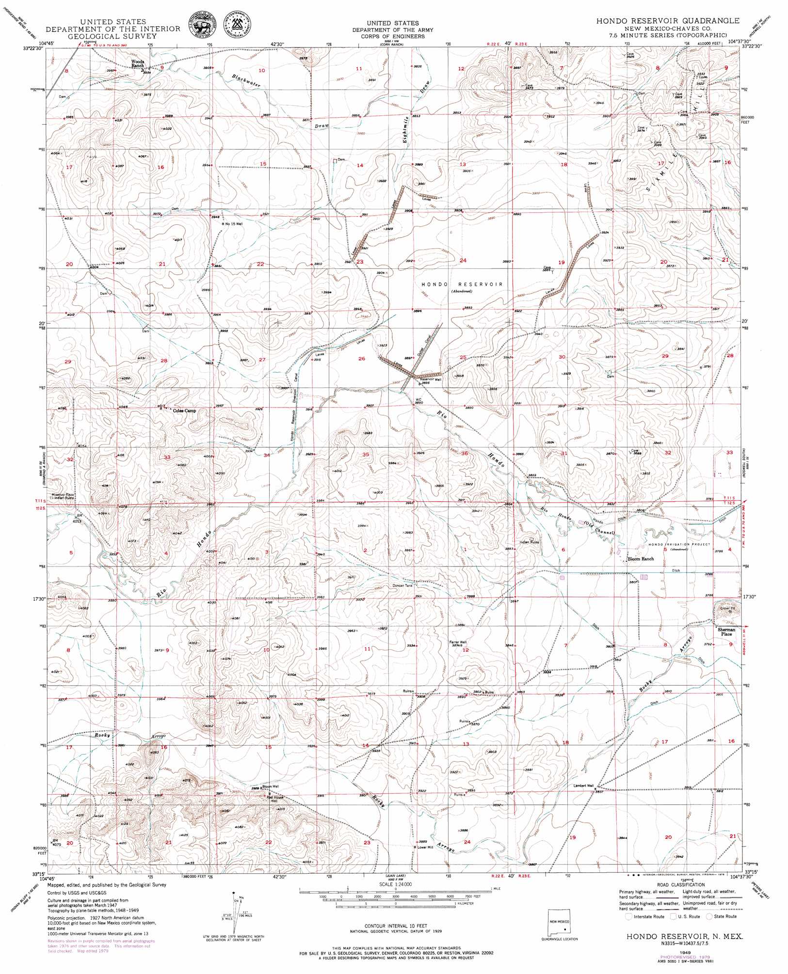
USGS Topo Quad 33104c6 - 1:24,000 scale
| Topo Map Name: | Hondo Reservoir |
| USGS Topo Quad ID: | 33104c6 |
| Print Size: | ca. 21 1/4" wide x 27" high |
| Southeast Coordinates: | 33.25° N latitude / 104.625° W longitude |
| Map Center Coordinates: | 33.3125° N latitude / 104.6875° W longitude |
| U.S. State: | NM |
| Filename: | o33104c6.jpg |
| Download Map JPG Image: | Hondo Reservoir topo map 1:24,000 scale |
| Map Type: | Topographic |
| Topo Series: | 7.5´ |
| Map Scale: | 1:24,000 |
| Source of Map Images: | United States Geological Survey (USGS) |
| Alternate Map Versions: |
Hondo Reservoir NM 1949 Download PDF Buy paper map Hondo Reservoir NM 1949, updated 1979 Download PDF Buy paper map Hondo Reservoir NM 2010 Download PDF Buy paper map Hondo Reservoir NM 2013 Download PDF Buy paper map Hondo Reservoir NM 2017 Download PDF Buy paper map |
1:24,000 Topo Quads surrounding Hondo Reservoir
Elsie Canyon |
White Flat Se |
Barn Draw |
Panther Hill |
Melena |
Horseshoe Bend Nw |
Blackwater Hill |
Corn Ranch |
Roswell North |
Bitter Lake |
Horseshoe Bend |
Diamond A Ranch |
Hondo Reservoir |
Roswell South |
South Spring |
Skunk Canyon |
Lucky Lake |
Juan Lake |
Peters Lake |
Dexter West |
Dark Canyon |
Indian Bluff |
Kincaid Ranch |
Hackberry Ranch |
Hagerman Sw |
> Back to 33104a1 at 1:100,000 scale
> Back to 33104a1 at 1:250,000 scale
> Back to U.S. Topo Maps home
Hondo Reservoir topo map: Gazetteer
Hondo Reservoir: Canals
Hondo Ditch elevation 1164m 3818′Hondo Reservoir Diversion Canal elevation 1193m 3914′
Outlet Canal elevation 1192m 3910′
Hondo Reservoir: Populated Places
Missouri Plaza (historical) elevation 1232m 4041′Sherman Place elevation 1154m 3786′
Hondo Reservoir: Reservoirs
Duncan Tank elevation 1190m 3904′Hondo Reservoir elevation 1191m 3907′
Two Rivers Reservoir elevation 1213m 3979′
Hondo Reservoir: Valleys
Blackwater Draw elevation 1171m 3841′Hondo Reservoir: Wells
Bloom Well elevation 1197m 3927′Farrar Well elevation 1182m 3877′
Lambert Well elevation 1170m 3838′
Number 15 Well elevation 1202m 3943′
Red House Well elevation 1198m 3930′
Hondo Reservoir digital topo map on disk
Buy this Hondo Reservoir topo map showing relief, roads, GPS coordinates and other geographical features, as a high-resolution digital map file on DVD: