Horseshoe Bend Topo Map New Mexico
To zoom in, hover over the map of Horseshoe Bend
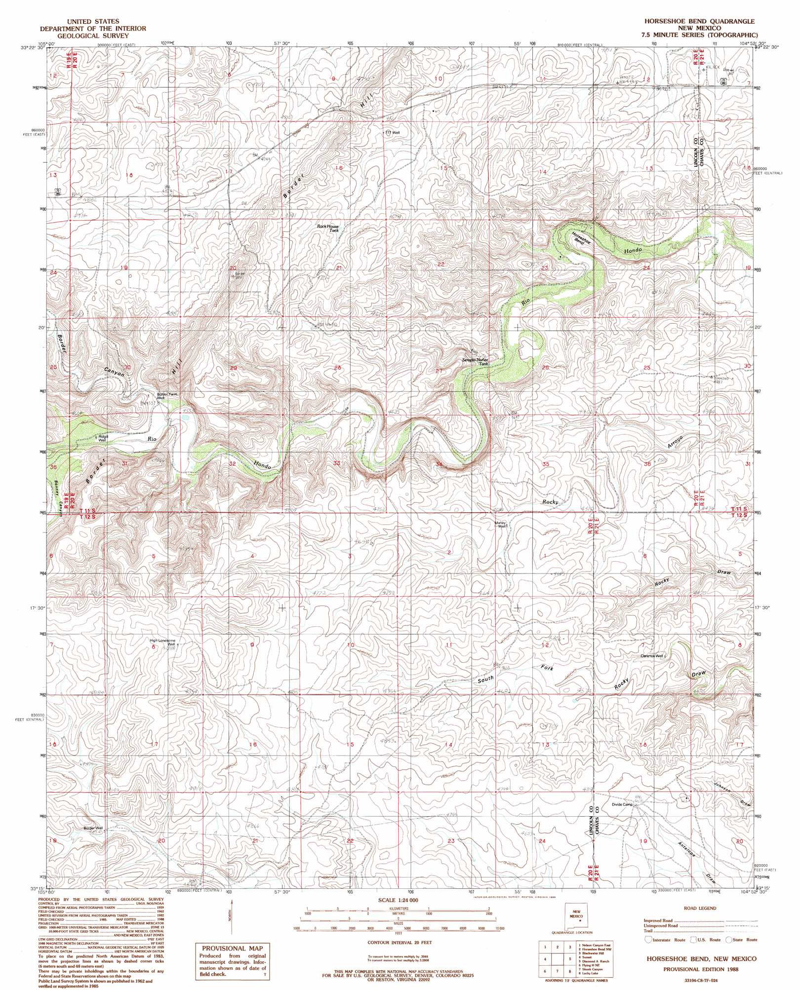
USGS Topo Quad 33104c8 - 1:24,000 scale
| Topo Map Name: | Horseshoe Bend |
| USGS Topo Quad ID: | 33104c8 |
| Print Size: | ca. 21 1/4" wide x 27" high |
| Southeast Coordinates: | 33.25° N latitude / 104.875° W longitude |
| Map Center Coordinates: | 33.3125° N latitude / 104.9375° W longitude |
| U.S. State: | NM |
| Filename: | o33104c8.jpg |
| Download Map JPG Image: | Horseshoe Bend topo map 1:24,000 scale |
| Map Type: | Topographic |
| Topo Series: | 7.5´ |
| Map Scale: | 1:24,000 |
| Source of Map Images: | United States Geological Survey (USGS) |
| Alternate Map Versions: |
Horseshoe Bend NM 2010 Download PDF Buy paper map Horseshoe Bend NM 2013 Download PDF Buy paper map Horseshoe Bend NM 2017 Download PDF Buy paper map |
1:24,000 Topo Quads surrounding Horseshoe Bend
Arabela |
Granville Canyon |
Elsie Canyon |
White Flat Se |
Barn Draw |
Nelson Canyon West |
Nelson Canyon East |
Horseshoe Bend Nw |
Blackwater Hill |
Corn Ranch |
Tinnie |
Sunset |
Horseshoe Bend |
Diamond A Ranch |
Hondo Reservoir |
Flying H Nw |
Flying H Ne |
Skunk Canyon |
Lucky Lake |
Juan Lake |
Loco Canyon |
Flying H |
Dark Canyon |
Indian Bluff |
Kincaid Ranch |
> Back to 33104a1 at 1:100,000 scale
> Back to 33104a1 at 1:250,000 scale
> Back to U.S. Topo Maps home
Horseshoe Bend topo map: Gazetteer
Horseshoe Bend: Bends
Horseshoe Bend elevation 1330m 4363′Horseshoe Bend: Reservoirs
Rock House Tank elevation 1411m 4629′Serapio Nuñez Tank elevation 1332m 4370′
Horseshoe Bend: Valleys
Bonney Canyon elevation 1396m 4580′Border Canyon elevation 1383m 4537′
Horseshoe Bend: Wells
12586 Water Well elevation 1312m 4304′Border Farm Well elevation 1401m 4596′
Border Well elevation 1478m 4849′
Clarence Well elevation 1378m 4520′
High Lonesome Well elevation 1551m 5088′
Maney Well elevation 1394m 4573′
Ridgill Well elevation 1398m 4586′
Sevenhundred and Seventyseven Well elevation 1398m 4586′
Horseshoe Bend digital topo map on disk
Buy this Horseshoe Bend topo map showing relief, roads, GPS coordinates and other geographical features, as a high-resolution digital map file on DVD: