Sardine Mountain Topo Map New Mexico
To zoom in, hover over the map of Sardine Mountain
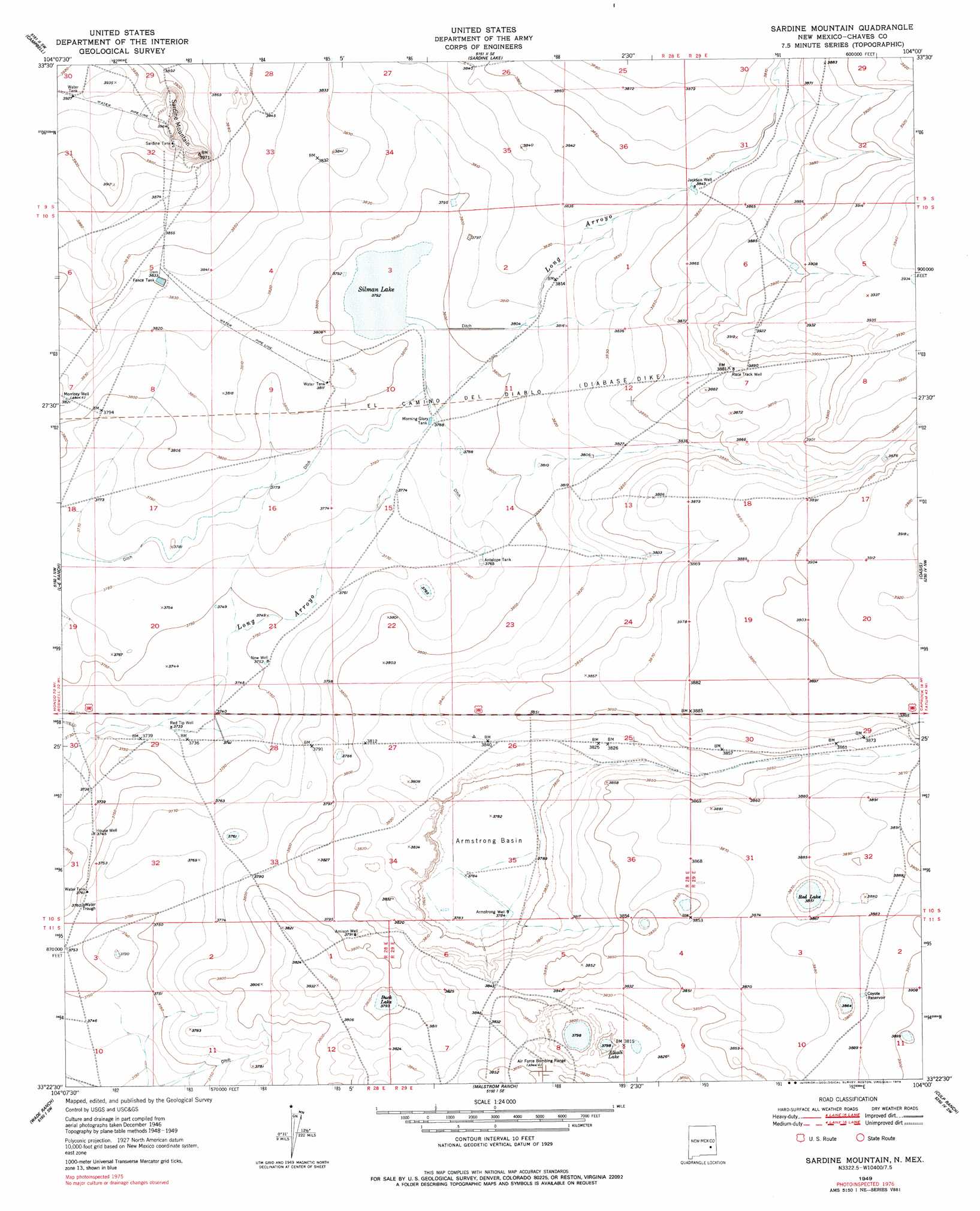
USGS Topo Quad 33104d1 - 1:24,000 scale
| Topo Map Name: | Sardine Mountain |
| USGS Topo Quad ID: | 33104d1 |
| Print Size: | ca. 21 1/4" wide x 27" high |
| Southeast Coordinates: | 33.375° N latitude / 104° W longitude |
| Map Center Coordinates: | 33.4375° N latitude / 104.0625° W longitude |
| U.S. State: | NM |
| Filename: | o33104d1.jpg |
| Download Map JPG Image: | Sardine Mountain topo map 1:24,000 scale |
| Map Type: | Topographic |
| Topo Series: | 7.5´ |
| Map Scale: | 1:24,000 |
| Source of Map Images: | United States Geological Survey (USGS) |
| Alternate Map Versions: |
Sardine Mountain NM 1949 Download PDF Buy paper map Sardine Mountain NM 1949, updated 1979 Download PDF Buy paper map Sardine Mountain NM 2010 Download PDF Buy paper map Sardine Mountain NM 2013 Download PDF Buy paper map Sardine Mountain NM 2017 Download PDF Buy paper map |
1:24,000 Topo Quads surrounding Sardine Mountain
Eightmile Draw |
Haystack Mountain |
Elkins |
Curlew Lake |
Lone Wolf |
Acme |
Campbell |
Sardine Lake |
Presler Lake |
Curlew Lake Se |
Comanche Spring |
L E Ranch |
Sardine Mountain |
Oasis |
Mescalero Point Ne |
Bottomless Lakes |
Wade Ranch |
Malstrom Ranch |
Culp Ranch |
Mescalero Point |
Dexter East |
Bar C Bar Ranch |
Conner Well |
Vest Camp |
Caudill Ranch |
> Back to 33104a1 at 1:100,000 scale
> Back to 33104a1 at 1:250,000 scale
> Back to U.S. Topo Maps home
Sardine Mountain topo map: Gazetteer
Sardine Mountain: Basins
Armstrong Basin elevation 1154m 3786′Sardine Mountain: Lakes
Alkali Lake elevation 1157m 3795′Buck Lake elevation 1158m 3799′
Red Lake elevation 1175m 3854′
Silman Lake elevation 1156m 3792′
Sardine Mountain: Reservoirs
Antelope Tank elevation 1150m 3772′Coyote Reservoir elevation 1184m 3884′
Fence Tank elevation 1169m 3835′
Morning Glory Tank elevation 1155m 3789′
Sardine Tank elevation 1209m 3966′
Sardine Mountain: Summits
Sardine Mountain elevation 1212m 3976′Sardine Mountain: Wells
Amison Well elevation 1156m 3792′Armstrong Well elevation 1155m 3789′
House Well elevation 1142m 3746′
Jackson Well elevation 1171m 3841′
Morrisey Well elevation 1165m 3822′
New Well elevation 1145m 3756′
Race Track Well elevation 1186m 3891′
Red Tip Well elevation 1139m 3736′
Sardine Mountain digital topo map on disk
Buy this Sardine Mountain topo map showing relief, roads, GPS coordinates and other geographical features, as a high-resolution digital map file on DVD: