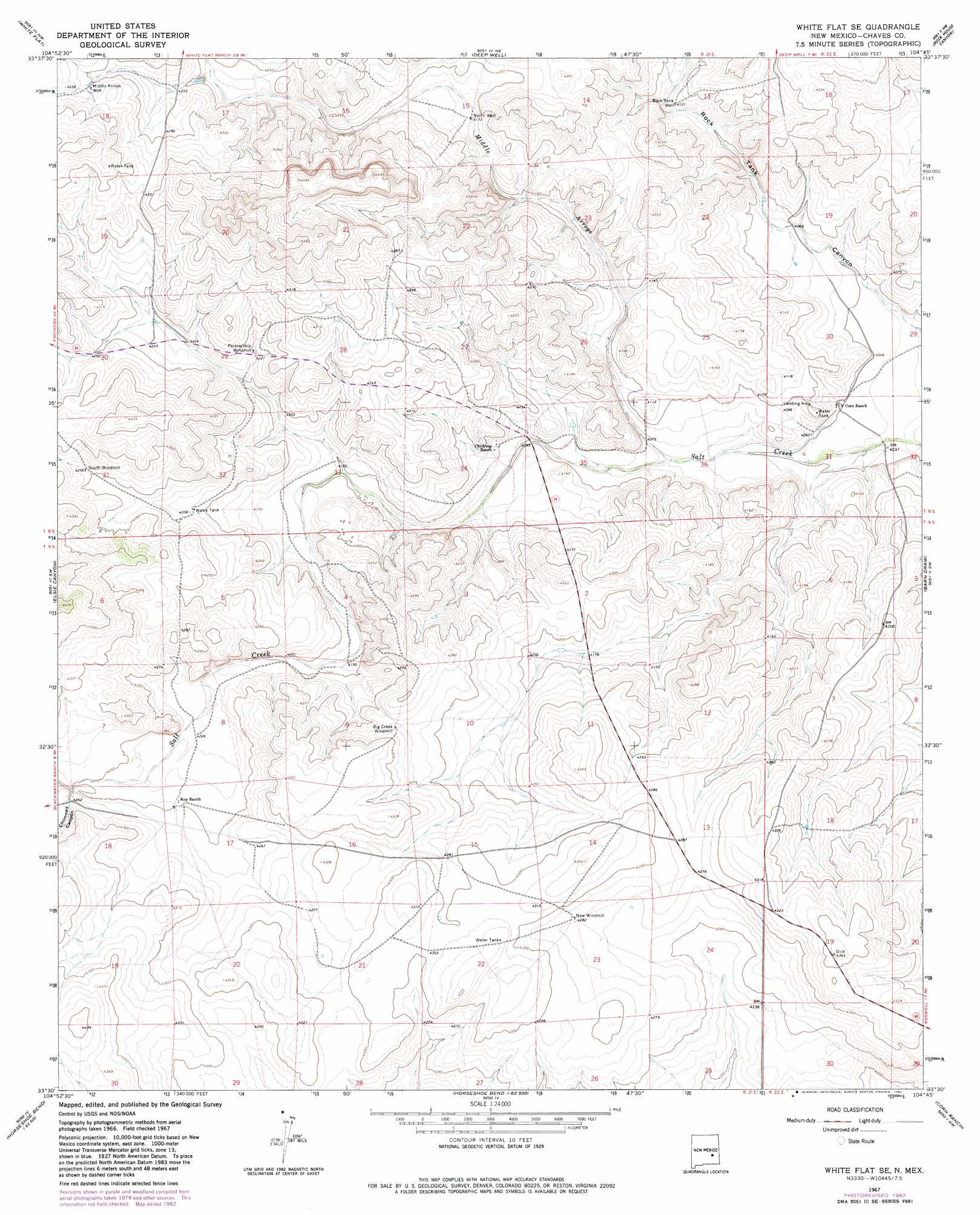
White Flat Se Topo Map New Mexico
To zoom in, hover over the map of White Flat Se
USGS Topo Quad 33104e7 - 1:24,000 scale
| Topo Map Name: | White Flat Se |
| USGS Topo Quad ID: | 33104e7 |
| Print Size: | ca. 21 1/4" wide x 27" high |
| Southeast Coordinates: | 33.5° N latitude / 104.75° W longitude |
| Map Center Coordinates: | 33.5625° N latitude / 104.8125° W longitude |
| U.S. State: | NM |
| Filename: | o33104e7.jpg |
| Download Map JPG Image: | White Flat Se topo map 1:24,000 scale |
| Map Type: | Topographic |
| Topo Series: | 7.5´ |
| Map Scale: | 1:24,000 |
| Source of Map Images: | United States Geological Survey (USGS) |
| Alternate Map Versions: |
White Flat SE NM 1967, updated 1971 Download PDF Buy paper map White Flat SE NM 1967, updated 1982 Download PDF Buy paper map White Flat SE NM 2010 Download PDF Buy paper map White Flat SE NM 2013 Download PDF Buy paper map White Flat SE NM 2017 Download PDF Buy paper map |
1:24,000 Topo Quads surrounding White Flat Se
Cistern Draw |
North Lake |
Round Mountain Se |
Mesa Sw |
Mesa Se |
Arroyo Serrano East |
White Flat |
Deep Well |
Rock House Canyon |
Marley Draw |
Granville Canyon |
Elsie Canyon |
White Flat Se |
Barn Draw |
Panther Hill |
Nelson Canyon East |
Horseshoe Bend Nw |
Blackwater Hill |
Corn Ranch |
Roswell North |
Sunset |
Horseshoe Bend |
Diamond A Ranch |
Hondo Reservoir |
Roswell South |
> Back to 33104e1 at 1:100,000 scale
> Back to 33104a1 at 1:250,000 scale
> Back to U.S. Topo Maps home
White Flat Se topo map: Gazetteer
White Flat Se: Arroyos
Middle Arroyo elevation 1239m 4064′White Flat Se: Valleys
Chimney Canyon elevation 1296m 4251′White Flat Se: Wells
Middle Arroyo Well elevation 1314m 4311′North Well elevation 1272m 4173′
Rock Tank Well elevation 1259m 4130′
White Flat Se digital topo map on disk
Buy this White Flat Se topo map showing relief, roads, GPS coordinates and other geographical features, as a high-resolution digital map file on DVD: