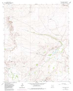
Coyote Draw Topo Map New Mexico
To zoom in, hover over the map of Coyote Draw
USGS Topo Quad 33104f4 - 1:24,000 scale
| Topo Map Name: | Coyote Draw |
| USGS Topo Quad ID: | 33104f4 |
| Print Size: | ca. 21 1/4" wide x 27" high |
| Southeast Coordinates: | 33.625° N latitude / 104.375° W longitude |
| Map Center Coordinates: | 33.6875° N latitude / 104.4375° W longitude |
| U.S. State: | NM |
| Filename: | o33104f4.jpg |
| Download Map JPG Image: | Coyote Draw topo map 1:24,000 scale |
| Map Type: | Topographic |
| Topo Series: | 7.5´ |
| Map Scale: | 1:24,000 |
| Source of Map Images: | United States Geological Survey (USGS) |
| Alternate Map Versions: |
Coyote Draw NM 1963, updated 1964 Download PDF Buy paper map Coyote Draw NM 1963, updated 1982 Download PDF Buy paper map Coyote Draw NM 2010 Download PDF Buy paper map Coyote Draw NM 2013 Download PDF Buy paper map Coyote Draw NM 2017 Download PDF Buy paper map |
1:24,000 Topo Quads surrounding Coyote Draw
> Back to 33104e1 at 1:100,000 scale
> Back to 33104a1 at 1:250,000 scale
> Back to U.S. Topo Maps home
Coyote Draw topo map: Gazetteer
Coyote Draw: Basins
Yellow Lake Sink elevation 1135m 3723′Coyote Draw: Lakes
Cocklebur Lakes elevation 1096m 3595′Coons Lake elevation 1152m 3779′
Yellow Lake elevation 1097m 3599′
Coyote Draw: Mines
Acme Sand Pit elevation 1101m 3612′Coyote Draw: Reservoirs
Hilltop Tank elevation 1200m 3937′Stewart Tank elevation 1122m 3681′
TX Tank elevation 1222m 4009′
Coyote Draw: Valleys
Coyote Draw elevation 1090m 3576′Milner Draw elevation 1097m 3599′
Coyote Draw: Wells
10007 Water Well elevation 1101m 3612′10714 Water Well elevation 1102m 3615′
10753 Water Well elevation 1150m 3772′
10755 Water Well elevation 1103m 3618′
10772 Water Well elevation 1098m 3602′
10776 Water Well elevation 1091m 3579′
10777 Water Well elevation 1091m 3579′
10797 Water Well elevation 1104m 3622′
Coyote Draw digital topo map on disk
Buy this Coyote Draw topo map showing relief, roads, GPS coordinates and other geographical features, as a high-resolution digital map file on DVD:


