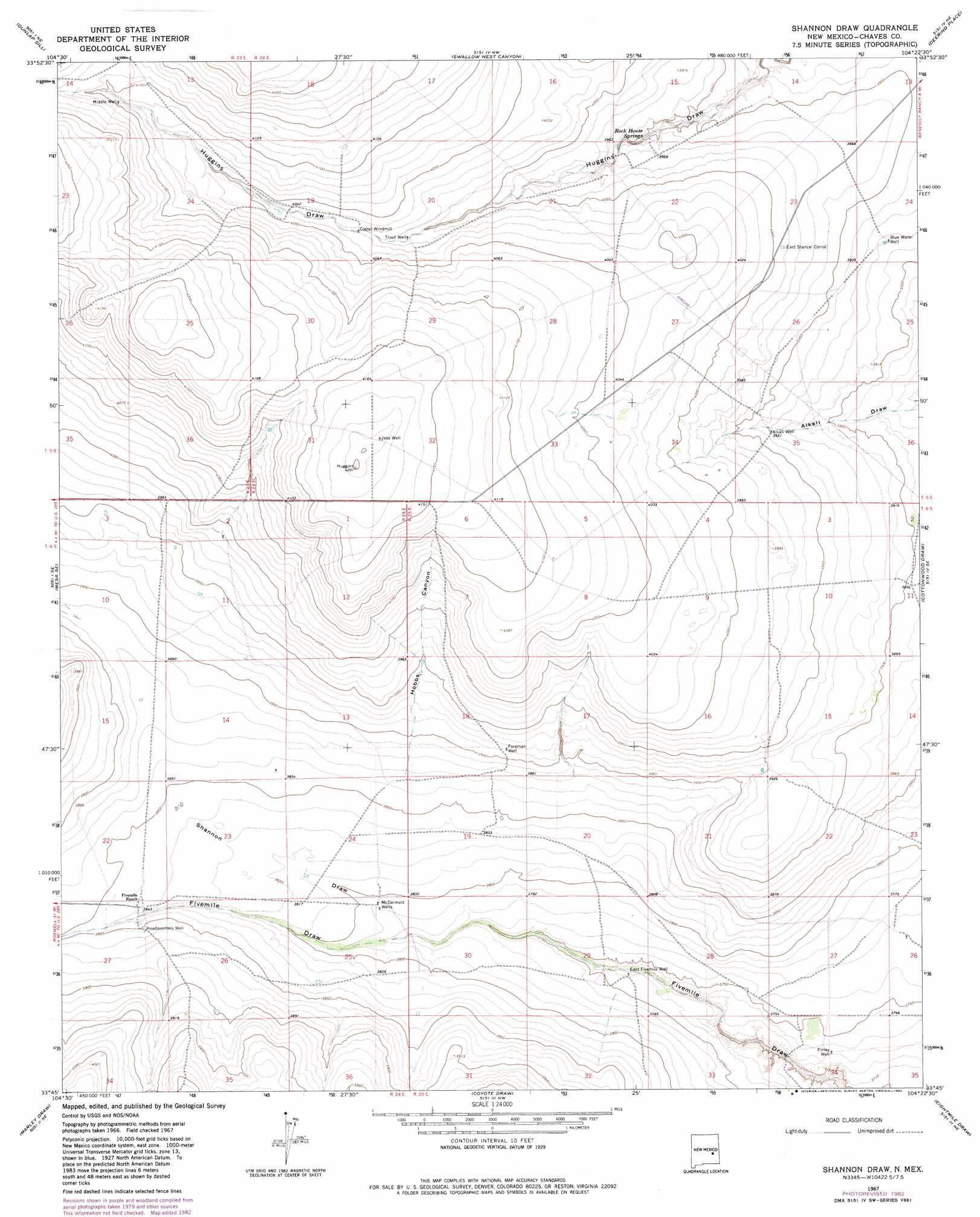
Shannon Draw Topo Map New Mexico
To zoom in, hover over the map of Shannon Draw
USGS Topo Quad 33104g4 - 1:24,000 scale
| Topo Map Name: | Shannon Draw |
| USGS Topo Quad ID: | 33104g4 |
| Print Size: | ca. 21 1/4" wide x 27" high |
| Southeast Coordinates: | 33.75° N latitude / 104.375° W longitude |
| Map Center Coordinates: | 33.8125° N latitude / 104.4375° W longitude |
| U.S. State: | NM |
| Filename: | o33104g4.jpg |
| Download Map JPG Image: | Shannon Draw topo map 1:24,000 scale |
| Map Type: | Topographic |
| Topo Series: | 7.5´ |
| Map Scale: | 1:24,000 |
| Source of Map Images: | United States Geological Survey (USGS) |
| Alternate Map Versions: |
Shannon Draw NM 1967, updated 1971 Download PDF Buy paper map Shannon Draw NM 1967, updated 1982 Download PDF Buy paper map Shannon Draw NM 2010 Download PDF Buy paper map Shannon Draw NM 2013 Download PDF Buy paper map Shannon Draw NM 2017 Download PDF Buy paper map |
1:24,000 Topo Quads surrounding Shannon Draw
Devils Well |
Dunlap |
Lovelady Draw |
La Espia Peak |
Cooley Lake |
Mesa |
Dunlap Sill |
Swallow Nest Canyon |
Deering Place |
Hernandez Lake |
Mesa Sw |
Mesa Se |
Shannon Draw |
Cottonwood Draw |
Haystack Butte |
Rock House Canyon |
Marley Draw |
Coyote Draw |
Eightmile Draw |
Haystack Mountain |
Barn Draw |
Panther Hill |
Melena |
Acme |
Campbell |
> Back to 33104e1 at 1:100,000 scale
> Back to 33104a1 at 1:250,000 scale
> Back to U.S. Topo Maps home
Shannon Draw topo map: Gazetteer
Shannon Draw: Populated Places
McDermott Wells elevation 1156m 3792′Shannon Draw: Springs
Rock House Springs elevation 1203m 3946′Shannon Draw: Valleys
Hobbs Canyon elevation 1178m 3864′Shannon Draw elevation 1149m 3769′
Shannon Draw digital topo map on disk
Buy this Shannon Draw topo map showing relief, roads, GPS coordinates and other geographical features, as a high-resolution digital map file on DVD: