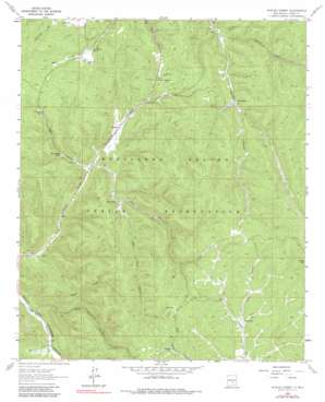
Apache Summit Topo Map New Mexico
To zoom in, hover over the map of Apache Summit
USGS Topo Quad 33105b6 - 1:24,000 scale
| Topo Map Name: | Apache Summit |
| USGS Topo Quad ID: | 33105b6 |
| Print Size: | ca. 21 1/4" wide x 27" high |
| Southeast Coordinates: | 33.125° N latitude / 105.625° W longitude |
| Map Center Coordinates: | 33.1875° N latitude / 105.6875° W longitude |
| U.S. State: | NM |
| Filename: | o33105b6.jpg |
| Download Map JPG Image: | Apache Summit topo map 1:24,000 scale |
| Map Type: | Topographic |
| Topo Series: | 7.5´ |
| Map Scale: | 1:24,000 |
| Source of Map Images: | United States Geological Survey (USGS) |
| Alternate Map Versions: |
Apache Summit NM 1963, updated 1967 Download PDF Buy paper map Apache Summit NM 1963, updated 1980 Download PDF Buy paper map Apache Summit NM 1963, updated 1990 Download PDF Buy paper map Apache Summit NM 2010 Download PDF Buy paper map Apache Summit NM 2013 Download PDF Buy paper map |
1:24,000 Topo Quads surrounding Apache Summit
> Back to 33105a1 at 1:100,000 scale
> Back to 33104a1 at 1:250,000 scale
> Back to U.S. Topo Maps home
Apache Summit topo map: Gazetteer
Apache Summit: Mines
Mescalero Apache Pit elevation 2332m 7650′Apache Summit: Reservoirs
Campbell Tank elevation 2290m 7513′Chatto Tank elevation 2276m 7467′
Goat Canyon Tank elevation 2224m 7296′
Goat Windmill elevation 2512m 8241′
Pete Gaines Tank elevation 2265m 7431′
Rock Tank elevation 2412m 7913′
Telephone Tank elevation 2449m 8034′
Treas Tank elevation 2255m 7398′
Wink Tank elevation 2329m 7641′
Apache Summit: Summits
Harley Mountain elevation 2636m 8648′Apache Summit: Valleys
Goat Canyon elevation 2183m 7162′Gravel Canyon elevation 2069m 6788′
Mud Canyon elevation 2255m 7398′
Rock Canyon elevation 2412m 7913′
Summit Canyon elevation 2257m 7404′
West Mud Canyon elevation 2190m 7185′
West Telephone Canyon elevation 2125m 6971′
Apache Summit: Wells
Carizzo Water Well elevation 2335m 7660′Fence Canyon Well elevation 2330m 7644′
Pete Gaines Well elevation 2291m 7516′
Sawmil Water Well elevation 2348m 7703′
Apache Summit digital topo map on disk
Buy this Apache Summit topo map showing relief, roads, GPS coordinates and other geographical features, as a high-resolution digital map file on DVD:


