Sunset Topo Map New Mexico
To zoom in, hover over the map of Sunset
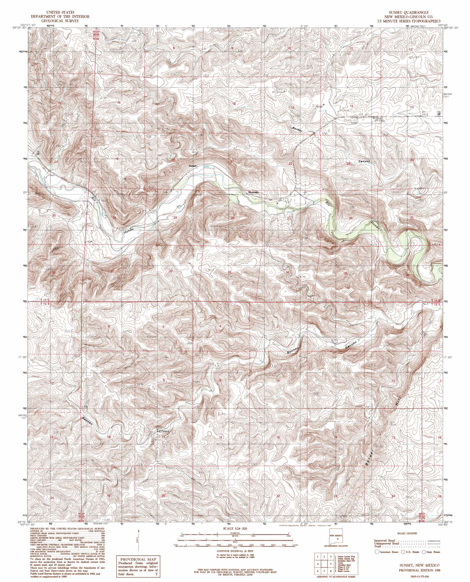
USGS Topo Quad 33105c1 - 1:24,000 scale
| Topo Map Name: | Sunset |
| USGS Topo Quad ID: | 33105c1 |
| Print Size: | ca. 21 1/4" wide x 27" high |
| Southeast Coordinates: | 33.25° N latitude / 105° W longitude |
| Map Center Coordinates: | 33.3125° N latitude / 105.0625° W longitude |
| U.S. State: | NM |
| Filename: | o33105c1.jpg |
| Download Map JPG Image: | Sunset topo map 1:24,000 scale |
| Map Type: | Topographic |
| Topo Series: | 7.5´ |
| Map Scale: | 1:24,000 |
| Source of Map Images: | United States Geological Survey (USGS) |
| Alternate Map Versions: |
Sunset NM 1988, updated 1989 Download PDF Buy paper map Sunset NM 2010 Download PDF Buy paper map Sunset NM 2013 Download PDF Buy paper map |
1:24,000 Topo Quads surrounding Sunset
Capitan Peak |
Arabela |
Granville Canyon |
Elsie Canyon |
White Flat Se |
San Patricio |
Nelson Canyon West |
Nelson Canyon East |
Horseshoe Bend Nw |
Blackwater Hill |
Wahalee Canyon |
Tinnie |
Sunset |
Horseshoe Bend |
Diamond A Ranch |
Deadman Lake |
Flying H Nw |
Flying H Ne |
Skunk Canyon |
Lucky Lake |
Clements Ranch |
Loco Canyon |
Flying H |
Dark Canyon |
Indian Bluff |
> Back to 33105a1 at 1:100,000 scale
> Back to 33104a1 at 1:250,000 scale
> Back to U.S. Topo Maps home
Sunset digital topo map on disk
Buy this Sunset topo map showing relief, roads, GPS coordinates and other geographical features, as a high-resolution digital map file on DVD: