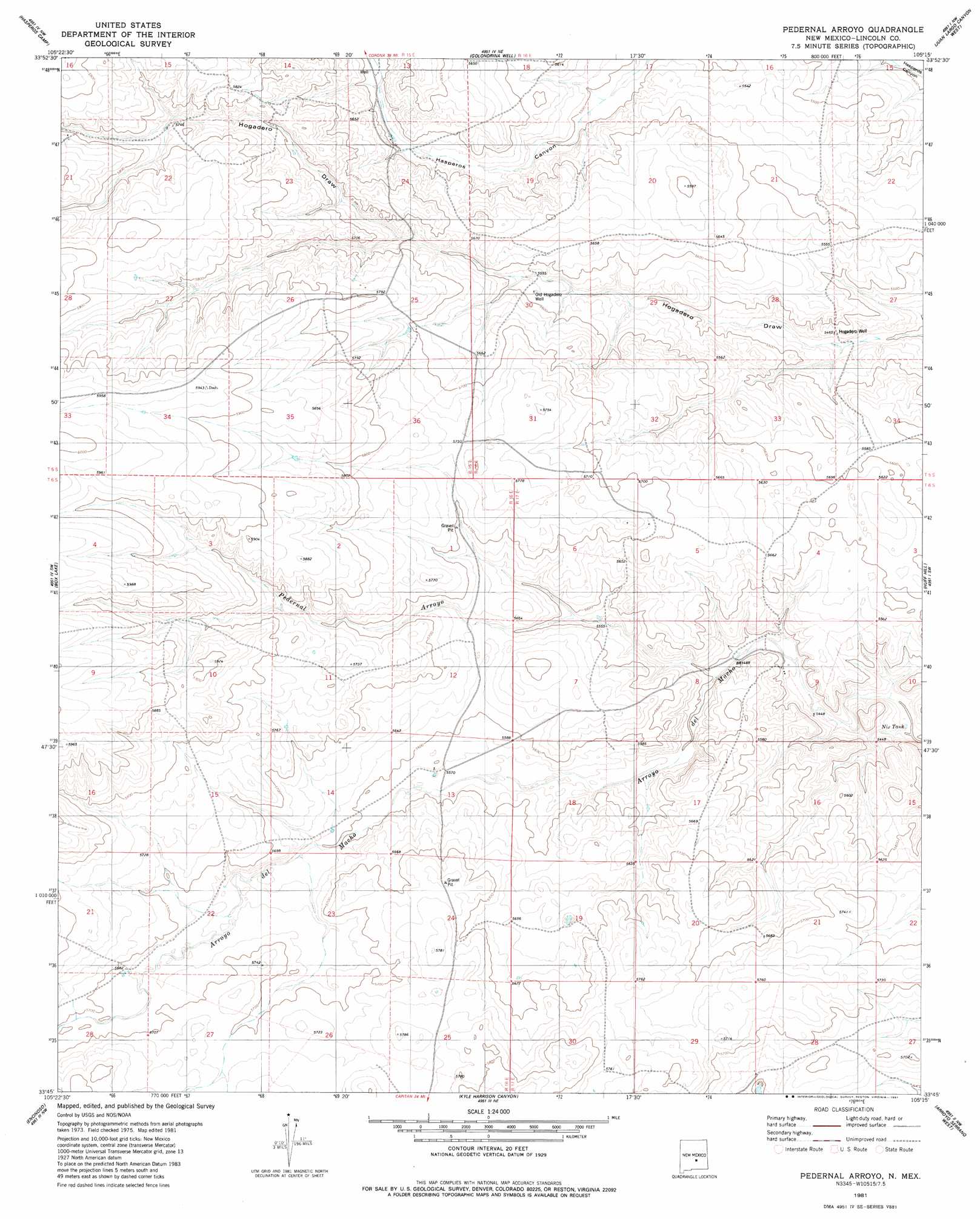
Pedernal Arroyo Topo Map New Mexico
To zoom in, hover over the map of Pedernal Arroyo
USGS Topo Quad 33105g3 - 1:24,000 scale
| Topo Map Name: | Pedernal Arroyo |
| USGS Topo Quad ID: | 33105g3 |
| Print Size: | ca. 21 1/4" wide x 27" high |
| Southeast Coordinates: | 33.75° N latitude / 105.25° W longitude |
| Map Center Coordinates: | 33.8125° N latitude / 105.3125° W longitude |
| U.S. State: | NM |
| Filename: | o33105g3.jpg |
| Download Map JPG Image: | Pedernal Arroyo topo map 1:24,000 scale |
| Map Type: | Topographic |
| Topo Series: | 7.5´ |
| Map Scale: | 1:24,000 |
| Source of Map Images: | United States Geological Survey (USGS) |
| Alternate Map Versions: |
Pedernal Arroyo NM 1981, updated 1981 Download PDF Buy paper map Pedernal Arroyo NM 2010 Download PDF Buy paper map Pedernal Arroyo NM 2013 Download PDF Buy paper map |
1:24,000 Topo Quads surrounding Pedernal Arroyo
Pelan Hill |
Red Bluff Draw West |
Red Bluff Draw East |
Cowboy Mesa Sw |
Cowboy Mesa |
Chupadero Mountain |
Hasperos Camp |
Golondrina Well |
Juan Largo Canyon West |
Juan Largo Canyon East |
Jicarilla Peak |
Box Lake |
Pedernal Arroyo |
Huff Hill |
Cistern Draw |
Jacob Spring |
Encinoso |
Kyle Harrison Canyon |
Arroyo Serrano West |
Arroyo Serrano East |
Capitan |
Capitan Pass |
Capitan Peak |
Arabela |
Granville Canyon |
> Back to 33105e1 at 1:100,000 scale
> Back to 33104a1 at 1:250,000 scale
> Back to U.S. Topo Maps home
Pedernal Arroyo topo map: Gazetteer
Pedernal Arroyo: Arroyos
Pedernal Arroyo elevation 1669m 5475′Pedernal Arroyo: Reservoirs
Nix Tank elevation 1704m 5590′Pedernal Arroyo: Wells
Hogadero Well elevation 1666m 5465′Old Hogadero Well elevation 1705m 5593′
Pedernal Arroyo digital topo map on disk
Buy this Pedernal Arroyo topo map showing relief, roads, GPS coordinates and other geographical features, as a high-resolution digital map file on DVD: