Dugout Canyon Topo Map New Mexico
To zoom in, hover over the map of Dugout Canyon
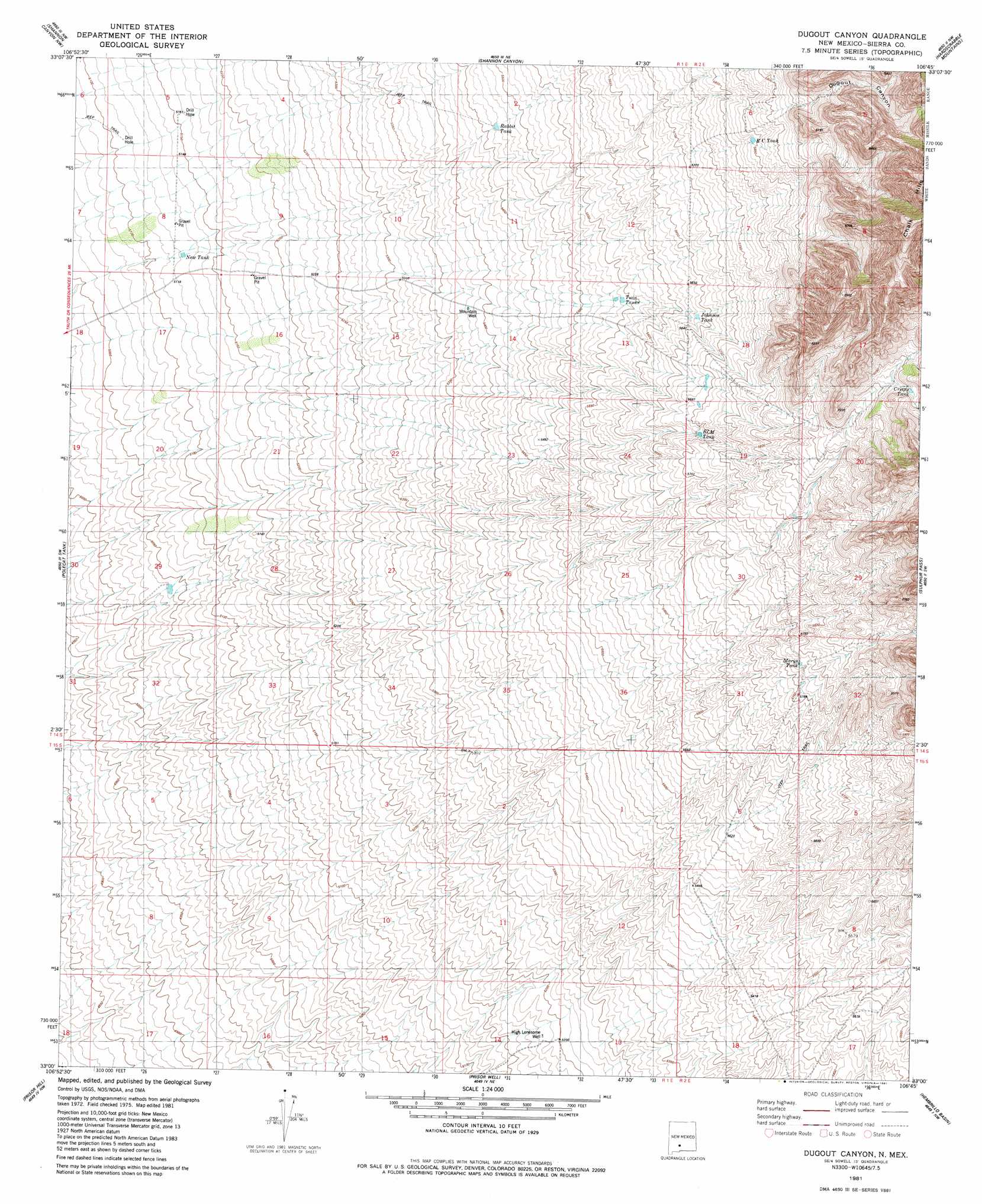
USGS Topo Quad 33106a7 - 1:24,000 scale
| Topo Map Name: | Dugout Canyon |
| USGS Topo Quad ID: | 33106a7 |
| Print Size: | ca. 21 1/4" wide x 27" high |
| Southeast Coordinates: | 33° N latitude / 106.75° W longitude |
| Map Center Coordinates: | 33.0625° N latitude / 106.8125° W longitude |
| U.S. State: | NM |
| Filename: | o33106a7.jpg |
| Download Map JPG Image: | Dugout Canyon topo map 1:24,000 scale |
| Map Type: | Topographic |
| Topo Series: | 7.5´ |
| Map Scale: | 1:24,000 |
| Source of Map Images: | United States Geological Survey (USGS) |
| Alternate Map Versions: |
Dugout Canyon NM 1981, updated 1981 Download PDF Buy paper map Dugout Canyon NM 1996, updated 2002 Download PDF Buy paper map Dugout Canyon NM 2010 Download PDF Buy paper map Dugout Canyon NM 2013 Download PDF Buy paper map Dugout Canyon NM 2017 Download PDF Buy paper map |
1:24,000 Topo Quads surrounding Dugout Canyon
Crocker |
Fairview Well |
Fence Canyon |
Big Gyp Mountain |
Salinas Peak |
Engle |
Shannon Canyon Nw |
Shannon Canyon |
Hardscrabble Mountains |
Tip Top Canyon |
Cutter |
Polecat Tank |
Dugout Canyon |
Sulphur Pass |
Strawberry Peak |
Upham |
Prisor Hill |
Prisor Well |
Hembrillo Basin |
Hembrillo Canyon |
Alivio |
Upham Hills |
Gilmore Draw |
Fleck Draw |
Gardner Peak |
> Back to 33106a1 at 1:100,000 scale
> Back to 33106a1 at 1:250,000 scale
> Back to U.S. Topo Maps home
Dugout Canyon topo map: Gazetteer
Dugout Canyon: Reservoirs
BLM Tank elevation 1735m 5692′Crispy Tank elevation 1852m 6076′
Johnson Tank elevation 1719m 5639′
Marys Tank elevation 1763m 5784′
New Tank elevation 1563m 5127′
R C Tank elevation 1784m 5853′
Rabbit Tank elevation 1668m 5472′
Twin Tanks elevation 1681m 5515′
Dugout Canyon: Valleys
Dugout Canyon elevation 1729m 5672′Dugout Canyon: Wells
High Lonesome Well elevation 1581m 5187′Mountain Well elevation 1642m 5387′
Dugout Canyon digital topo map on disk
Buy this Dugout Canyon topo map showing relief, roads, GPS coordinates and other geographical features, as a high-resolution digital map file on DVD: